Menu


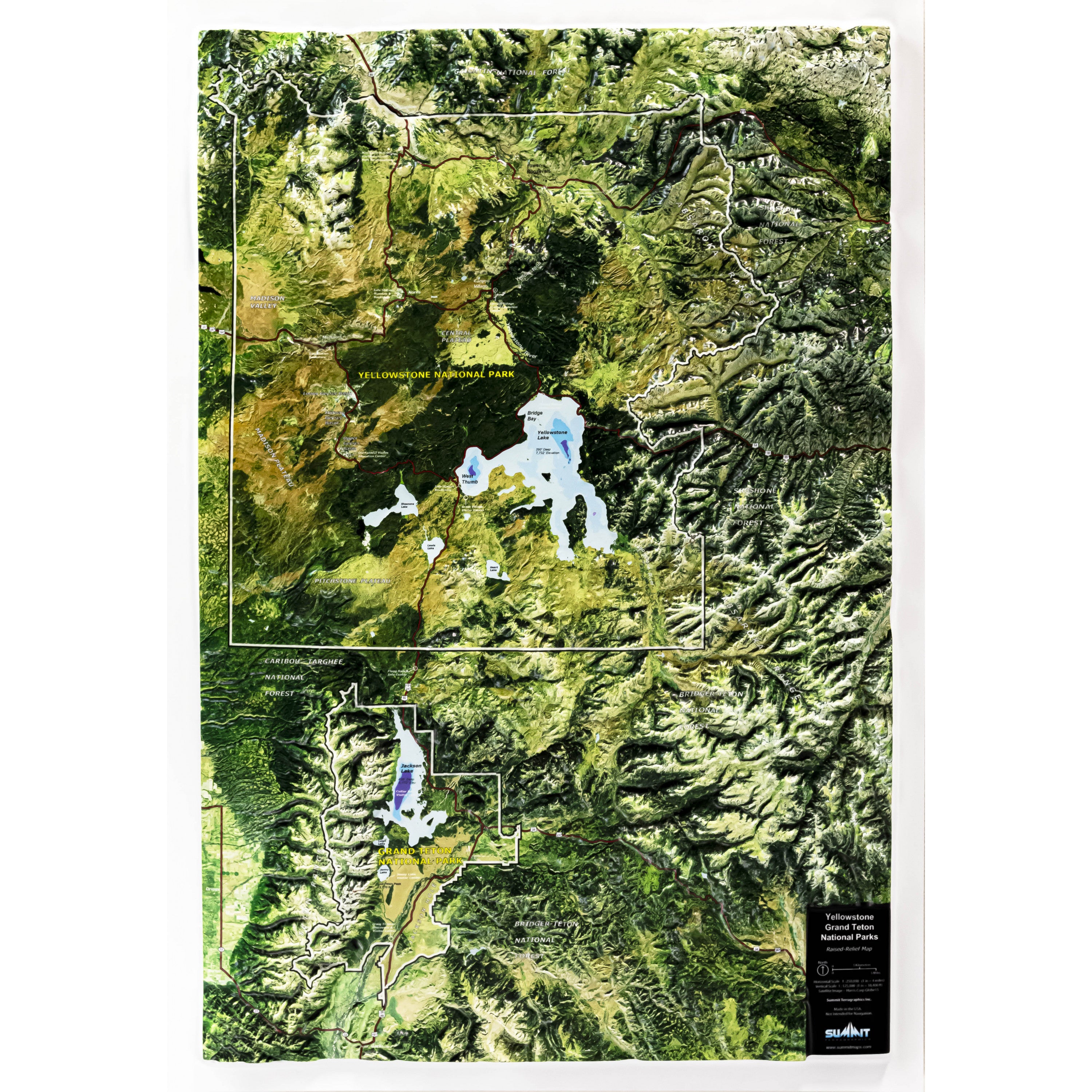
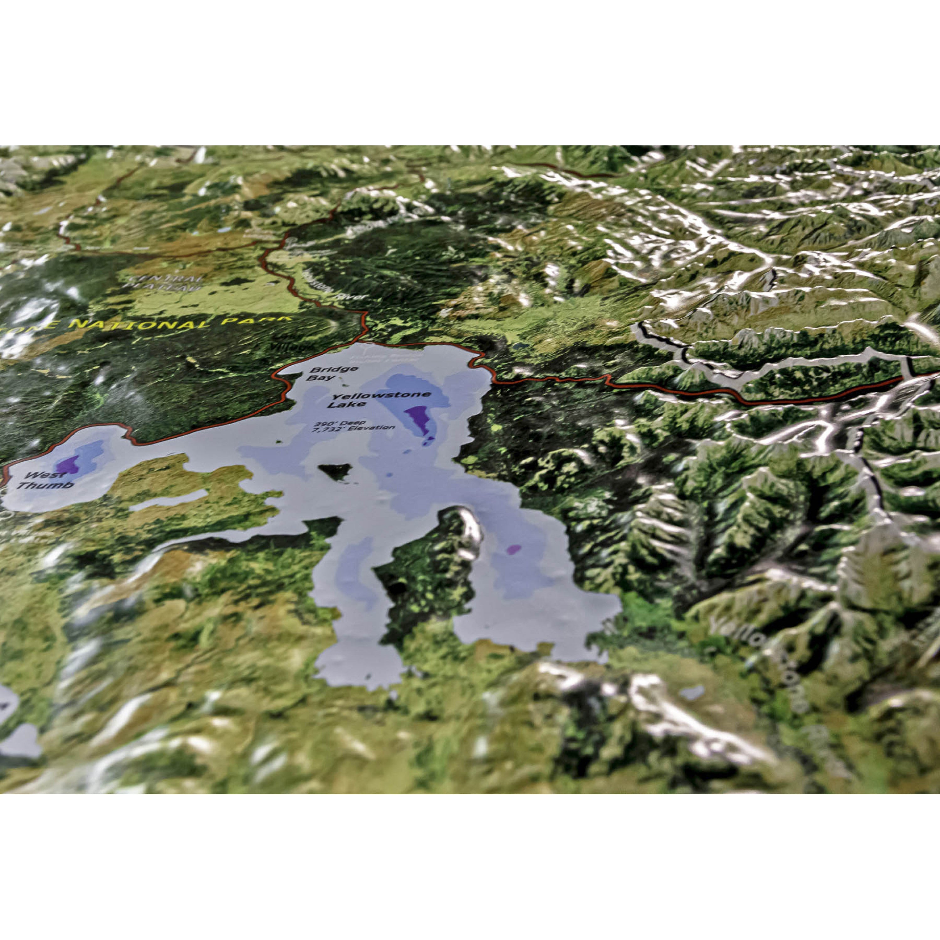
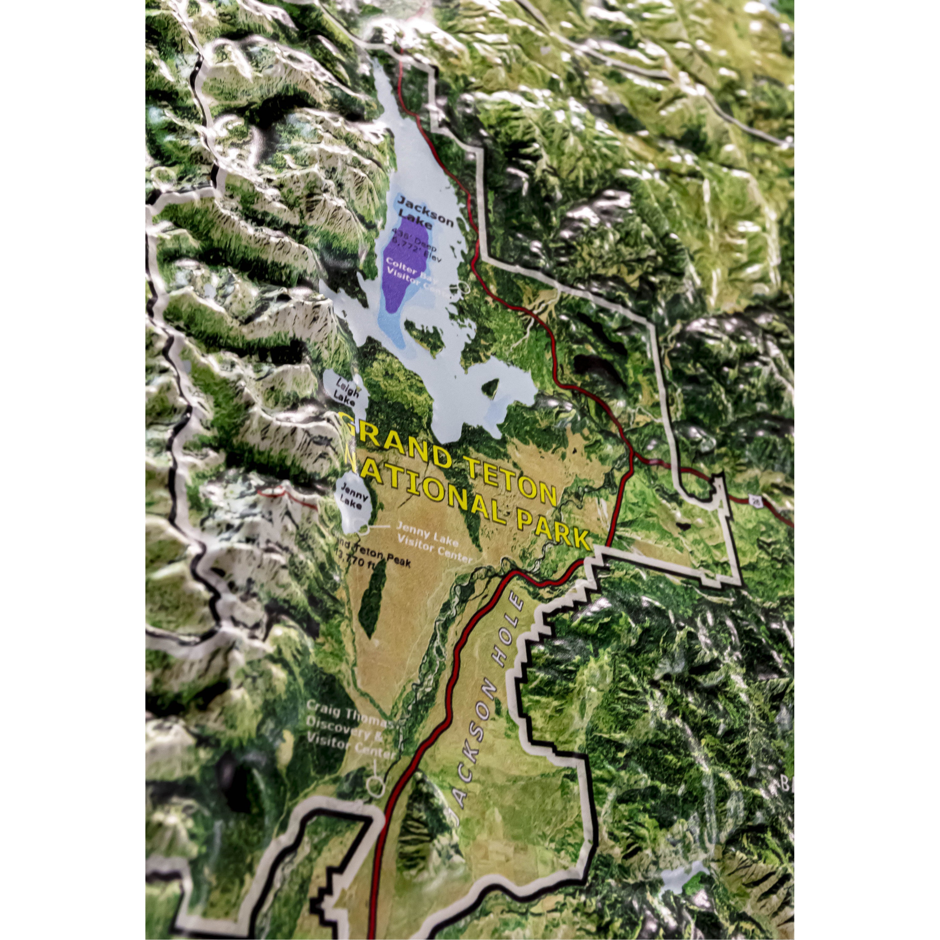
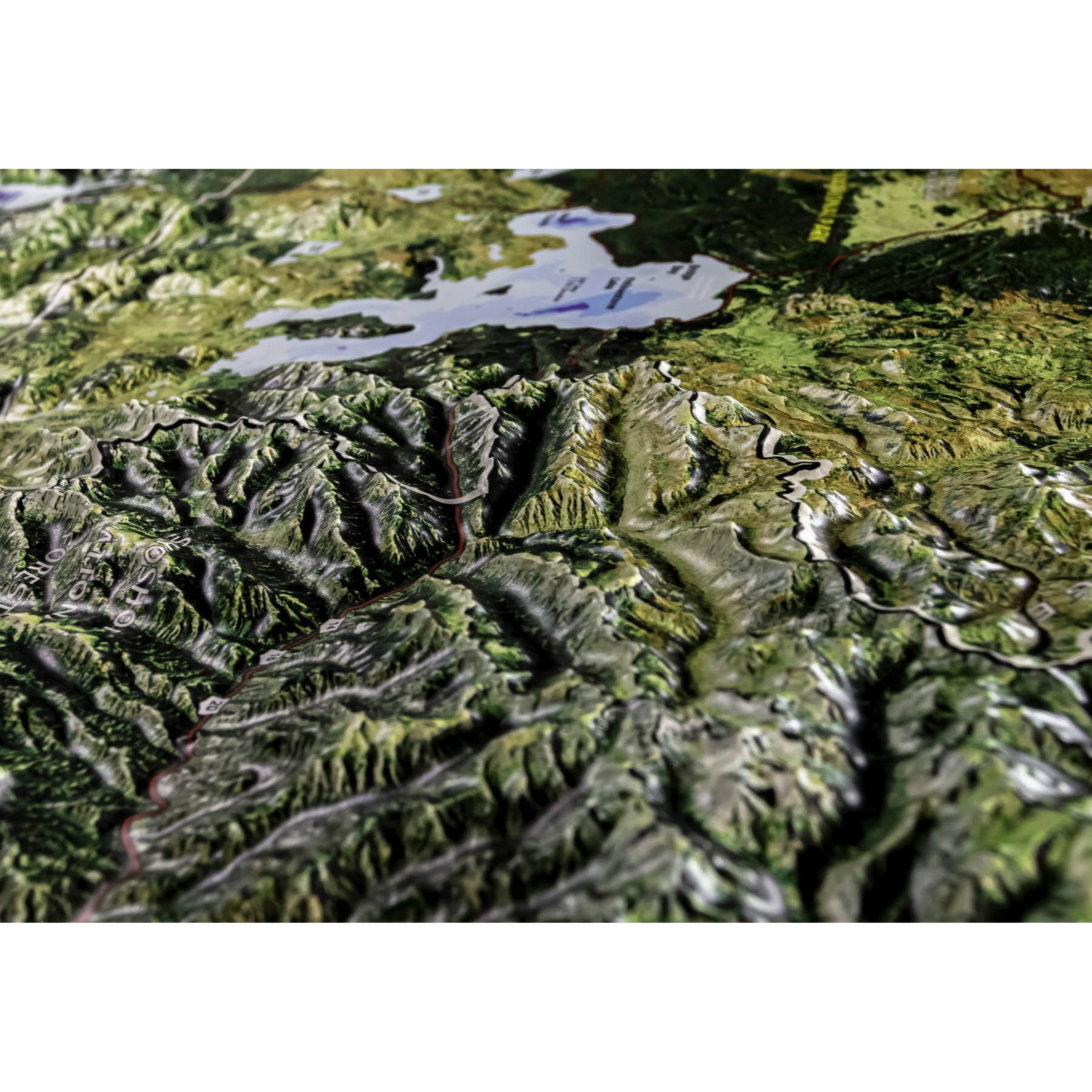
This raised relief wall map of Yellowstone and Grand Teton National Parks shows amazing 3D detail of the dramatic mountains, valleys, plateaus, and rivers of northwest Wyoming. The high-resolution satellite image shows the smallest details in true earth colors. The park's key features (roads, visitor centers, geysers, lakes, ...) are shown and labeled. Yellowstone's and Grand Teton's dramatic topography is easy to see and understand with the precisely molded 3D shape. The magnificent Grand Teton Range has nearly an inch of vertical relief. Park visitors and outdoor enthusiasts will value this unique and beautiful map for planning new trips to the park and recalling past ones. It is available both unframed (poster style) and framed (light, natural or dark stained solid oak wood and black aluminum).
Each raised relief map starts as a map printed on a flat study sheet of vinyl. It is carefully registered over a 3D model that is made from USGS digital elevation model data. The vinyl is heated to make it pliable and a vacuum is created to form the map over the model. Take a look at the process below.

This large map is available fully framed and ready to hang or unframed, perfect for pinning to a bulletin board.
Usually ships in 5-7 business days. Please allow additional 5 business days for framed options.
This raised relief wall map of Yellowstone and Grand Teton National Parks shows amazing 3D detail of the dramatic mountains, valleys, plateaus, and rivers of northwest Wyoming. The high-resolution satellite image shows the smallest details in true earth colors. The park's key features (roads, visitor centers, geysers, lakes, ...) are shown and labeled. Yellowstone's and Grand Teton's dramatic topography is easy to see and understand with the precisely molded 3D shape. The magnificent Grand Teton Range has nearly an inch of vertical relief. Park visitors and outdoor enthusiasts will value this unique and beautiful map for planning new trips to the park and recalling past ones. It is available both unframed (poster style) and framed (light, natural or dark stained solid oak wood and black aluminum).
Each raised relief map starts as a map printed on a flat study sheet of vinyl. It is carefully registered over a 3D model that is made from USGS digital elevation model data. The vinyl is heated to make it pliable and a vacuum is created to form the map over the model. Take a look at the process below.
This large map is available fully framed and ready to hang or unframed, perfect for pinning to a bulletin board.
Usually ships in 5-7 business days. Please allow additional 5 business days for framed options.