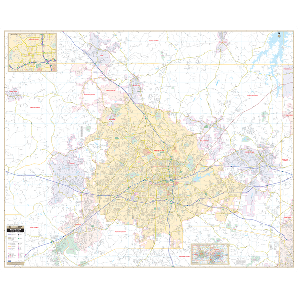
Our Winston-Salem and Forsyth County, NC Wall Map, with adjacent areas, measures 73" x 60" (6'1" W x 5' H) and features up-to-date cartography, with new streets and changes in complete street detail; is printed in color, with a markable and washable laminated surface; and offers a street index in a separate book-format.
The area of coverage includes all of Forsyth County, with the following boundaries:
- North to the Forsyth-Stokes County line, and King, in Stokes County
- South to the Forsyth-Davidson County line
- East to the Forsyth-Guilford County line
- West to the Forsyth-Yadkin County line, and East Bend, in Yadkin County
The Winston-Salem and Forsyth County, NC also includes an inset map of Downtown Winston-Salem, and an area map.
Details and features include:
- AIRPORTS
- BLOCK NUMBERS
- CEMETERIES
- CITY LIMITS
- EDUCATIONAL INSTITUTIONS
- GOLF COUNTRY CLUBS
- GOVERNMENT BUILDINGS
- HOSPITALS
- LIBRARIES
- POINTS OF INTEREST
- POLICE STATIONS
- RAILROADS
- RECREATIONAL PARKS
- SHOPPING CENTERS
- STREETS HIGHWAYS
- WATER FEATURES
- ZIP CODE BOUNDARIES
Optional framing rails are available, top and bottom, for easy wall mounting. Spring roller mounting is also available.
Year: 2016
Edition: 2nd
These maps are printed and finished to order. Please allow 2-3 weeks before shipment.