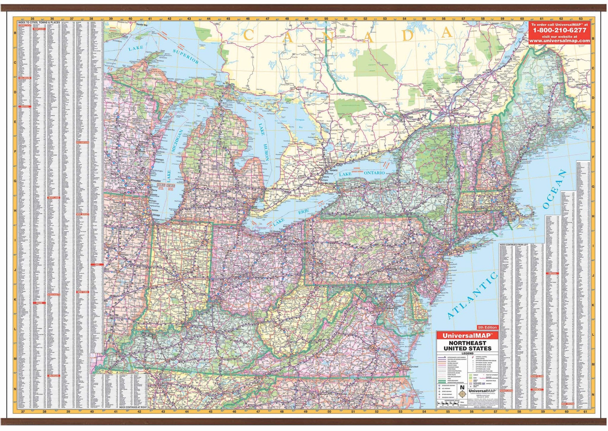
The 5th Edition Northeast United States Wall Map by Kappa Map Group measures 64" W x 46" H and shows all of the following states: Connecticut, Delaware, Indiana, Kentucky, Maine, Maryland, Massachusetts, Michigan, New Hampshire, New Jersey, New York, Ohio, Pennsylvania, Rhode Island, Vermont, Virginia, and West Virginia.
The boundaries are as follows: North: to include Thunder Bay in western Ontario: South: to include northern Tennessee to the Atlantic Ocean including Nashville; East: to the Atlantic Ocean; West: to include Thunder Bay, Madison WI to Paducah, Kentucky.
The special features and data include: state highways, time zones, interstate highways, rivers and lakes, freeways, national forests, state lines, mountain ranges, longitude and latitude lines, cities and towns. Protected with a laminate finish, which is both markable and washable. In addition, for your convenience, the map is indexed on the face of the face of the map.
Map is available with the following options:
-
Laminated:Laminated for protection on both sides. Use wet erase markers to write on wipe off.
-
Railed:Black plastic framing rails are added on the top and bottom of your Laminated map for easy wall mounting.
-
Spring roller:A Spring roller is applied to a Laminated map to turn it into a pull down map.
-
Spring roller/Backboard:Laminated map is attached to spring roller and we provide backboard and all components to mount map on wall.
Year: 2009
5th Edition