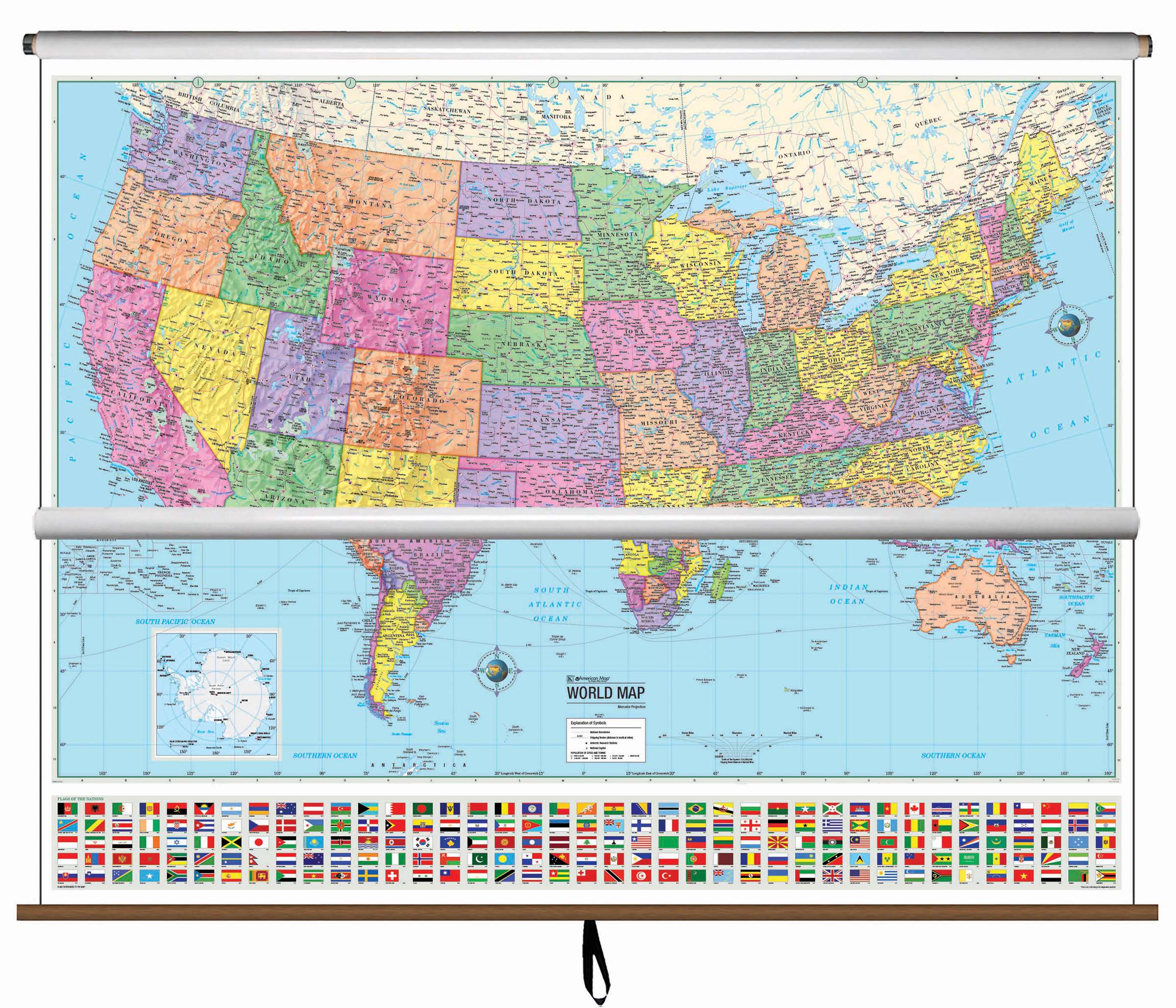
This US/World Advanced Political Spring Roller is a top-seller, boasting both United States and World Political Classroom maps with advanced features. It displays captivating, clear cartography with vivid colors and an abundance of information, such as country and state boundaries, capitals, major waterways, and major cities.
This high quality series is appropriate for grades 6-12, and includes content that meets national and state curriculum standards. The US map displays state borders, capitals, time zones, and insets of Alaska, Puerto Rico, and Hawaii, along with a physical inset map of the US. Images of all 50 state flags are included, as well as a locator map to show the country's location in North America. The World map features the national capitals of 193 countries, as well as the flags of each country.
All maps in this series are markable with a wet or dry erase marker. Durably laminated maps measure 64" x 49", and are mounted on roller with or without a backboard.