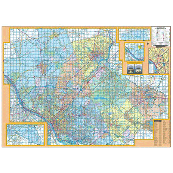
The Trenton/Mercer County, NJ Wall Map by Kappa Map Group measures 72? x 54? and provides complete street detail at a scale of 1? = 1,656 feet. Printed in color with a markable, washable-laminated surface. Streets are indexed in a separate book. Hanging rails included mounted top and bottom.
The area of coverage includes all of Mercer County with the following boundaries: North: to the Somerset/Hunterdon County line, including Hopewell Boro; South: to the Burlington County line: East: to Middlesex/Monmouth County line, including Hightstown Boro; West: to the Pennsylvania State line. Includes a special page overlay to match Franklin Maps? Street Atlas.
Details include streets and highways, government buildings, airports, mileage circles, water features, hospitals, shopping centers, educational facilities, railroads, recreational parks, golf courses and country clubs, cemeteries, ZIP code numbers/boundaries, city limits/annexations, and points of interest.
Railed wall maps can be turned into pull down maps on spring rollers for an additional $30.
Year: 2004
Edition: 2nd
These maps are printed and finished to order. Please allow 4-6 weeks for delivery.