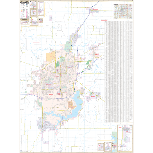
Our Springfield, IL Wall Map, with adjacent areas, measures
55" x 74" (4'7" W x 6'2" H) and features up-to-date cartography, with new streets and changes in complete street detail; is printed in color, with a markable and washable laminated surface; and offers a street index printed on the map.
The area of coverage includes all of Springfield, with the following boundaries:
- North to Williamsville and the Sangamon County line
- South to Chatham
- East to Spaulding, Riverton, and Rochester
- West to Curran Road
The Springfield, IL Wall Map also includes insets of: Loami, Pawnee, Mechanicsburg, Auburn, Thayer, Illiopolis, Pleasant Plains, Berlin, New Berlin, Divernon, Buffalo, and Cantrall; and a area map of Sangamon County.
Details and features include:
- AIRPORTS
- BLOCK NUMBERS
- CEMETERIES
- CITY LIMITS
- EDUCATIONAL INSTITUTIONS
- FIRE POLICE STATIONS
- GOLF COUNTRY CLUBS
- GOVERNMENT BUILDINGS
- HOSPITALS
- LIBRARIES
- POINTS OF INTEREST
- RAILROADS
- RECREATIONAL PARKS
- SHOPPING CENTERS
- STREETS HIGHWAYS
- WATER FEATURES
- ZIP CODE BOUNDARIES
Framing rails are included, top and bottom, for easy wall mounting. Spring roller mounting is also available, for an additional $30.
Year: 2012
Edition: 1st
These maps are printed and finished to order. Please allow 4-6 weeks for delivery.