Menu


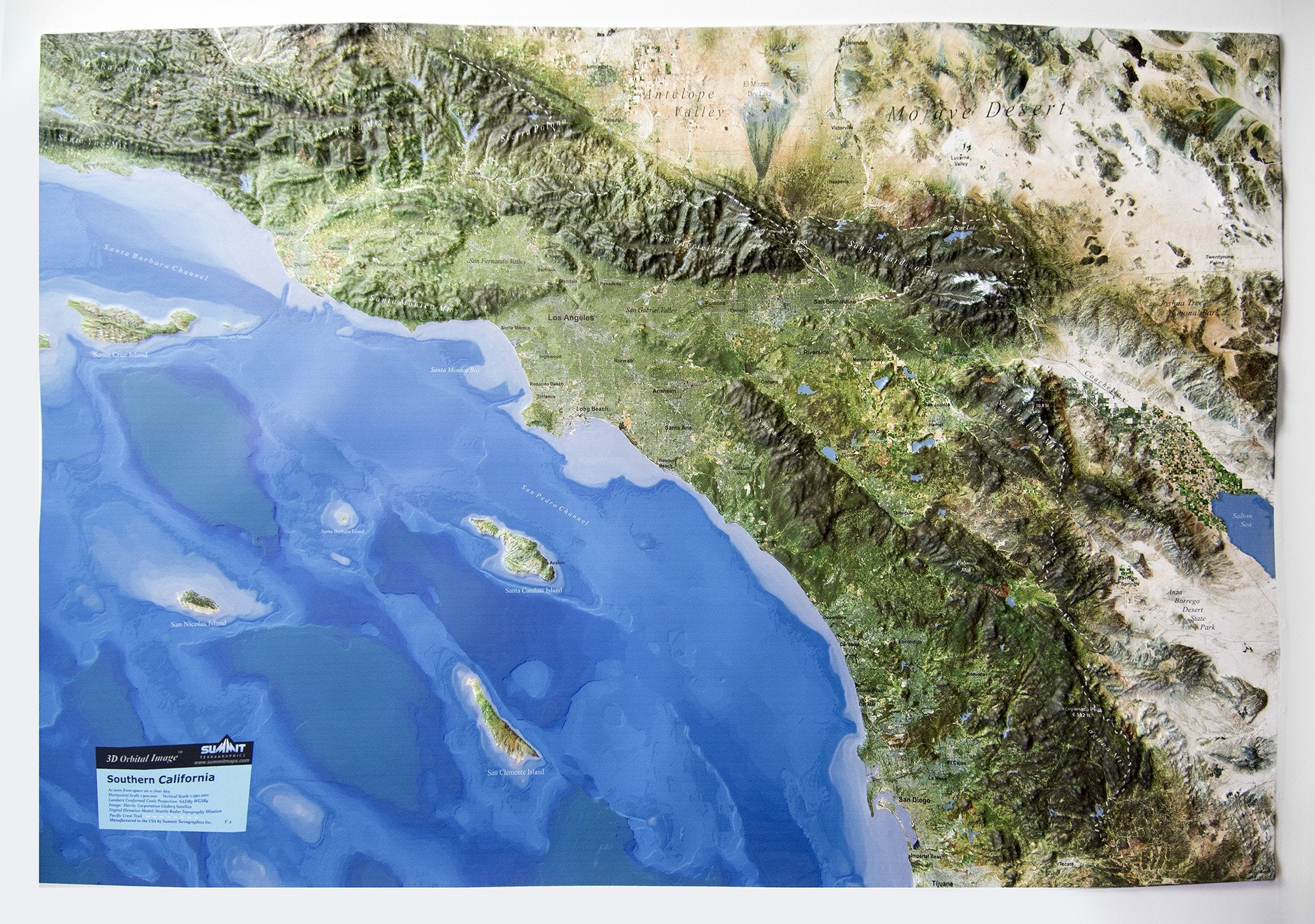
This raised relief map shows central California and Northern Sierra in stunning 3D detail, as though you were looking down from space on a clear day. The high-resolution satellite image is draped over the precisely molded 3D terrain shape, showing the beauty of the mountains, valleys, and deserts. The map covers from San Francisco and the Bay Area to the spectacular Sierra Mountains and Lake Tahoe, and includes Yosemite National Park and Mammoth ski area. Key towns, mountain ranges/peaks, valleys, and deserts are labeled for easy reference. Hikers, backpackers, naturalists, and all outdoor enthusiasts will value this amazing 3D raised relief map. It is available unframed (poster style) or framed in black aluminum, light or dark stained solid oak wood, or black painted wood.

This large map is available fully framed and ready to hang or unframed, perfect for pinning to a bulletin board.
Usually ships in 5-7 business days. Please allow additional 5 business days for framed options.
This raised relief map shows central California and Northern Sierra in stunning 3D detail, as though you were looking down from space on a clear day. The high-resolution satellite image is draped over the precisely molded 3D terrain shape, showing the beauty of the mountains, valleys, and deserts. The map covers from San Francisco and the Bay Area to the spectacular Sierra Mountains and Lake Tahoe, and includes Yosemite National Park and Mammoth ski area. Key towns, mountain ranges/peaks, valleys, and deserts are labeled for easy reference. Hikers, backpackers, naturalists, and all outdoor enthusiasts will value this amazing 3D raised relief map. It is available unframed (poster style) or framed in black aluminum, light or dark stained solid oak wood, or black painted wood.
This large map is available fully framed and ready to hang or unframed, perfect for pinning to a bulletin board.
Usually ships in 5-7 business days. Please allow additional 5 business days for framed options.