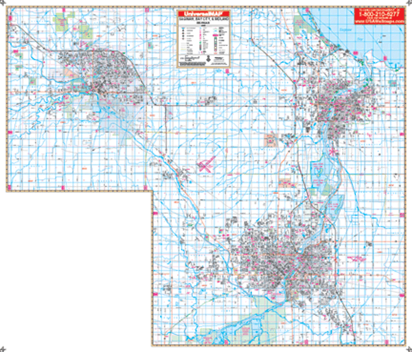
The Saginaw, Midland, and Bay City, Michigan Wall Map is published by Universal Map. Measures 70? W x 60? H in complete street detail at a scale of 1? = 2,640 feet. Provides up-to-date cartography with new streets and changes. Printed in color with a markable/washable-laminated surface. Streets are indexed on the face of the map. Provided with hanging rails mounted top and bottom.
Covers all of Saginaw, Midland, and Bay City: North: Bay City Recreation area; 3 miles north of Midland city limits; South: Shiawassee national wildlife refuge; Exit 144 on I-75; East: 2 ?® miles east of Essexville; West: 3 miles west of Midland city limits.
Details included: all streets and highways, government buildings, airports, water features, fire/police stations, hospitals, shopping centers, educational facilities, railroads, recreational parks, golf/country clubs, post offices, mileage circles, city limits/annexations, cemeteries, longitude/latitude, ZIP codes/boundaries, and points of interest.
Railed wall maps can be turned into pull down maps on spring rollers for an additional $30.
Year: 2008
Edition: 3rd
These maps are printed and finished to order. Please allow 4-6 weeks for delivery.