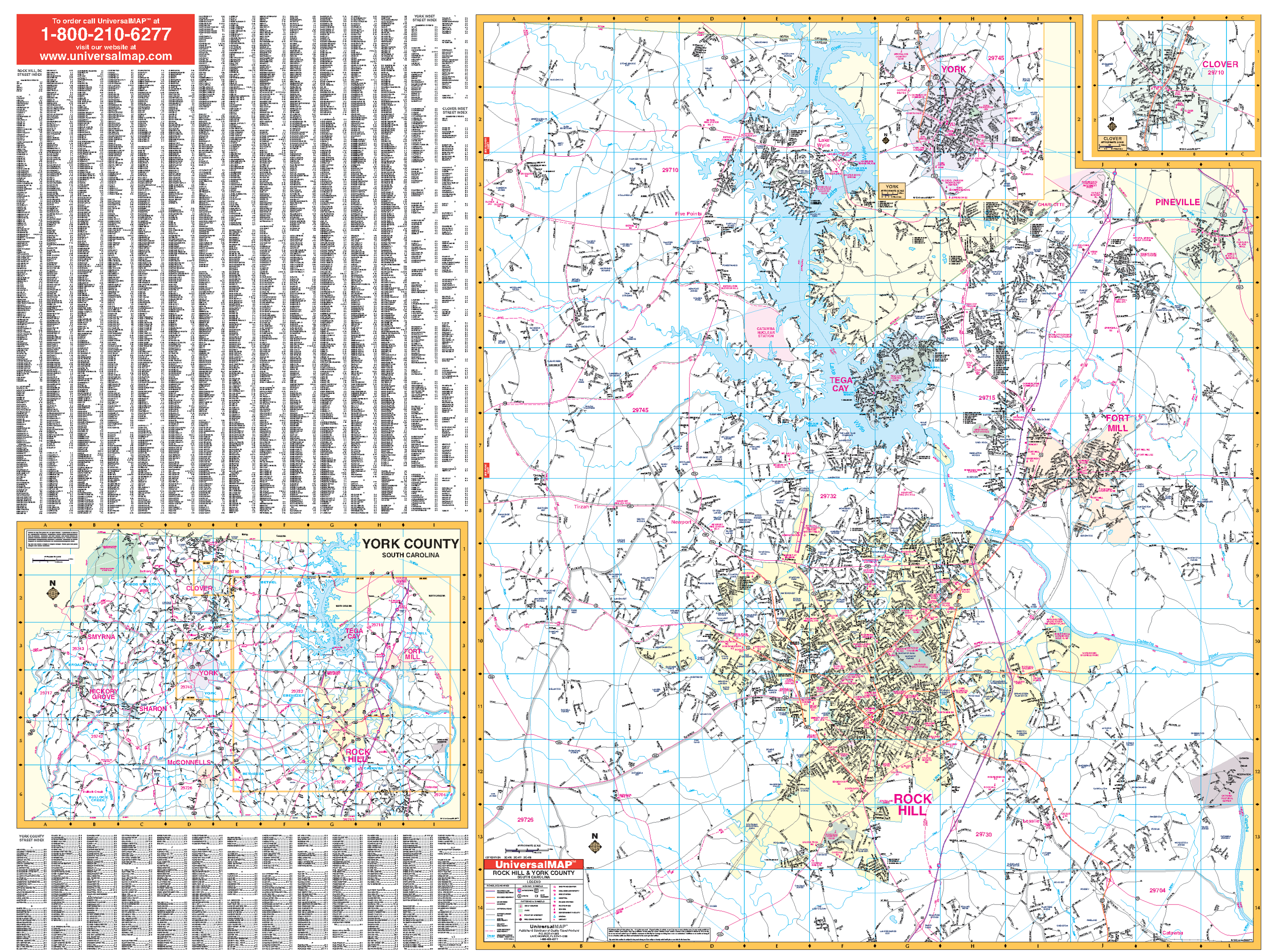
The Wall Map of Rock Hill, York County, SC with adjacent areas by Kappa Map Group measures 69? x 55? and is in complete street detail at a scale of 1? = 2,166 feet. Provides up-to-date cartography with new streets and changes. Printed in color with a laminated surface that is both markable and washable. Streets are indexed on the face of the map. Has hanging rails mounted top and bottom.
Covers all of Rock Hill with the following boundaries: North: to the state line; South: to exit 73 off I-77; East: to Pineville and 2 miles east of Fort Mill; West: 4 miles west of the Rock Hill city limits. insets: Clover and York, and York County with remaining residential streets.
Details include airports, all streets and highways, government buildings, cemeteries, shopping centers, fire and police stations, hospitals, water features, educational facilities, railroads, recreational parks, golf courses and country clubs, post offices, mileage circles, ZIP codes and boundaries, city limits and annexations, fire district lines, and points of interest.
Railed wall maps can be turned into pull down maps on spring rollers for an additional $30.
Year: 2009
Edition: 2nd
These maps are printed and finished to order. Please allow 4-6 weeks for delivery.