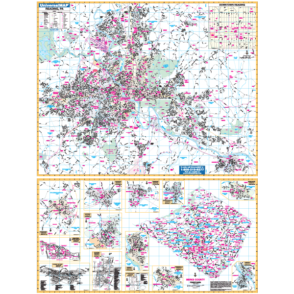
The Reading, Berks County, PA.
Specifications of this high quality map:
? Measures 4' 4" W x 6' 1" H (52" x 73")
? Complete street detail at a scale of 1?®" = 1,760 ft
? Up-to-date cartography with over 700 new streets and changes.
? Printed in color with a markable and washable laminated surface.
? Rails, mounted top and bottom. Hanging option of spring roller available.
? Streets are indexed in a separate book.
Area of Coverage:
? North: City of Temple
? South: Green Hills and Birdsboro
? East: Daniel Boone Homestead, Amity Township
? West: Sinking Spring, S. Heidelburg Township
Berks County Area Map (Scale 1" = 1.75 miles)
? Inset: includes Boyerstown, Penn St., (Berks Campus) Albright College, Kutztown Kutztown University, Robesonia, Hamburg, Alvernia College, Shoemakersville, Wernersville, Womelsdorf, Leesport and Fleetwood
Details Included: Airports , All Streets Highways, Government Buildings, Cemeteries, Shopping Centers, Fire Police Stations, Hospitals, Water Features, Educational Institutions, Railroads, Recreational Parks, Golf and Country , Post Offices, Points of Interest, ZIP Codes Boundaries, ?Mileage Circles, Fire District lines, City Limits, Annexations.
Railed wall maps can be turned into pull down maps on spring rollers for an additional $30.
Year: 2001
Edition: 1st
These maps are printed and finished to order. Please allow 4-6 weeks for delivery.