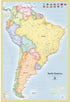
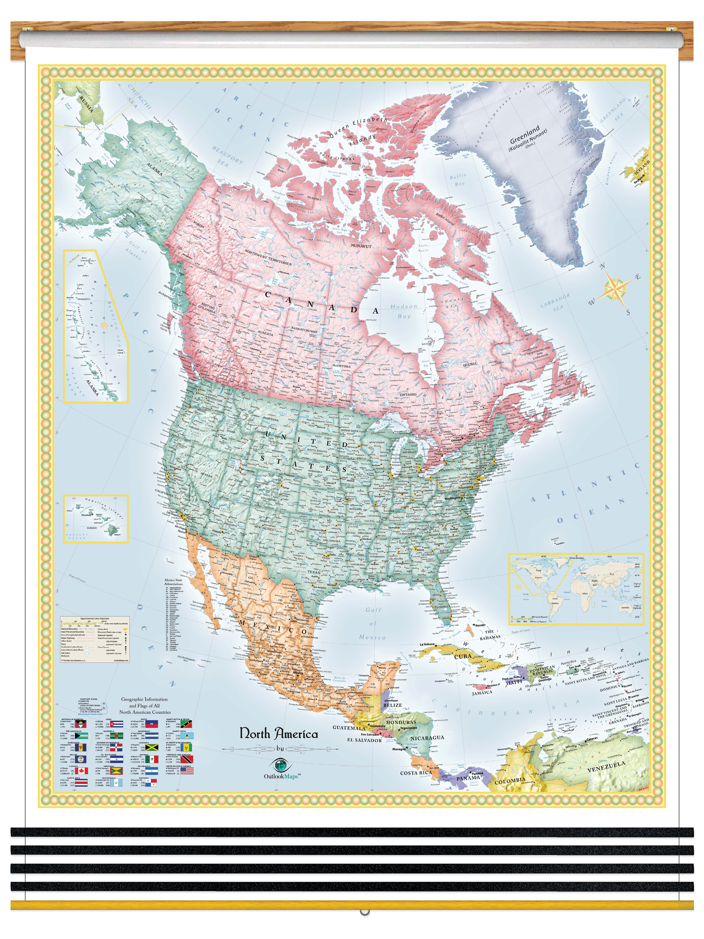
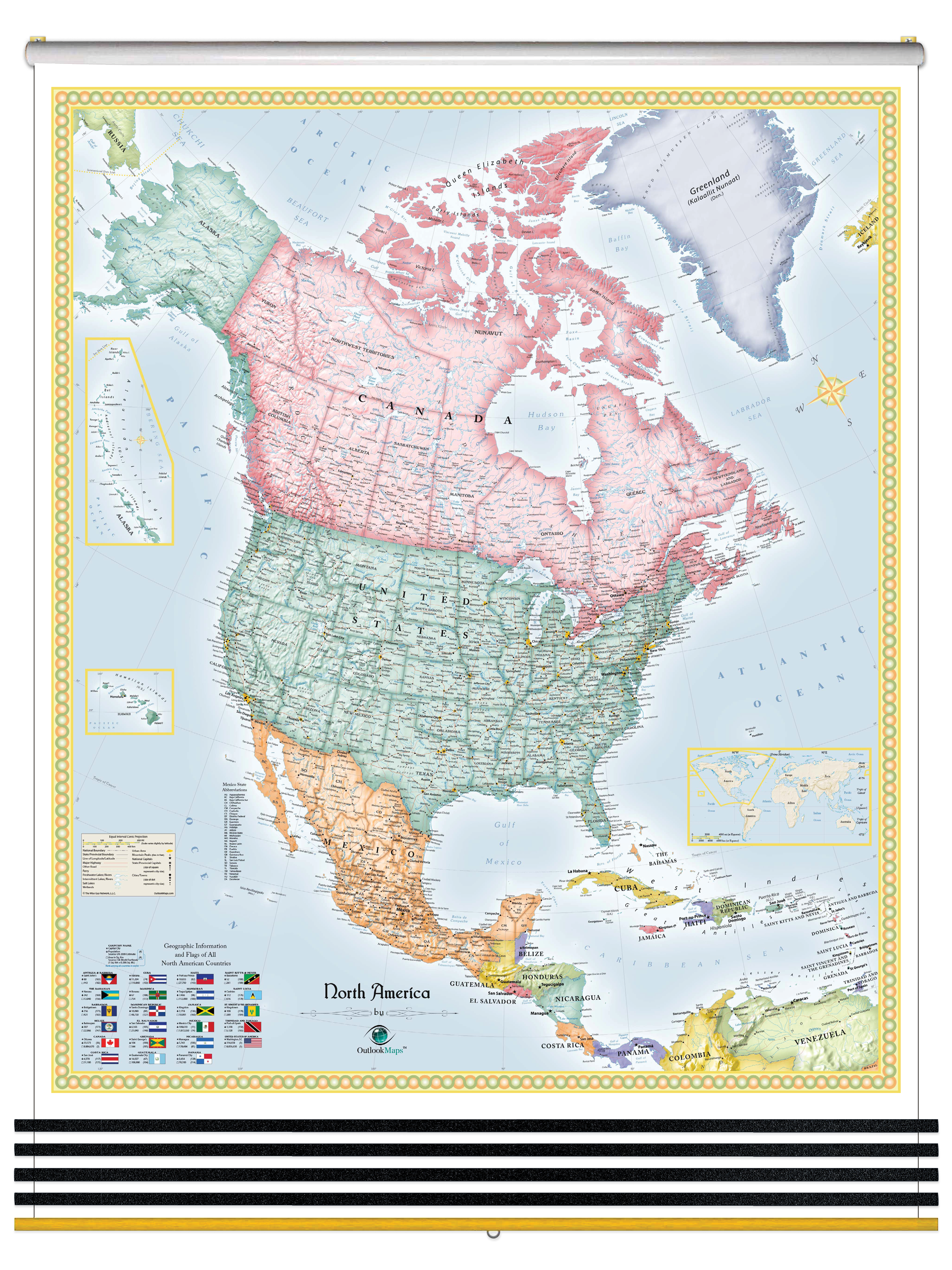
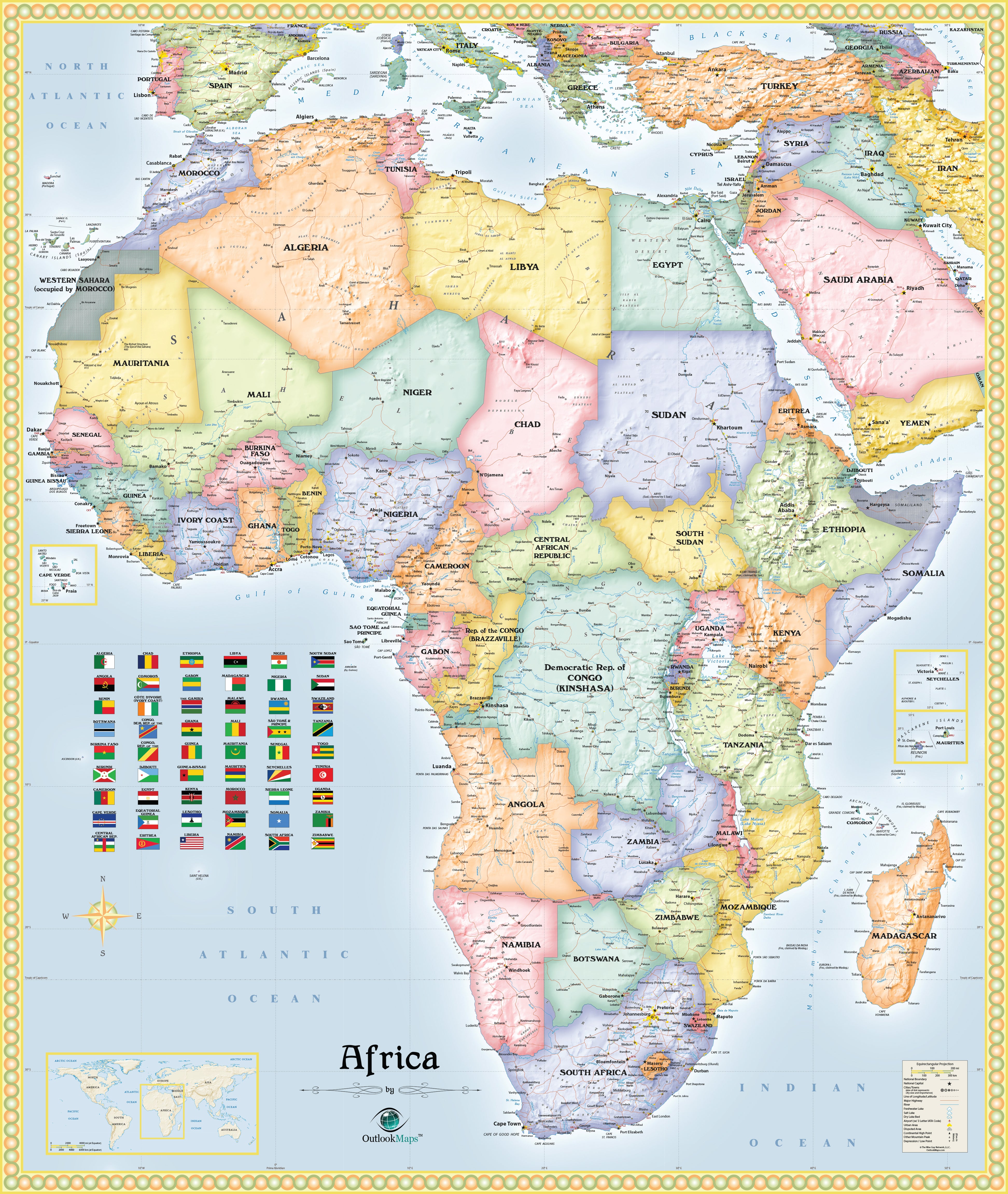
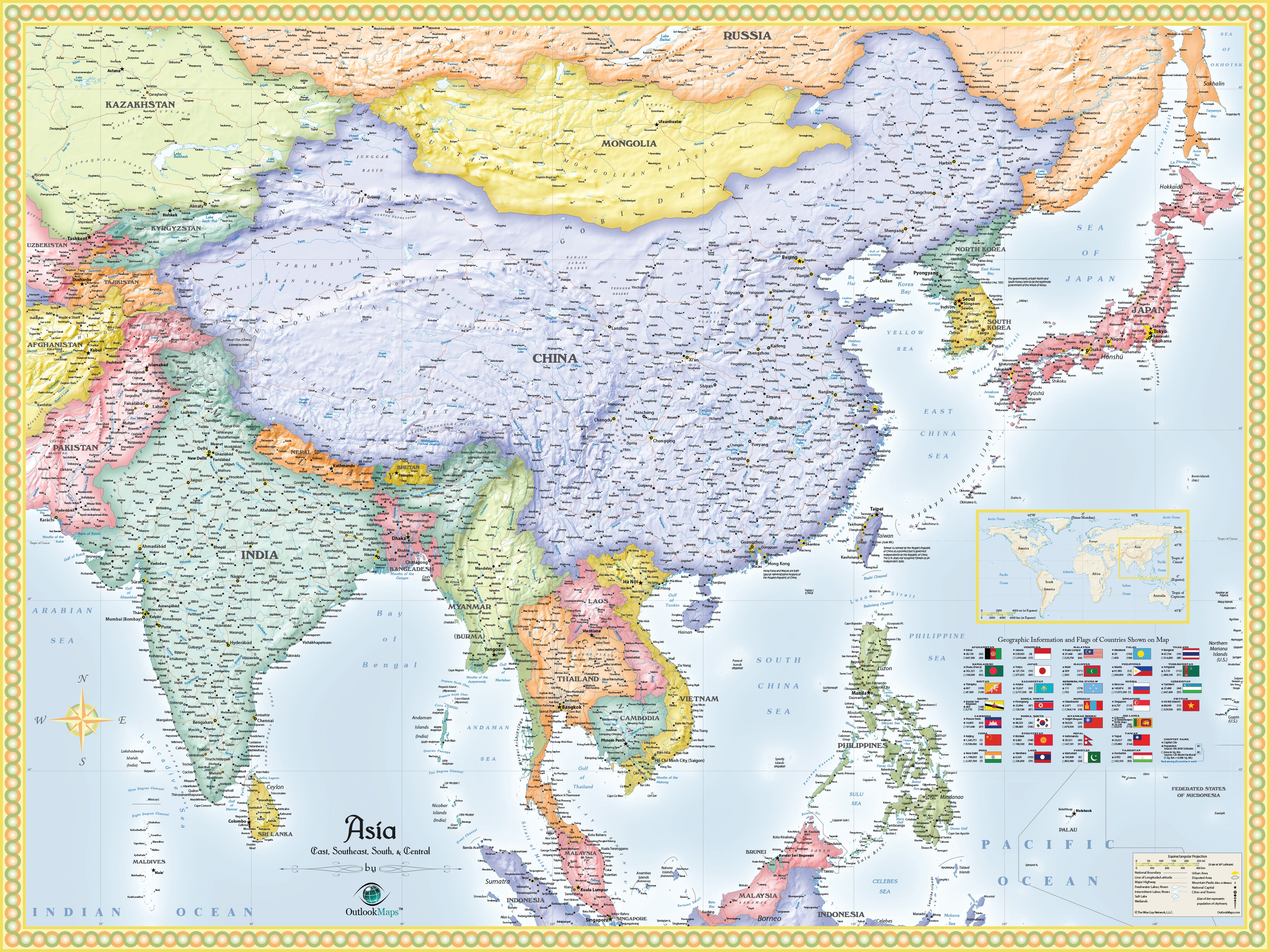
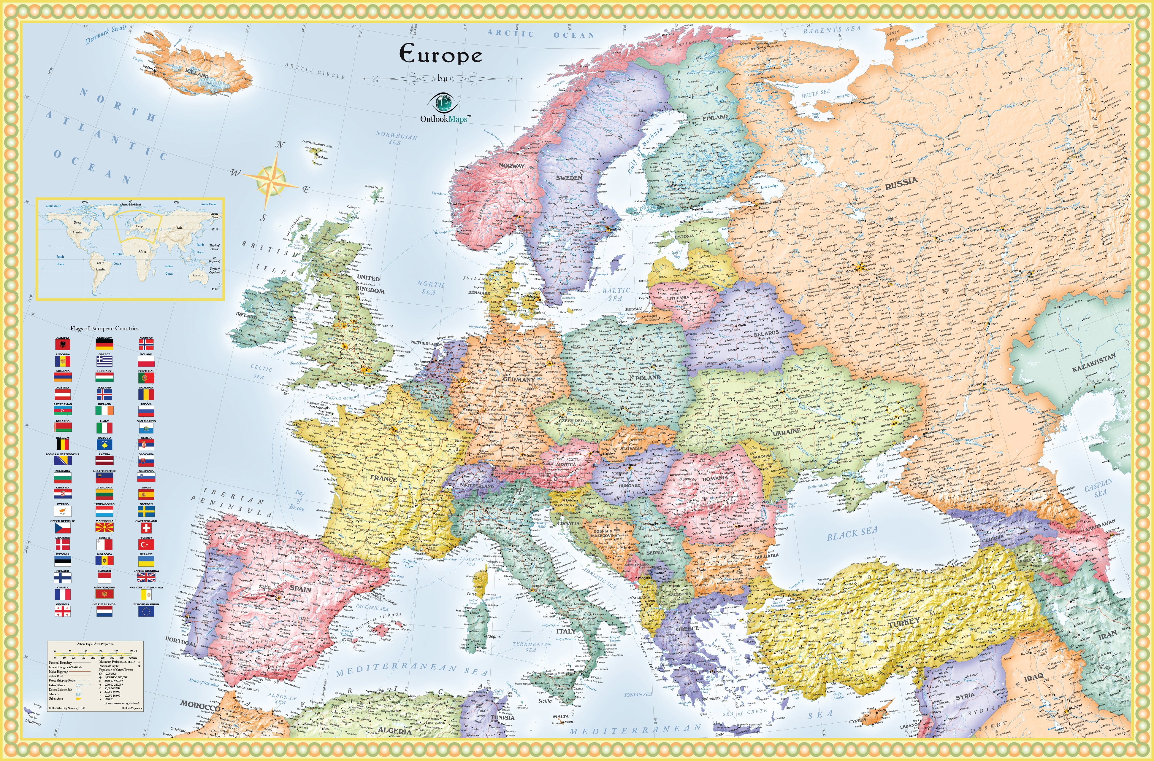
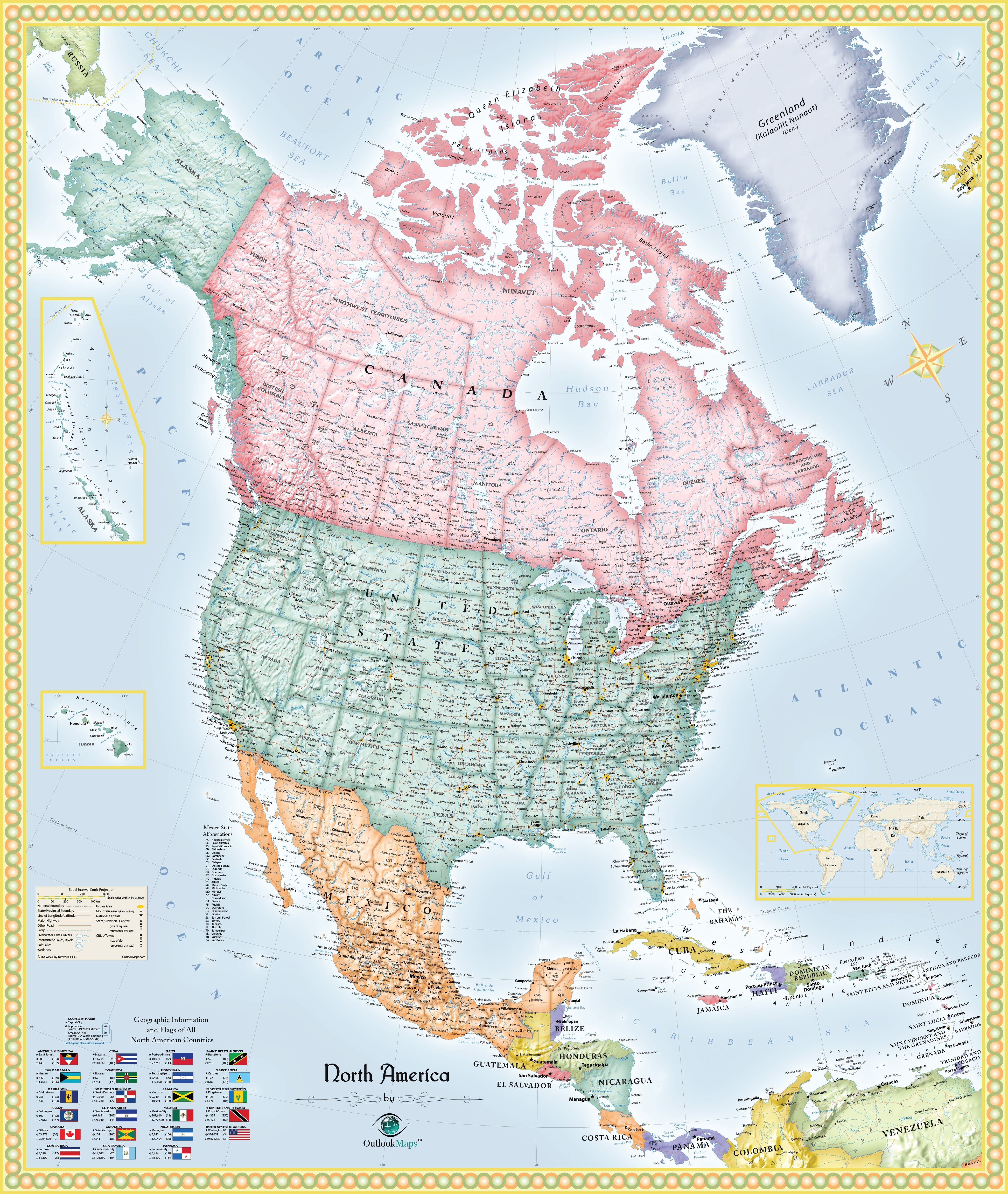
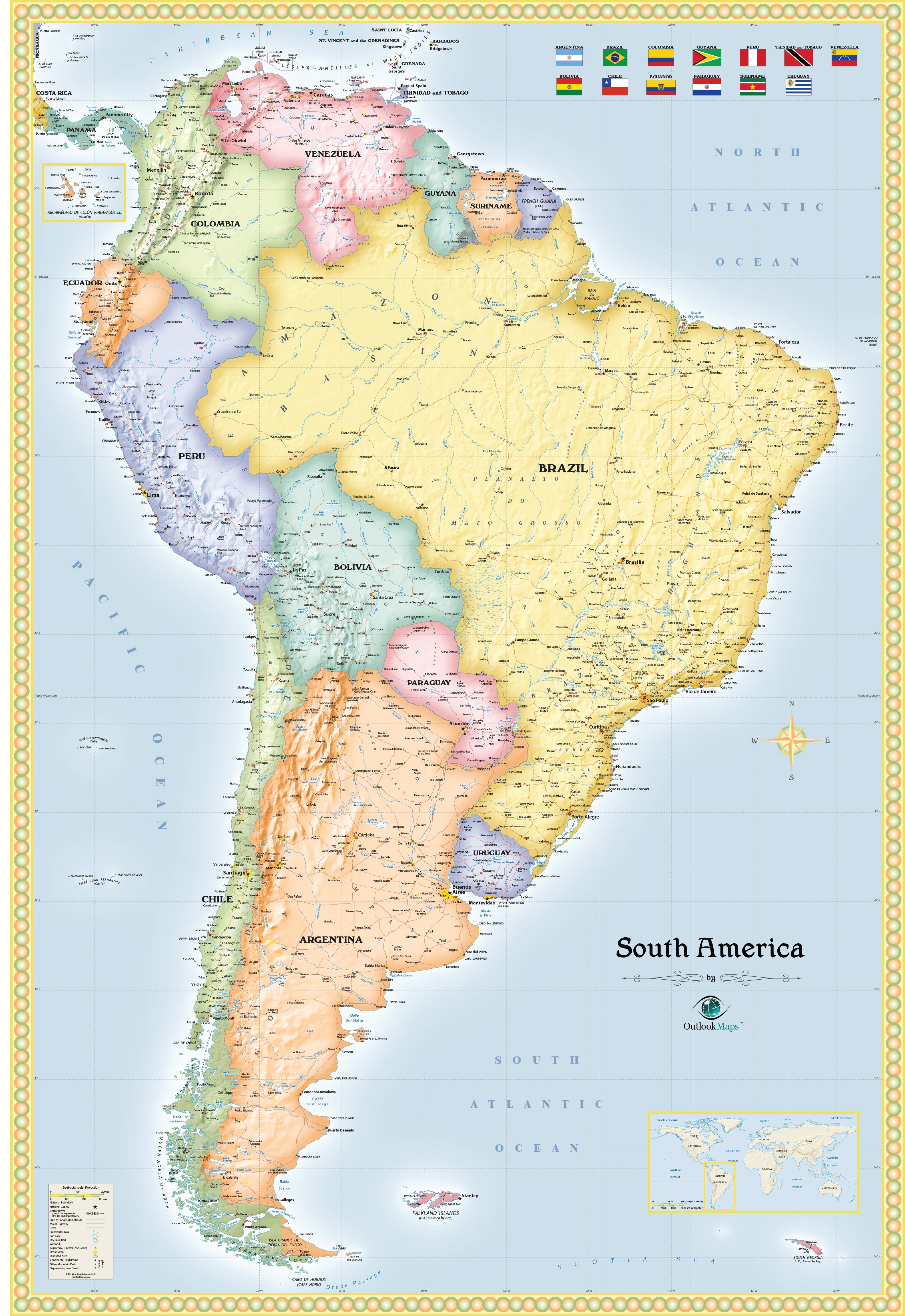
The combination of detail and beauty in this Political 5 Continent Maps Classroom Pull Down Bundle makes it ideal for education. The shaded relief of mountains and terrain, which is accomplished digitally using actual elevation data, gives the mountains striking depth and a three-dimensional appearance that makes them seem to jump off the page. Continents included are: North America, South America, Europe, Asia and Africa. Australia and Antarctica are not included.
These classroom maps include the following features:
Countries, shown in multi-color
National Capitals
Cities, labeled to show relative size and importance
3-D Shaded Relief of Mountains and Terrain
Water Features: Rivers, Lakes, Bays, Seas etc.
Land Natural Features: Mountain Ranges, Deserts, Islands, etc.
Major Airports, labeled with 3-letter IATA code
Peaks and Summits, labeled with elevation
Major Highways, unlabeled
Major Ferry Routes
Urban Areas
Longitude/Latitude Gridlines
National Flags
Insets showing Island Nations
Legend
All five Outlook Continent Maps are printed on 24lb. premium coated bond paper. They are also laminated on both sides using 3mm hot lamination, which protects your wall maps and allows you to write on them with dry-erase markers.
These laminated educational Pull Down maps are mounted to secure Spring Rollers ready to hang on any classroom wall.