Menu


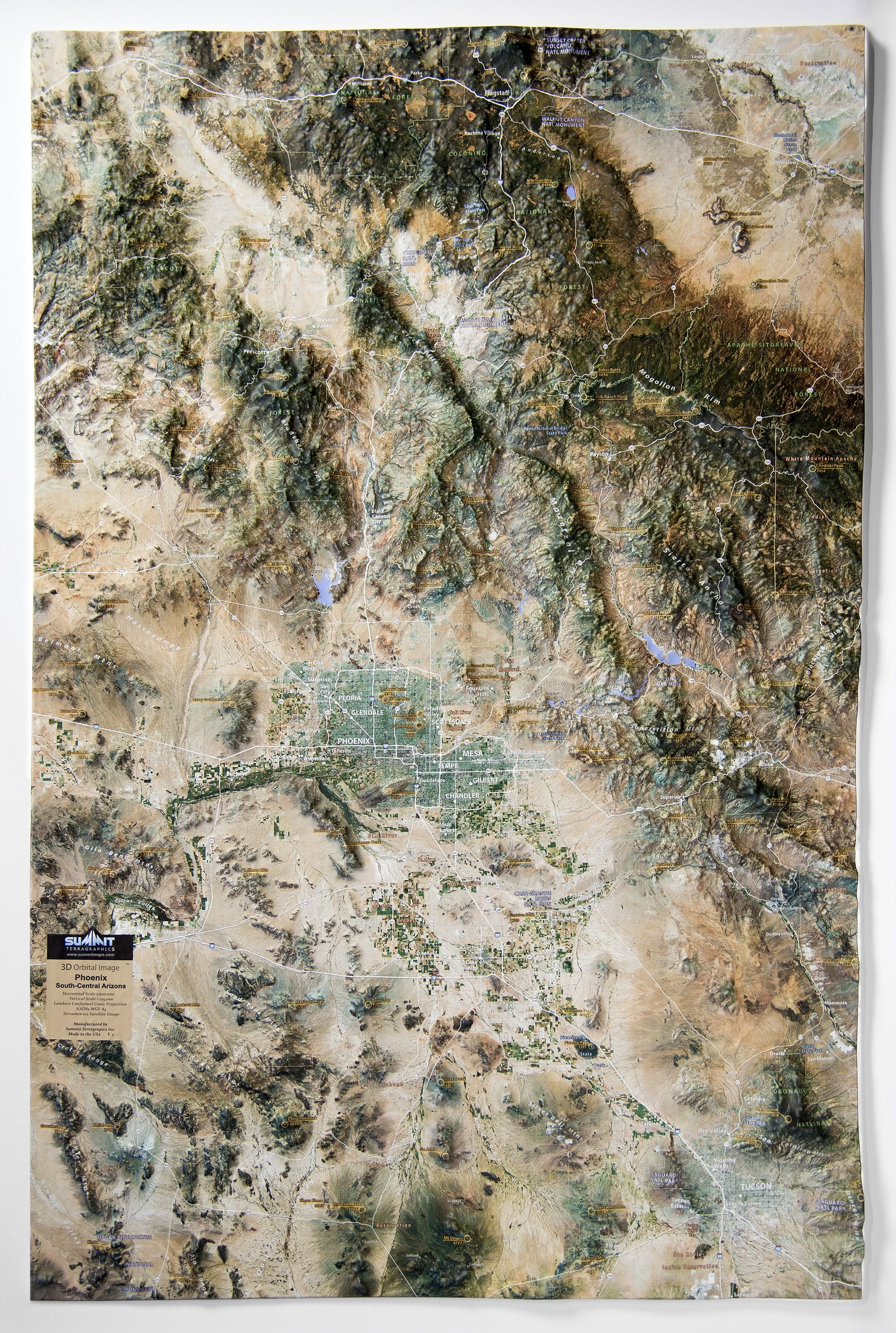
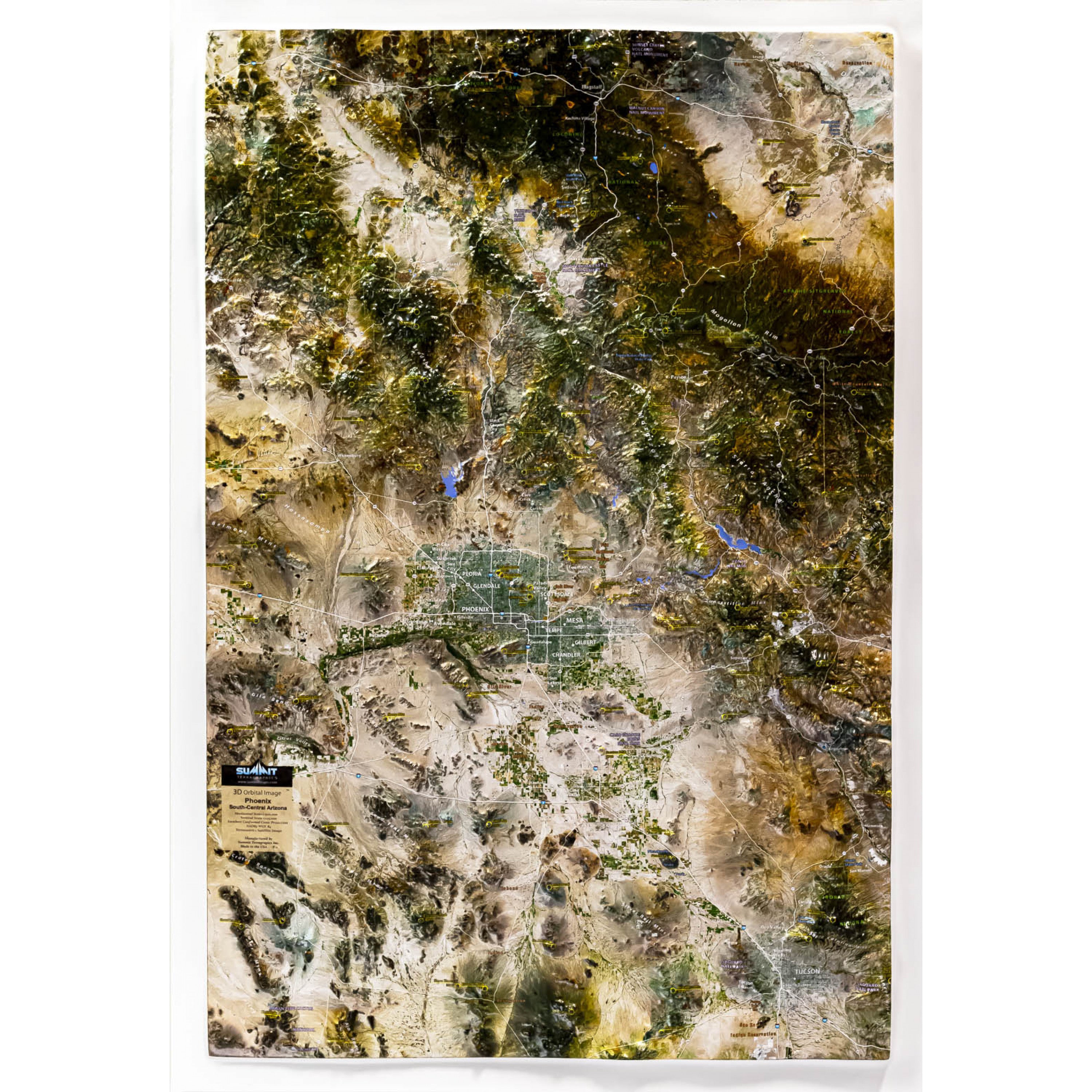
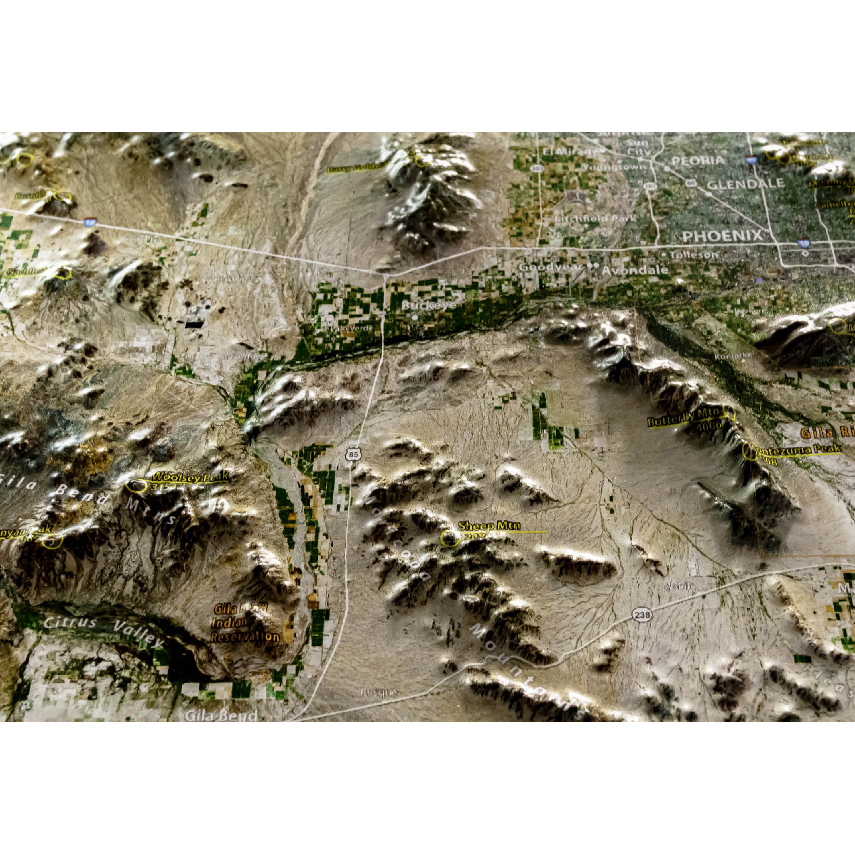
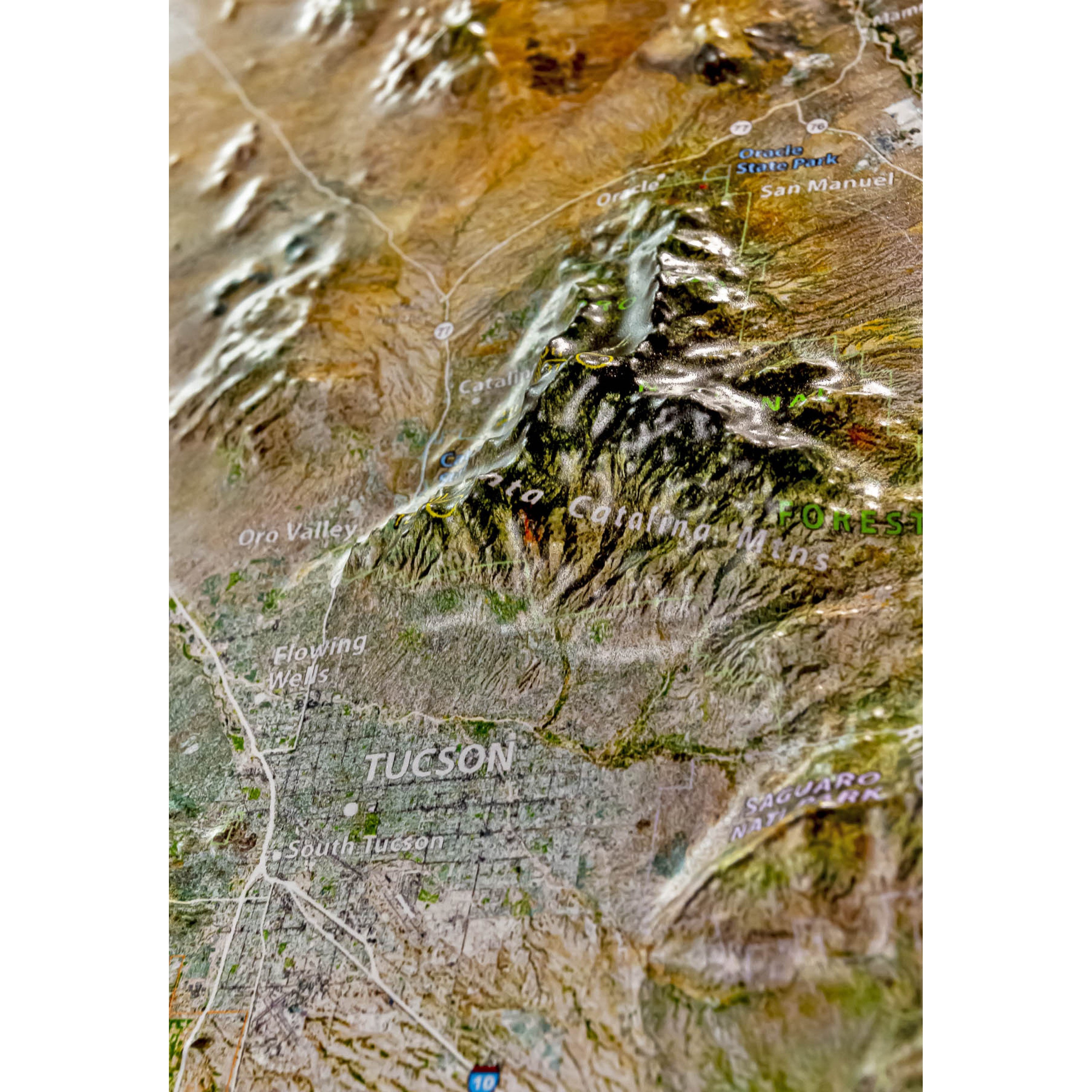
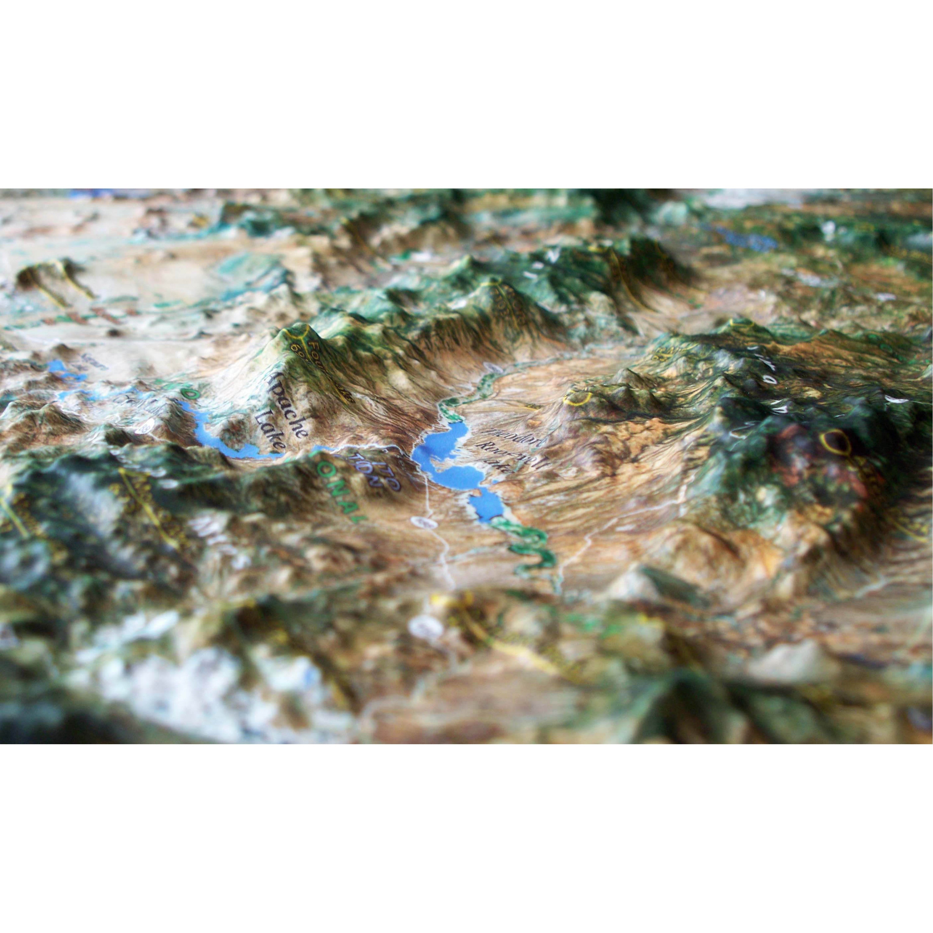
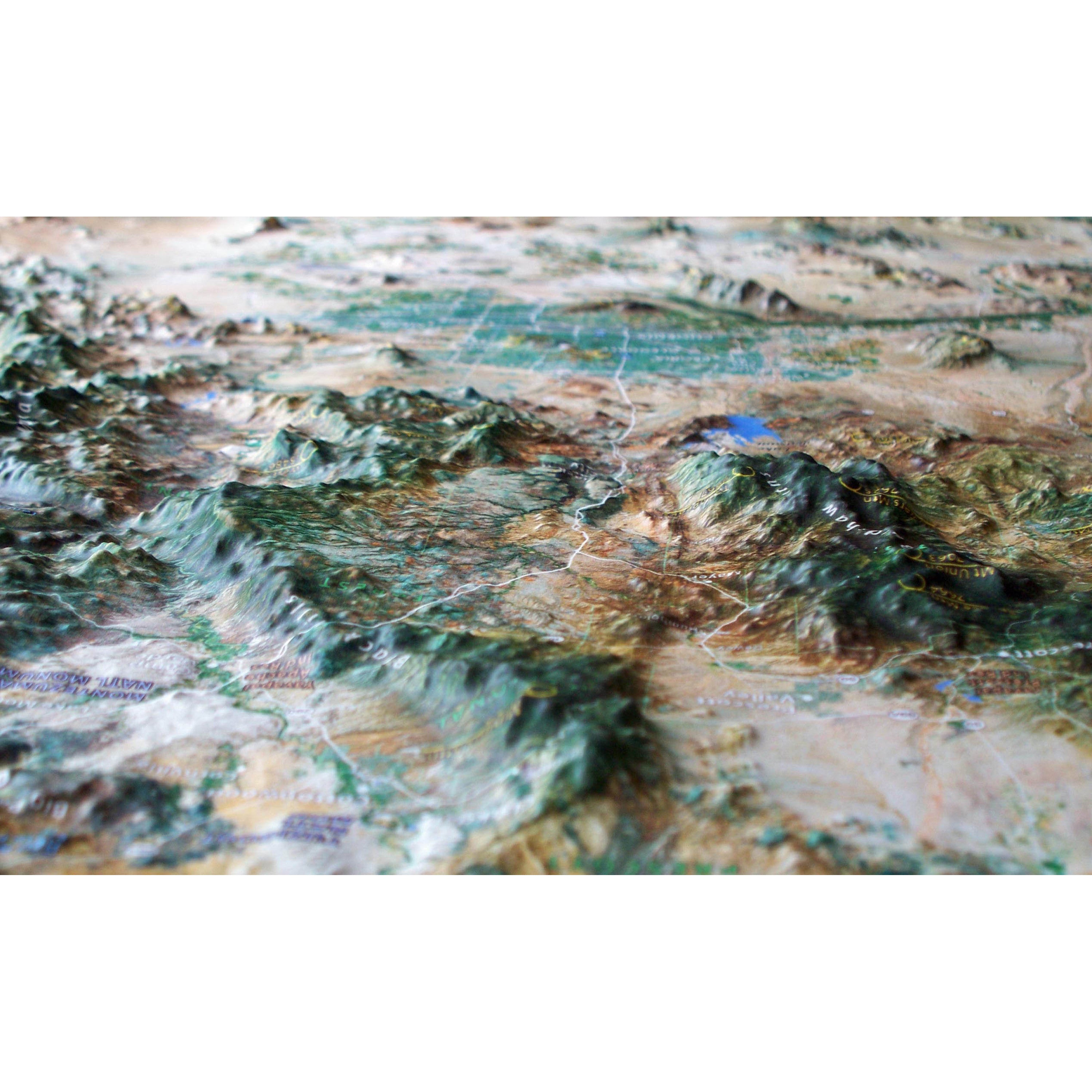
This Phoenix - South-Central Arizona 3D raised relief map stretches from the Juniper Mountains, west of Flagstaff, south and east to Tucson and the Saguaro National Park. At the center of this high-resolution satellite-image map are the cities of Phoenix, Glendale, Scottsdale, Mesa, Tempe, Gilbert, Chandler and more. But the real stars of any raised relief map are the geographic features—the peaks and ridges that rise from plains and low-lying desert. You can run your finger along the edge where the Mogollon Rim’s flat top drops off toward the smaller peaks to the south. And feel the mountains of the Mazatal, Sierra Ancha, and Superstition ranges that surround Theodore Roosevelt Lake. Farther west, Prescott National Forest crowns the Bradshaw Mountains while the Hassayampa Plain lies west of the big city. Available unframed or framed with four molding options (light, natural or dark stained solid oak wood and black aluminum).
Each raised relief map starts as a map printed on a flat study sheet of vinyl. It is carefully registered over a 3D model that is made from USGS digital elevation model data. The vinyl is heated to make it pliable and a vacuum is created to form the map over the model. Take a look at the process below.

This large map is available fully framed and ready to hang or unframed, perfect for pinning to a bulletin board.
Usually ships in 5-7 business days. Please allow additional 5 business days for framed options.
This Phoenix - South-Central Arizona 3D raised relief map stretches from the Juniper Mountains, west of Flagstaff, south and east to Tucson and the Saguaro National Park. At the center of this high-resolution satellite-image map are the cities of Phoenix, Glendale, Scottsdale, Mesa, Tempe, Gilbert, Chandler and more. But the real stars of any raised relief map are the geographic features—the peaks and ridges that rise from plains and low-lying desert. You can run your finger along the edge where the Mogollon Rim’s flat top drops off toward the smaller peaks to the south. And feel the mountains of the Mazatal, Sierra Ancha, and Superstition ranges that surround Theodore Roosevelt Lake. Farther west, Prescott National Forest crowns the Bradshaw Mountains while the Hassayampa Plain lies west of the big city. Available unframed or framed with four molding options (light, natural or dark stained solid oak wood and black aluminum).
Each raised relief map starts as a map printed on a flat study sheet of vinyl. It is carefully registered over a 3D model that is made from USGS digital elevation model data. The vinyl is heated to make it pliable and a vacuum is created to form the map over the model. Take a look at the process below.
This large map is available fully framed and ready to hang or unframed, perfect for pinning to a bulletin board.
Usually ships in 5-7 business days. Please allow additional 5 business days for framed options.