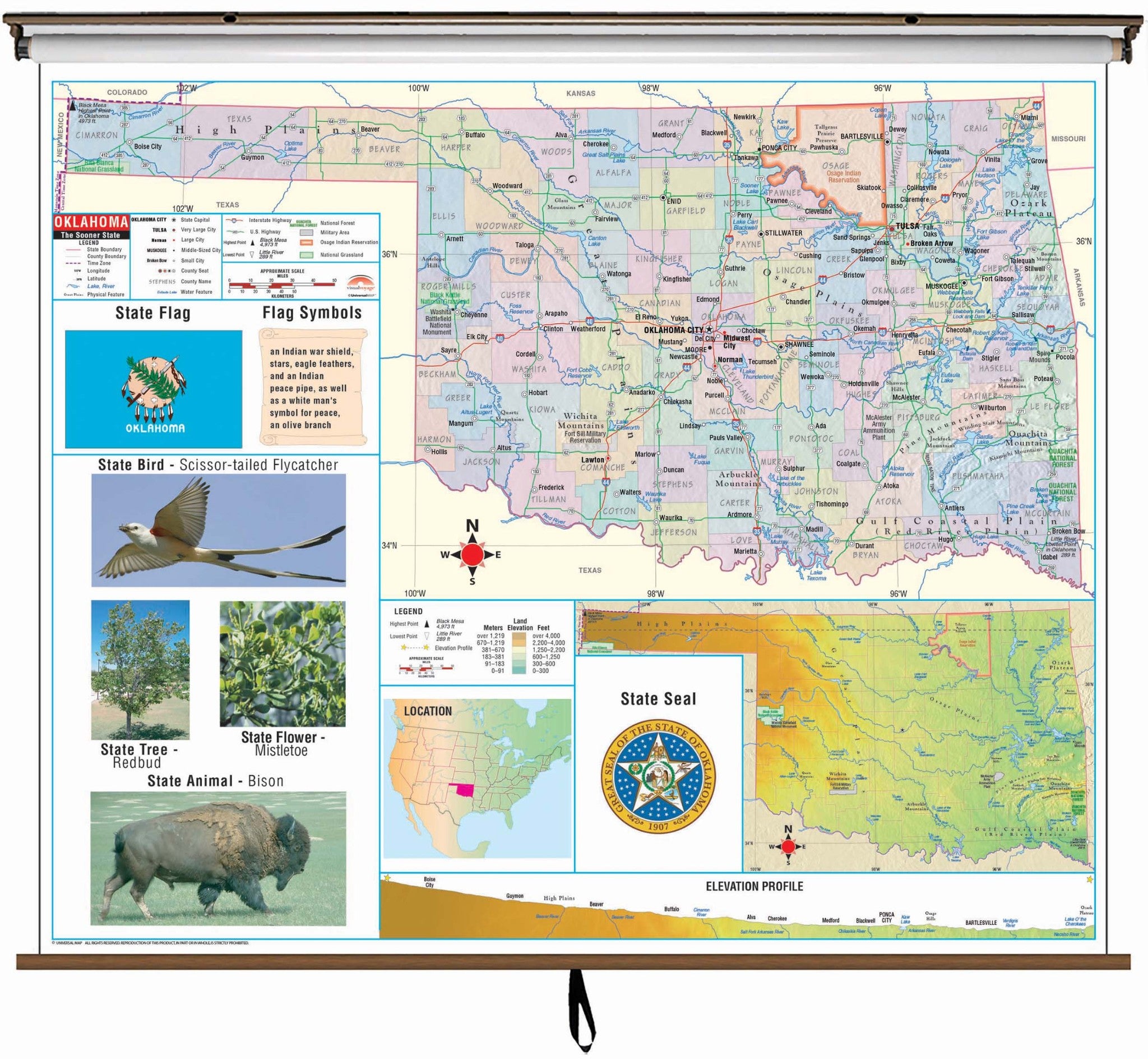
The Oklahoma State Primary Thematic Wall Map is the perfect teaching aid for state studies and related subjects. Political/physical maps with hypsometric colorations; shows county boundaries, interstate highways, county seats, cities and towns and state regions..
Maps correlate with state standards and curriculum guidelines. They are constructed of heavy paper, with a write-on/wipe-off laminated finish that can be used with water-based or wet erase pens.
Primary Thematic Wall Maps feature basic state information; shows the state capital and major cities; state flag, state seal and motto, state tree, flower and bird. Measures 54" x 64" and corresponding deskpad map matches with the information on the Primary Wall Maps. .
This product is ideal for public, private, parochial, and home schools
These maps are printed and finished to order. Please allow 4-6 weeks for delivery.