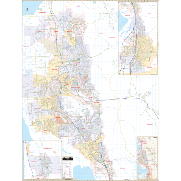
The Ogden, Davis/Weber Counties, Utah Wall Map by Kappa Map Group measures 58 x 76 inches and provides complete street detail at a scale of 1" = 2000'. Offers up-to-date cartography with new streets and changes.
Details and special features include all streets, post offices, hospitals, railroads, airports, cemeteries, shopping centers, water features, recreational parks, government buildings, fire and police stations, educational facilities, golf courses and country clubs, ZIP codes and ZIP code boundaries, city limits, and annexations.
Covers all of Ogden, Utah with the following boundaries: North: to Box Elder/Weber County line; South: to Farmington; East: to Wasatch-Cache National Forest and Morgan County Airport; West: to include all of Plain City. insets: Brigham City, Bountiful/N. Salt Lake City area extending from Farmington south-almost to the Salt Lake County line; and a vicinity map.
Framing rails are included on top and bottom for easy wall mounting. Railed wall maps can be turned into pull down maps on spring rollers for an additional $30.
Year: 2015
Edition: 2nd
These maps are printed and finished to order. Please allow 4-6 weeks for delivery.