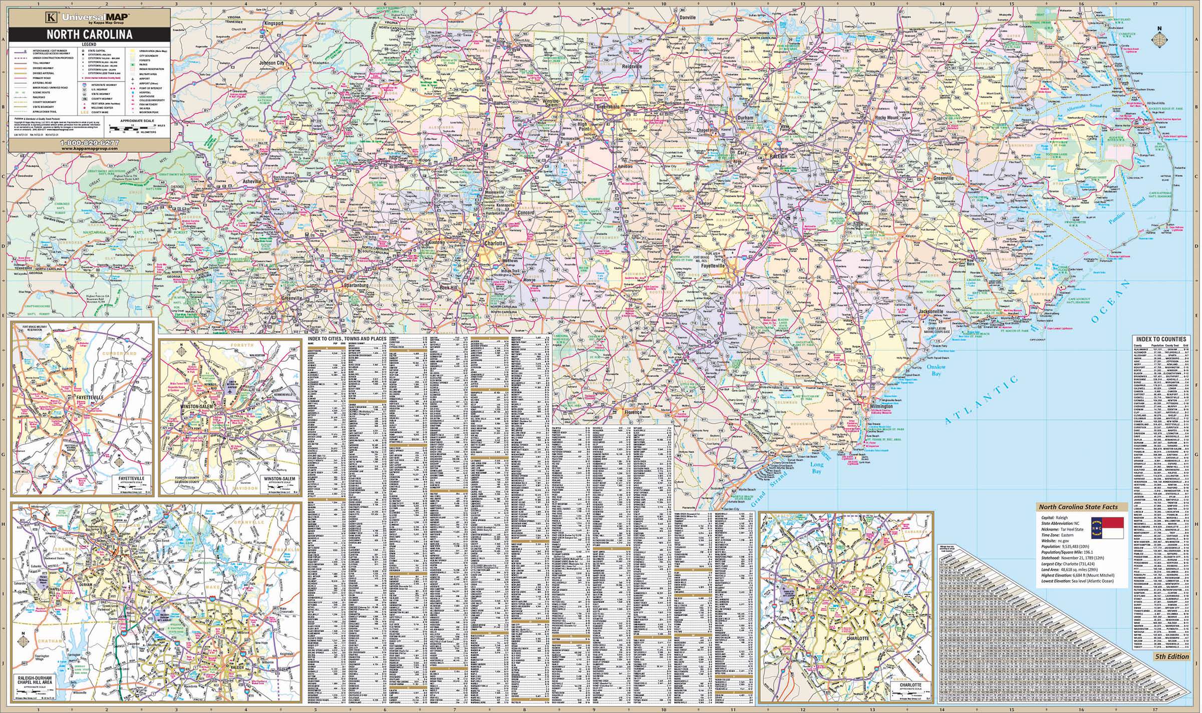
The North Carolina Wall Map by Kappa Map Group measures 68" W x 42" H. (5'8" W x 3'6" H) Provides cartography at a scale of 1" = 8 miles. Printed in color with a markable/washable surface. Cities and counties along with their populations are indexed on the face of the map.
Features color coded counties, mileage chart between major cities, state facts index and inset maps of Charlotte, Fayetteville, Winston Salem and the Raleigh / Durham / Chapel Hill area.
Includes the following details: all state highways, all federal highways, secondary roads, cities and towns, major waterways, major airports, state & national parks, state universities, military installations, wildlife areas, and various points of interest.
Map is available with the following options:
-
Laminated:Laminated for protection on both sides. Use wet erase markers to write on wipe off.
-
Railed:Black plastic framing rails are added on the top and bottom of your Laminated map for easy wall mounting.
-
Spring roller:A Spring roller is applied to a Laminated map to turn it into a pull down map.
-
Spring roller/Backboard:Laminated map is attached to spring roller and we provide backboard and all components to mount map on wall.
Year: 2013
5th Edition
These maps are printed and finished to order. Please allow 4-6 weeks for delivery.