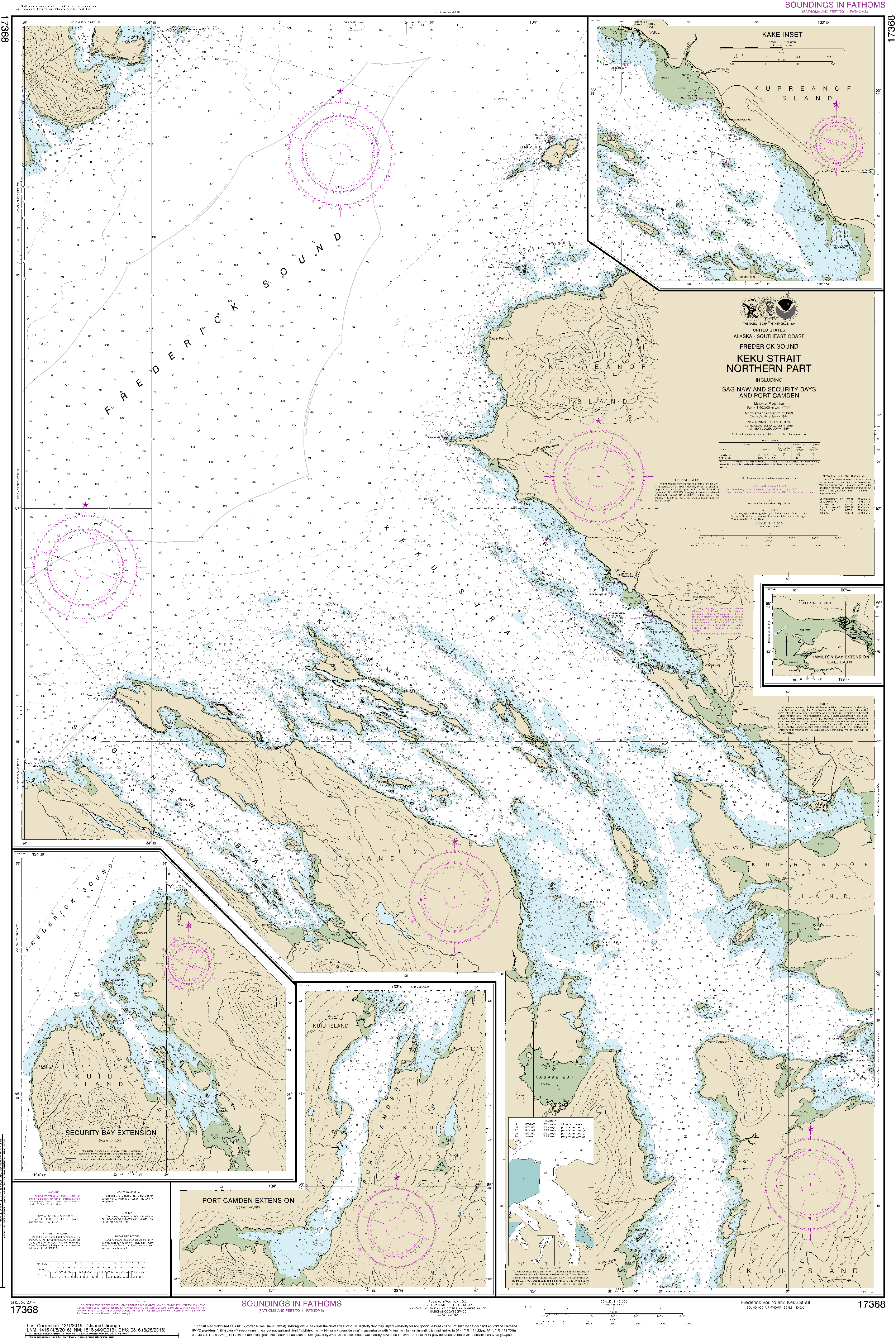
GeoMart is a authorized agent of NOAA and NGA print on demand nautical charts. Our charts are updated and printed after you place your order. This provides you with the most up to date NOAA approved nautical chart available. The NOAA Nautical Chart 17368: Keku Strait-northern part, including Saginaw and Security Bays and Port Camden;Kake Inset is printed on heavy weight acid free paper with the latest Notice to Mariners applied, and meets United States Coast Guard and international carriage requirements for commercial and recreational vessels.
Waterproof and Tyvek paper options available.
The waterproof paper looks and feels like regular paper and provides protection against exposure to water.
Tyvek is a near waterproof option that provides superior durability. With tear resistant durability, Tyvek can be balled up, stepped on, thrown across the wheelhouse and then be opened without damage to the chart.