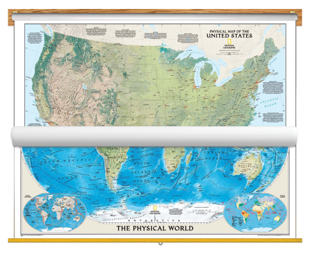
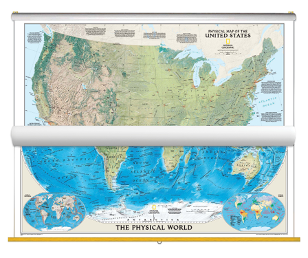
Educational and aesthetic, brighten up any classroom with this National Geographic Physical US and World Map Classroom Pull Down Bundle. The World Physical Map uses the Winkel Tripel projection to reduce distortion of land masses as they near the poles. Features include subtle border coloring on land, and prevailing winds and ocean currents at sea. Separate insets show the North and South Polar Regions, world tectonics, and world climate. See the magnificence of the US landscape with the US Physical map. The map depicts the great variety of natural vegetation in the US, from the tundra of Alaska to the desert in Arizona. Notes describe the major physical regions - from the Coastal Plain in the East to the Pacific Coast Mountains in the West, and beautiful hand-painted relief reveals topography and major features - creating a visually stunning reference map.
Both the National Geographic Physical USA & World Map are printed on 24lb. premium coated bond paper. They are also laminated on both sides using 3mm hot lamination, which protects your wall maps and allows you to write on them with dry-erase markers.
These laminated educational Pull Down maps are mounted to secure Spring Rollers ready to hang on any classroom wall.