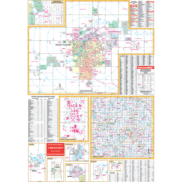
The Mount Pleasant and Isabella County, Michigan Wall Map by Kappa Map Group measures 41? x 60? using up-to-date cartography showing new streets and changes, plotted in complete street detail at a scale of 1? = 2,640 feet. Printed in color with a markable/washable?laminated surface. Street index provided on the face of the map. Framing rails are included on top and bottom for easy wall mounting. Railed wall maps can be turned into pull down maps on spring rollers for an additional $30.
Area of coverage: All of Isabella County.
Details include all streets and highways, government buildings, airports, water features, fire/police stations, hospitals, shopping centers, educational facilities, railroads, recreational parks, golf/country clubs, post offices, city limits/annexations, cemeteries, longitude latitude, ZIP codes/boundaries, and points of interest.
Year: 2006
Edition: 1st
These maps are printed and finished to order. Please allow 4-6 weeks for delivery.