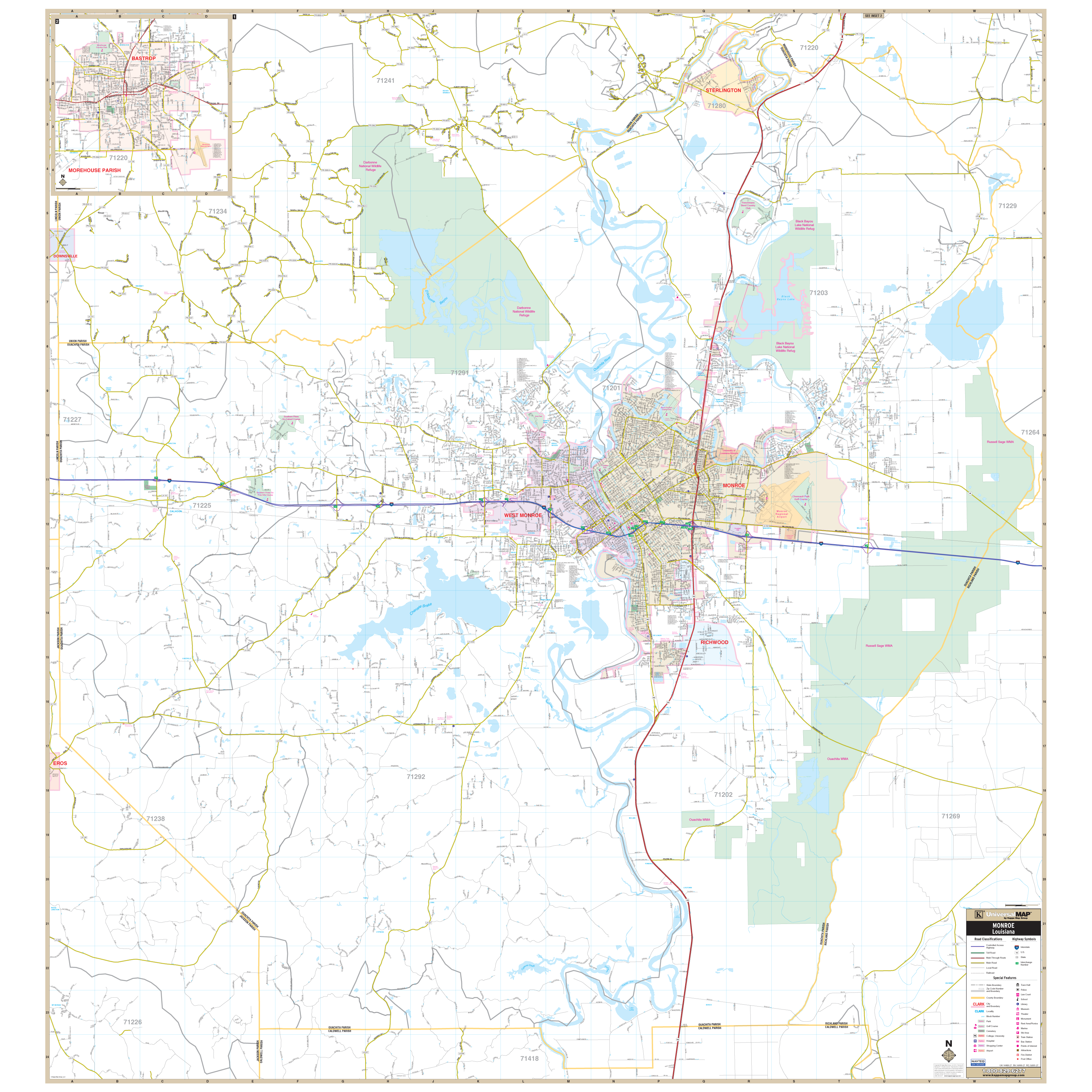
The Monroe/Ouachita Parish, Louisiana Wall Map by Kappa Map Group measures 58" W x 62" H. (4'10" x 5'2") Offers up-to-date cartography in complete street detail with all new streets and changes, and is printed in color with a markable and washable laminated surface . Streets are indexed in a separate book.
The area of coverage includes all of Ouachita Parish.
Details include Airports, All Streets Highways, Block Numbers, Cemeteries, City Limits (color coded), Educational Institutions, Fire Police Stations, Golf Country Clubs, Government Buildings, Hospitals, Libraries, Points of Interest, Post Offices, Railroads, Recreational Parks, Section/Township/Range Lines, Water Features, and ZIP Codes Boundaries.
Framing rails are included on top and bottom for easy wall mounting. Railed wall maps can be turned into pull down maps on spring rollers for an additional $30.
Year: 2013
Edition: 1st
These maps are printed and finished to order. Please allow 4-6 weeks for delivery.