Maptech U.S. Boating Charts with Tides and Currents

Sale price
$ 89.95
Regular price
$ 99.95
You save
$ 10 (11%)
Taxes and shipping calculated at checkout
In stock and ready for shipping

Frequently Bought Together

We Accept

American Express
Apple Pay
Diners Club
Discover
Google Pay
Mastercard
Shop Pay
Visa

Product Information

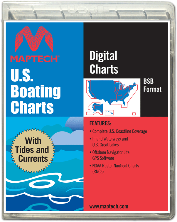
Maptech U.S. Boating Charts with Tides and Currents

TIRED OF DOWNLOADING NOAA CHARTS?

There is a better way, and tides and currents data is included with the charts. The easy-to-load U.S. Boating Charts with Tides and Currents USB Flash Drive has more than 2,200 up-to-date NOAA nautical charts and insets and more than 750 river charts from the U.S. Army Corp of Engineers. It comes with GPS real-time navigation software and U.S. Tides and Currents.

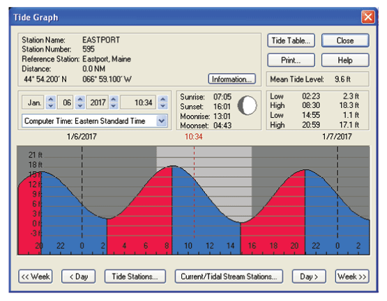
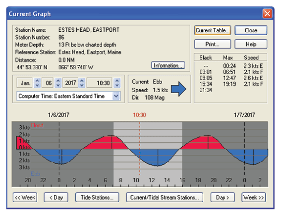
Tides and Currents
The Flash Drive contains complete data for the U.S. and graphically shows the current state of the tides and currents by specific station.

Click to Create Routes
Maptech's® "Offshore Navigator Lite" navigation software is included. Click your mouse to put a waypoint on a chart. Click again, and you're creating a route. It's that easy. Distances, bearings and GPS positions are calculated and displayed instantly.

Print Your Own Charts
Print your own customized GPS waypoints, route plans and chart segments.

GPS Positioning Rollover
Connect a GPS to your laptop and see your real-time position on the computer screen. Real-time positioning requires connecting an industry-standard NMEA 0183 GPS to your PC.

GPS Ready
The U.S. Boating Charts with Tides & Currents includes Maptech's® "Offshore Navigator Lite" GPS positioning software. Offshore Navigator Lite's GPS features include:

  • Real-Time Positioning:  Connect a USB GPS to your PC to see your position right on the chart. As you move the vessel icon moves.
  • Data Windows: Data Windows display key GPS data such as Lat/Lon, COG, and SOG. They also instantly calculate course information such as Cross-Track Error and Range and Bearing to the next waypoint.
  • Transfer Waypoints from PC to GPS: Transfer waypoints directly from your PC into popular GPS receivers. Say goodbye to the task of keying waypoints in one by one.

MINIMUM SYSTEM REQUIREMENTS

  • BSB CHART FORMAT: These Digital Charts are in the Maptech®/BSB file format. The Offshore Navigator Lite software included in this package is BSB-Compatible. If you are using another navigation program, please confirm with the manufacturer that it is BSB-Compatible.
  • PC MINIMUM REQUIREMENTS: Windows® XP, Vista, 7, 8, or 10; 120MB of RAM; 256 color, 800 x 600 display; 8 GB of hard disk space; mouse or drawing equivalent.

Recommended for You