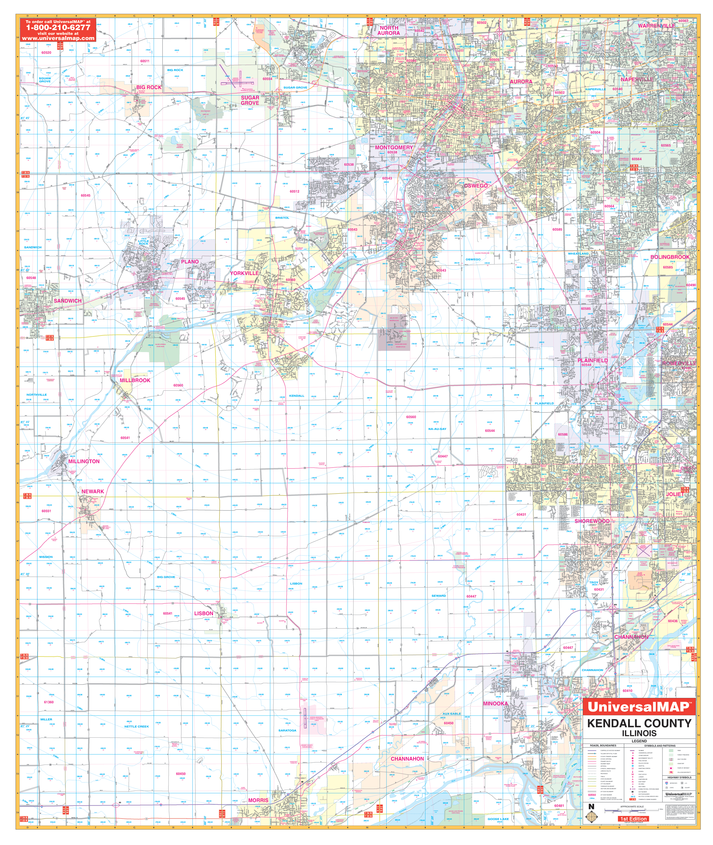
The Kendall County, Illinois Wall Map by Kappa Map Group measures 54? x 64? (4'8" W x 5'4" H) using up-to-date cartography showing new streets and changes, plotted in complete street detail at a scale of 1? = 2,640 feet. Printed in color with a markable/washable?laminated surface. Street index provided in a separate book. Framing rails are included on top and bottom for easy wall mounting. Railed wall maps can be turned into pull down maps on spring rollers for an additional $30.
Area of coverage: All of Kendall County with the following boundaries: North: To North Aurora, Warrenville, and Sugar Grove; South: To Morris the Kankakee River; East: To Bolingbrook, Romeoville, and Joliet; West: To Sandwich, Newark, and Millington.
Details include all streets and highways, airports, government buildings, airports, water features, fire/police stations, hospitals, shopping centers, educational facilities, railroads, recreational parks, golf/country clubs, post offices, Section /Township/range lines, mileage circles, city limits/annexations, cemeteries, longitude latitude, ZIP codes/boundaries, and points of interest.
Year: 2009
Edition: 2nd
These maps are printed and finished to order. Please allow 4-6 weeks for delivery.