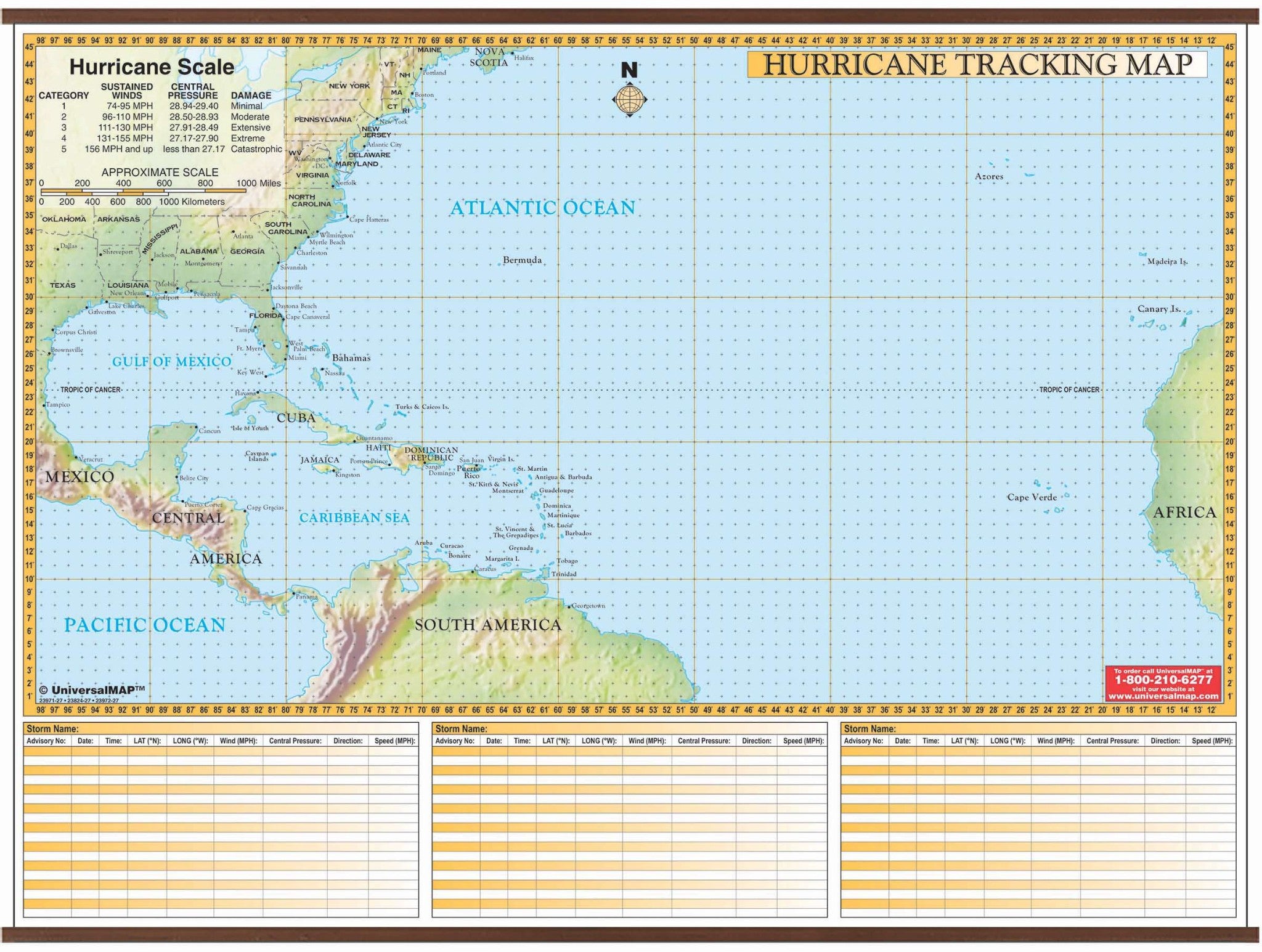
Educational and Informative–The Hurricane Tracking Chart Wall Map is a fabulous tool for tracking storms.
The map includes boundaries ranging north to the Maine-Nova Scotia Coast; south to the South American Northern Coastline; east to the African Coastline; and west to the Texas-Mexican coast and Central American coast.
Features gridded longitude/latitude lines, a hurricane scale chart, and three storm tracking charts. The Map is laminated with a heavy-duty washable finish that can be written on by water-based and wet erase markers for years of use!
64" x 50"
Map is available with the following options:
-
Laminated:Laminated for protection on both sides. Use wet erase markers to write on wipe off.
-
Railed:Black plastic framing rails are added on the top and bottom of your Laminated map for easy wall mounting.
-
Spring roller:A Spring roller is applied to a Laminated map to turn it into a pull down map.
-
Spring roller/Backboard:Laminated map is attached to spring roller and we provide backboard and all components to mount map on wall.