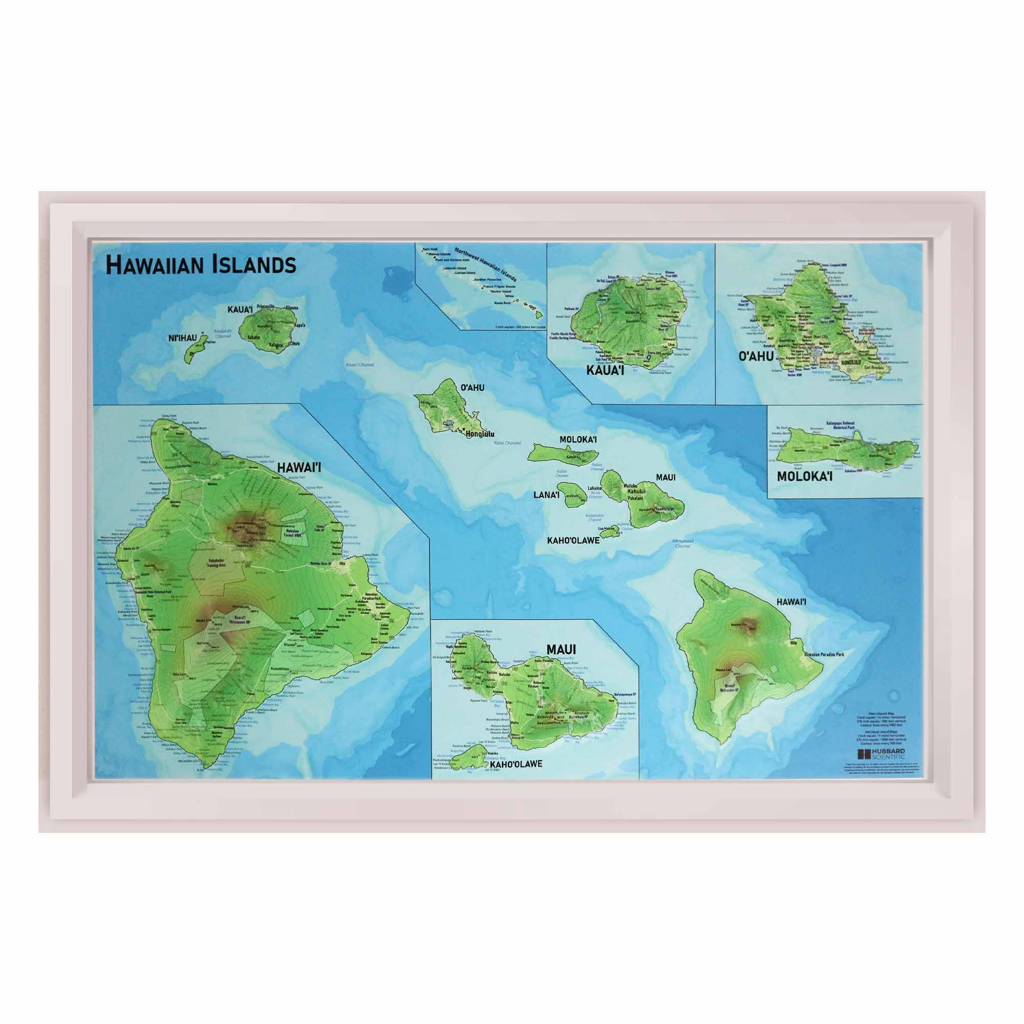
Unveil the Majesty of Hawaii
Dive into the topographical wonders of the Hawaiian Islands with our meticulously crafted Hawaii Raised Relief Map. Perfect for adventurers and geography aficionados alike, this map brings the lush landscapes and dramatic contours of Hawaii right into your home or office. Explore the volcanic peaks, verdant valleys, and sparkling coastlines that make Hawaii a place of awe and wonder. Whether you’re a seasoned traveler recounting your journeys or a dreamer planning your future adventures, this map serves as a constant inspiration and a stunning piece of art.
A Navigator’s Dream
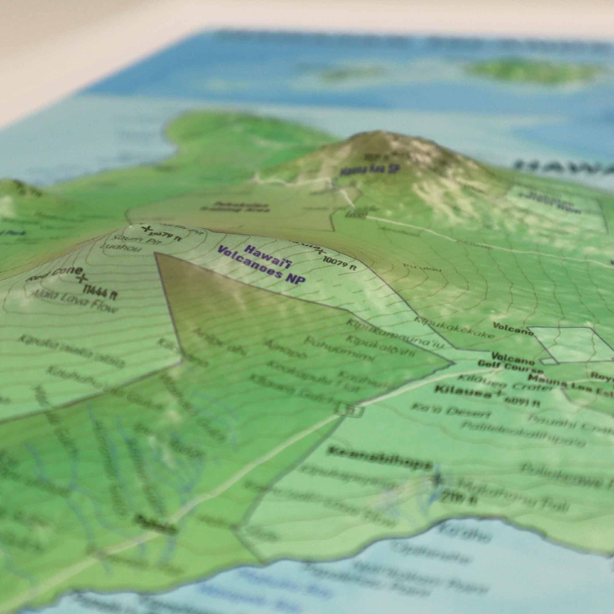
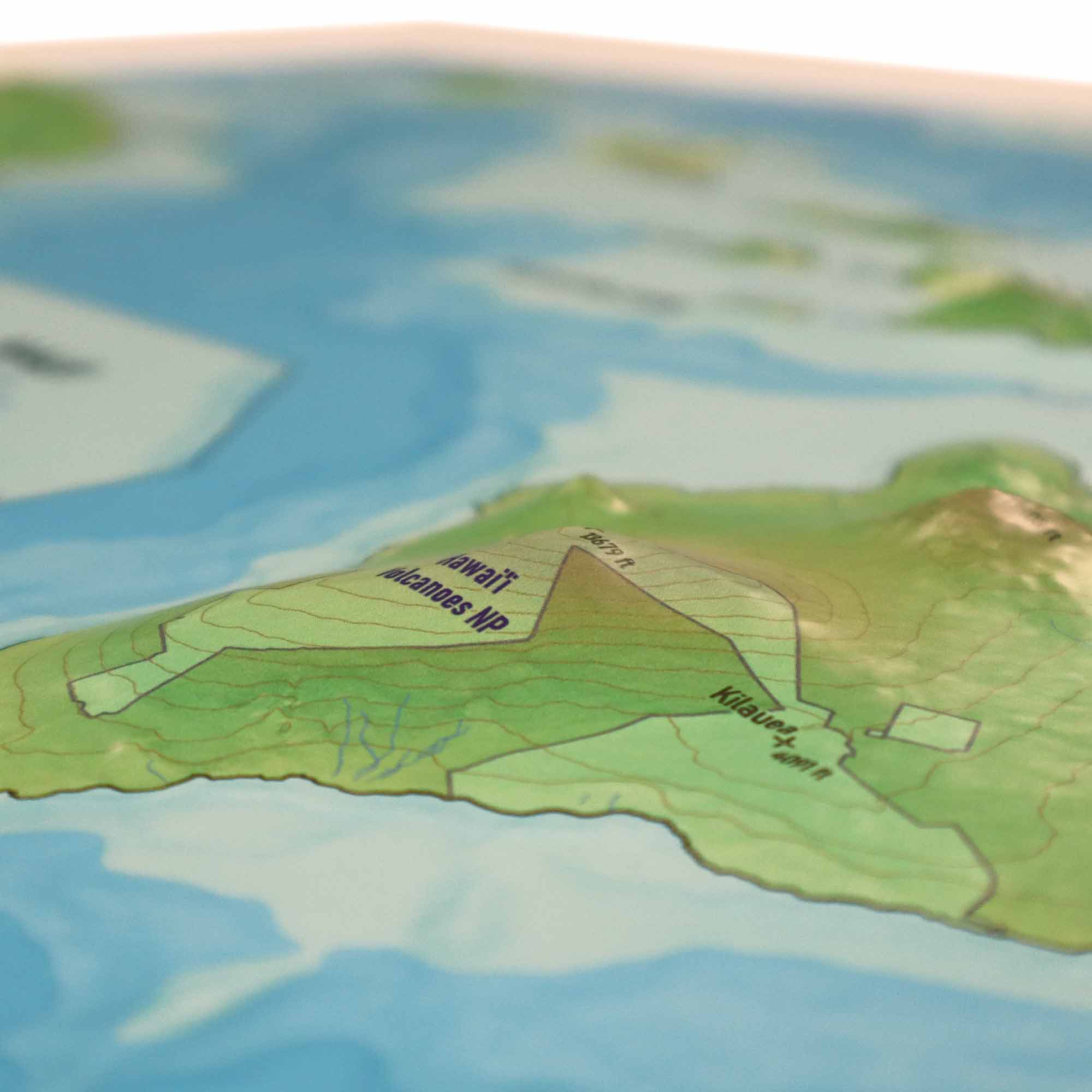
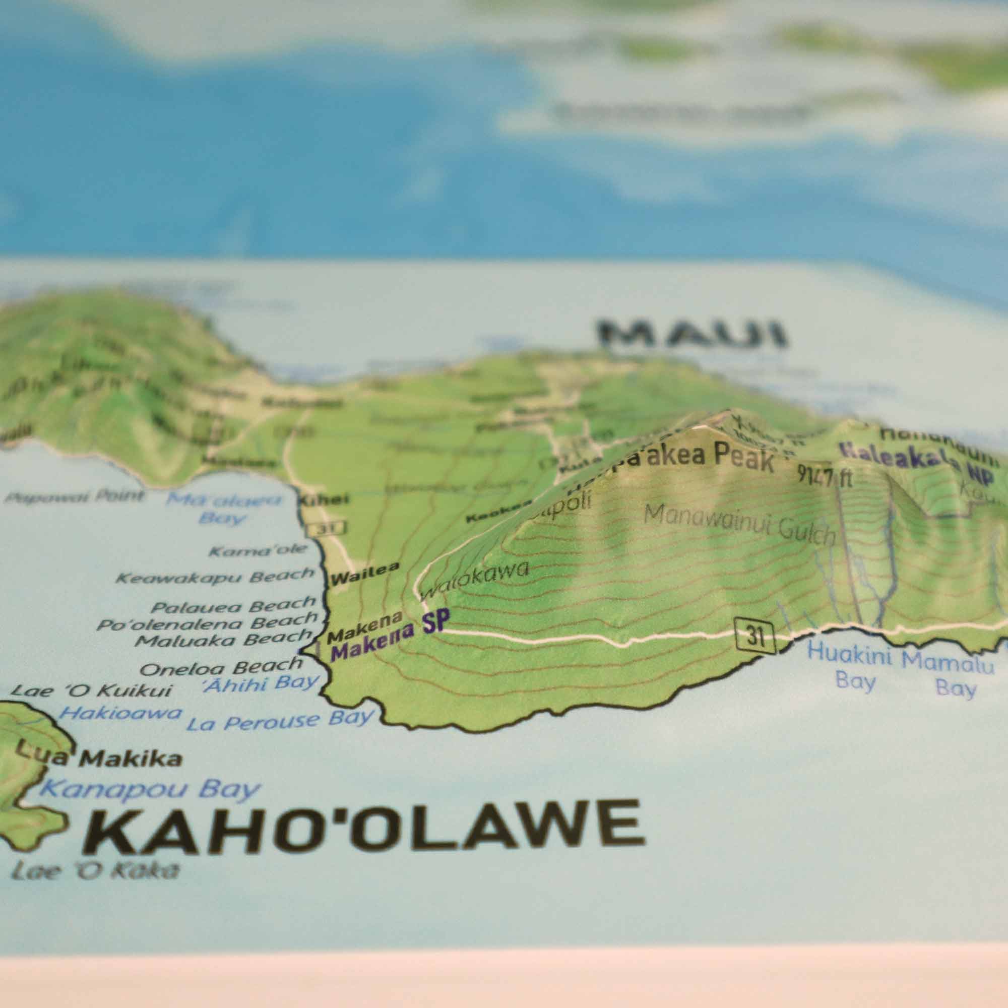
Ideal for educational purposes or as a unique decorative piece, our Hawaii Raised Relief Map is not just a map but a bridge to the Hawaiian spirit. Its raised relief feature allows you to physically feel the varied elevations of the islands, from the towering Mauna Kea to the depths of Waimea Canyon. It's a tactile experience that brings geography to life, making it a perfect tool for teachers, students, and anyone with a deep appreciation for the Earth's natural beauty.
Connect with the Hawaiian Legacy
Embrace the rich history and culture of Hawaii every time you glance at this map. Beyond its geographical accuracy, it tells the story of Hawaii's majestic landscapes, sacred sites, and the resilient spirit of its people. This map isn’t just an object of admiration; it's a conversation starter, a piece of history, and a tribute to the islands' breathtaking natural wonders.
Here's why this Hawaii raised relief map is a must-have:
-
Tactile Exploration: Experience Hawaii's unique topography firsthand; the raised relief allows you to feel the islands' dramatic landscapes, from towering peaks to deep valleys, making it a captivating educational tool or conversation piece.
-
Visually Stunning: With its precise detailing and artistic representation, this map serves not only as a geographical tool but also as a striking piece of art that enhances any room, ideal for home, office, or classroom settings.
-
Cultural Connection: Connect with Hawaii's rich cultural heritage and history through the physical landscape, offering a unique way to appreciate the islands' beauty and the stories embedded in their geography.
-
Educational Value: An invaluable resource for students, teachers, and geography enthusiasts, this map provides a hands-on learning experience that brings to life the geological wonders and environmental diversity of Hawaii.
-
Gift of Adventure: Perfect as a gift for travelers, explorers, or anyone fascinated by Hawaii, the map inspires exploration and dreaming of future adventures to the Hawaiian Islands, making it a thoughtful and inspiring present.
Whether you're a seasoned hiker, armchair explorer, or simply captivated by Hawaii's beauty, this raised relief map is the perfect way to:
-
Navigate Hawaii's Terrain: Trace the islands' rugged coastlines, volcanic peaks, and lush valleys, planning your next hike or reminiscing about trails conquered.
-
Bring Hawaii into Your Home: Experience the allure of the islands from anywhere, offering a window to tropical vistas and serene landscapes without leaving your living room.
-
Deepen Your Connection: Gain a deeper understanding of Hawaii's natural wonders and ecological diversity, fostering a greater appreciation for its unique beauty and cultural significance.
-
Inspire Island Adventures: Fuel your wanderlust with a tangible representation of Hawaii's landscapes, sparking dreams of future explorations and adventures across the Pacific paradise.
Order your Hawaii raised relief map today and embark on a geographical adventure, all from the comfort of your home!