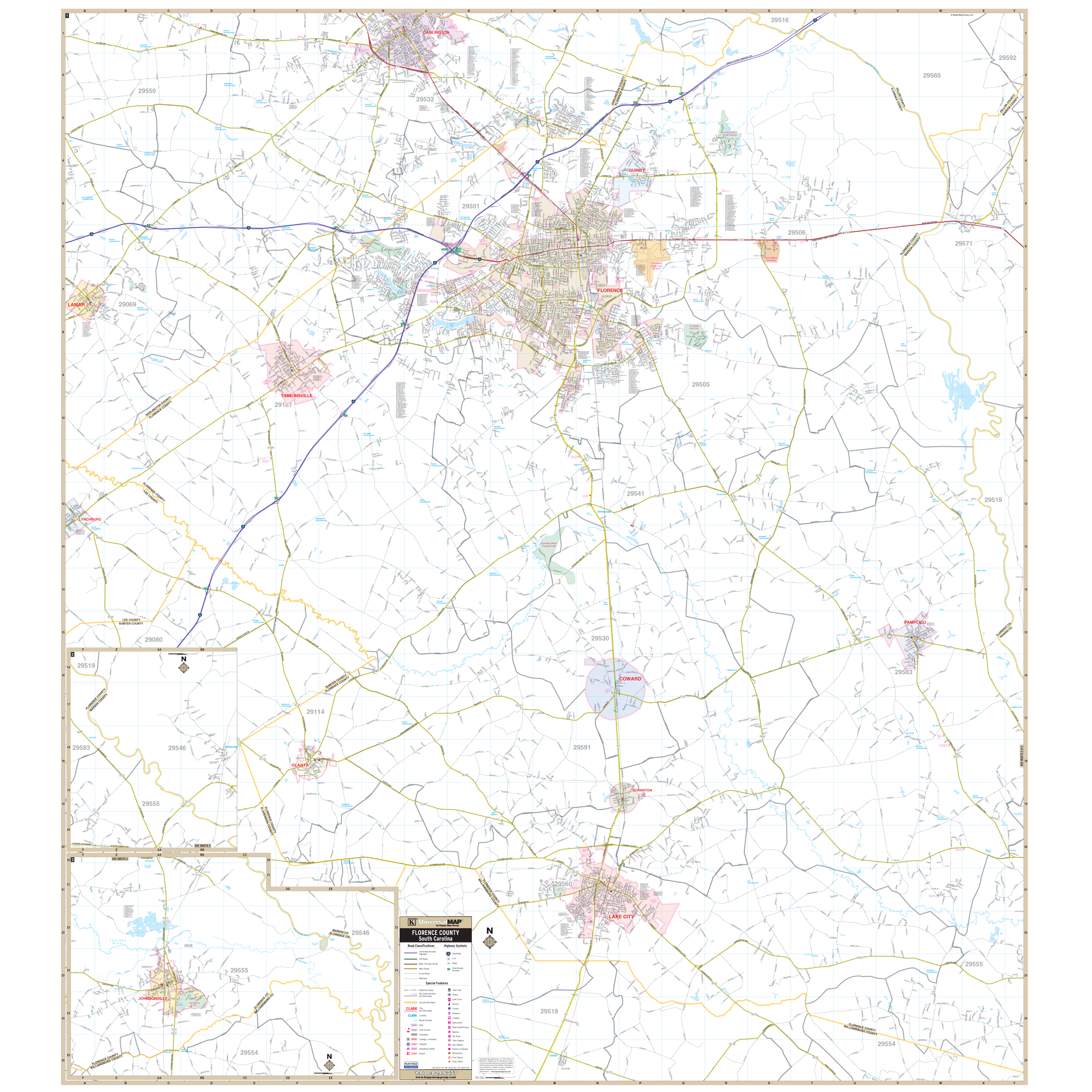
The Florence/Florence County, South Carolina Wall Map s by Kappa Map Group shows complete street detail at a scale of 1" = 3,042 feet. Area of coverage is all of Florence County with the following boundaries: North to the northern tip of Florence County Line; South the Florence/Williamsburg County Line; East to the Florence/Marion County Line ; and West to the western tip of Florence County to include all of Lamar in Darlington County. Streets are indexed in a separate book.
Features all streets/highways, government buildings, airports, golf courses/country clubs, railroads, ZIP codes/boundaries, shopping centers, recreational parks, cemeteries, educational institutions, hospitals, post offices, city limits (color coded), fire/police stations, and more.
Measures 58" by 66", in full color, and is laminated, and includes framing rails on top and bottom for easy wall mounting. Railed wall maps can be turned into pull down maps on spring rollers for an additional $30.
Year: 2013
Edition: 1st
These maps are printed and finished to order. Please allow 4-6 weeks for delivery.