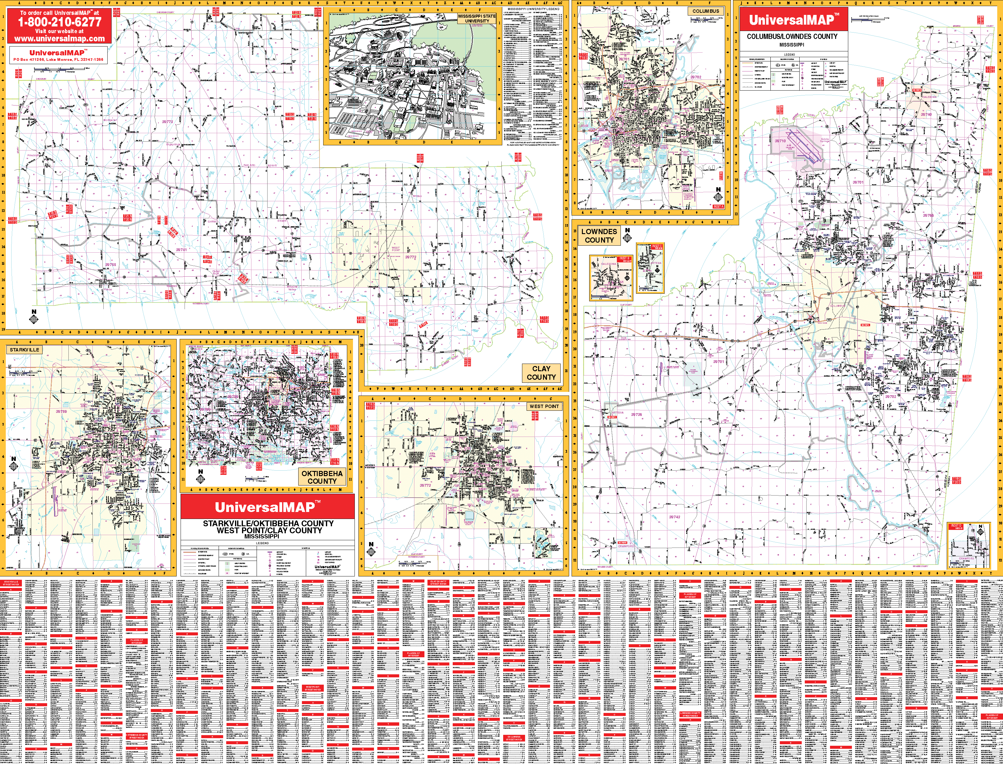
The Columbus, Starksville, and West Point, Mississippi Wall Map by Kappa Map Group measures 50? x 72? providing up-to-date cartography in complete street detail. Printed in color with a markable and washable laminated surface. Framing rails are included on top and bottom for easy wall mounting. Streets indexed on the face of the map.
Area of coverage ranges as follows: Section One --Clay County (scale 1? = 5,280 feet) with a city inset of West Point (scale 1? = 2,340 feet); Section Two --Lowndes County (scale 1? = 2,011 feet) with a city inset of Columbus (scale 1? = 2,011 and insets of Artesia, Crawford, and Caledonia; Section Three --Oktibbeha County (scale 1? = 1.6 mi) and a city inset of Starksville (scale 1? = 2,283 ft.). It also includes an inset map of Mississippi State University.
The details, features, and data covered on this map include: all streets and highways, government buildings, ZIP codes/boundaries, airports, golf courses and country clubs, railroads, post offices, shopping centers, cemeteries, city limits and annexations, educational facilities, fire and police stations, hospitals, water features, mileage circles, and points of interest.
Railed wall maps can be turned into pull down maps on spring rollers for an additional $30.
Year: 2006
Edition: 2nd
These maps are printed and finished to order. Please allow 4-6 weeks for delivery.