Our Cleveland and Cuyahoga Co, OH Wall Map, with adjacent areas, measures
58" x 60" (4'10" W x 5' H) and features up-to-date cartography, with new streets and changes in complete street detail; is printed in color, with a markable and washable laminated surface; and offers a street index in a separate book-format.
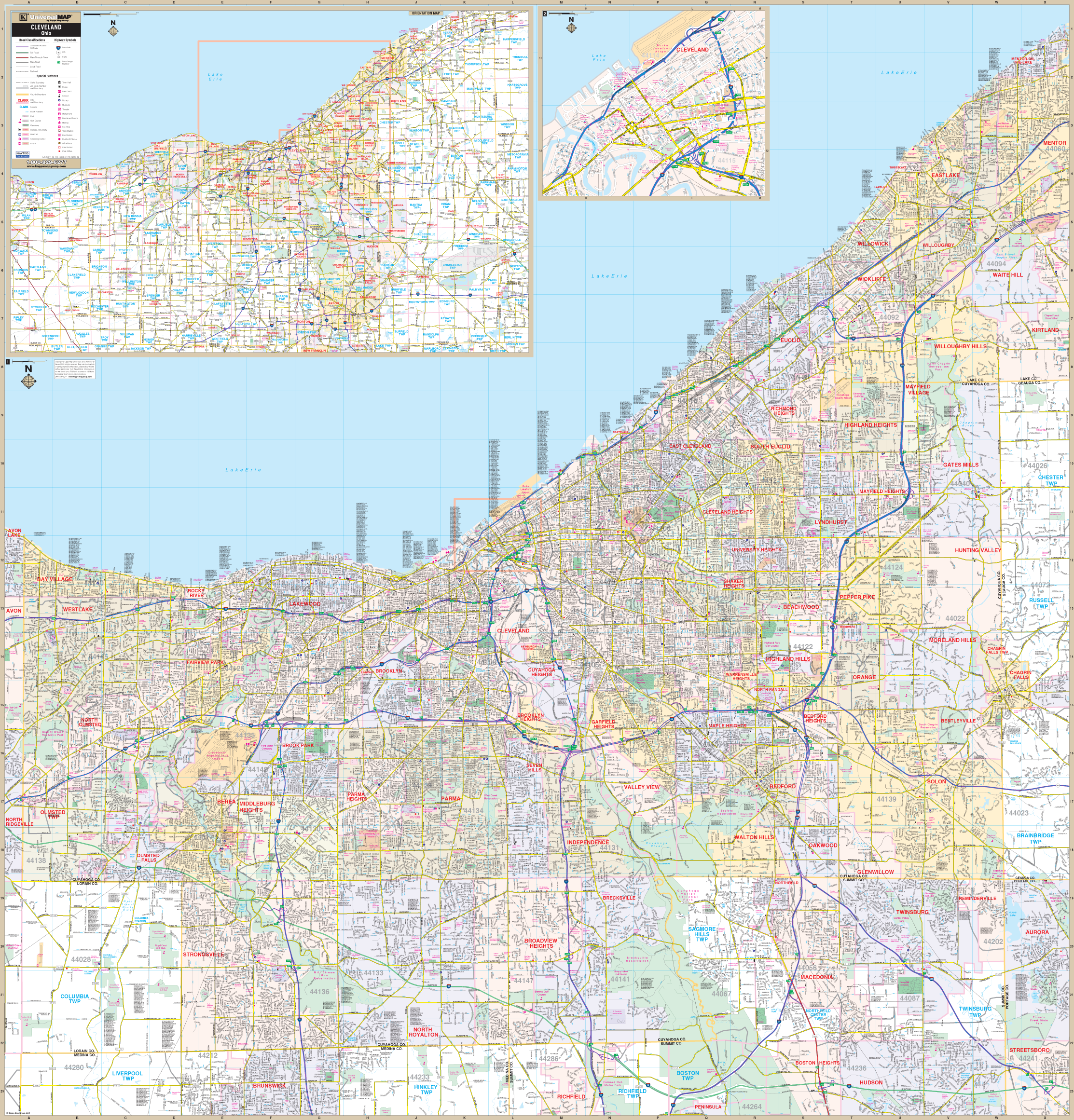
The area of coverage includes all of Cuyahoga County, with the following boundaries:
- North to Lake Erie
- South to Richfield in Summit County, showing 80 and 480 interchange
- East to Mentor in Lake County
- West to Avon Lake, in Lorain County
The Cleveland and Cuyahoga Co, OH Wall Map also includes insets of Downtown Cleveland (shows Rock Roll Hall of Fame, FirstEnergy Stadium and Cleveland State University ), Northeast Ohio, and a seven-county area map.
Details and features include:
- AIRPORTS
- CEMETERIES
- CITY LIMITS
- EDUCATIONAL INSTITUTIONS
- FIRE POLICE STATIONS
- GOLF COUNTRY CLUBS
- GOVERNMENT BUILDINGS
- HOSPITALS
- LATITUDE LONGITUDE LINES
- MILEAGE CIRCLES
- POST OFFICES
- RAILROADS
- SHOPPING CENTERS
- STREETS HIGHWAYS
- WATER FEATURES
- ZIP CODE BOUNDARIES
Framing rails are included, top and bottom, for easy wall mounting. Spring roller mounting is also available, for an additional $30.
Year: 2013
Edition: 1st
These maps are printed and finished to order. Please allow 4-6 weeks for delivery.