Our Cleveland and Bradley Co, TN Wall Map, with adjacent areas, measures
54" x 67" (4'6" W x 5'7" H) and features up-to-date cartography, with new streets and changes in complete street detail; is printed in color, with a markable and washable laminated surface; and offers a street index in a separate book-format.
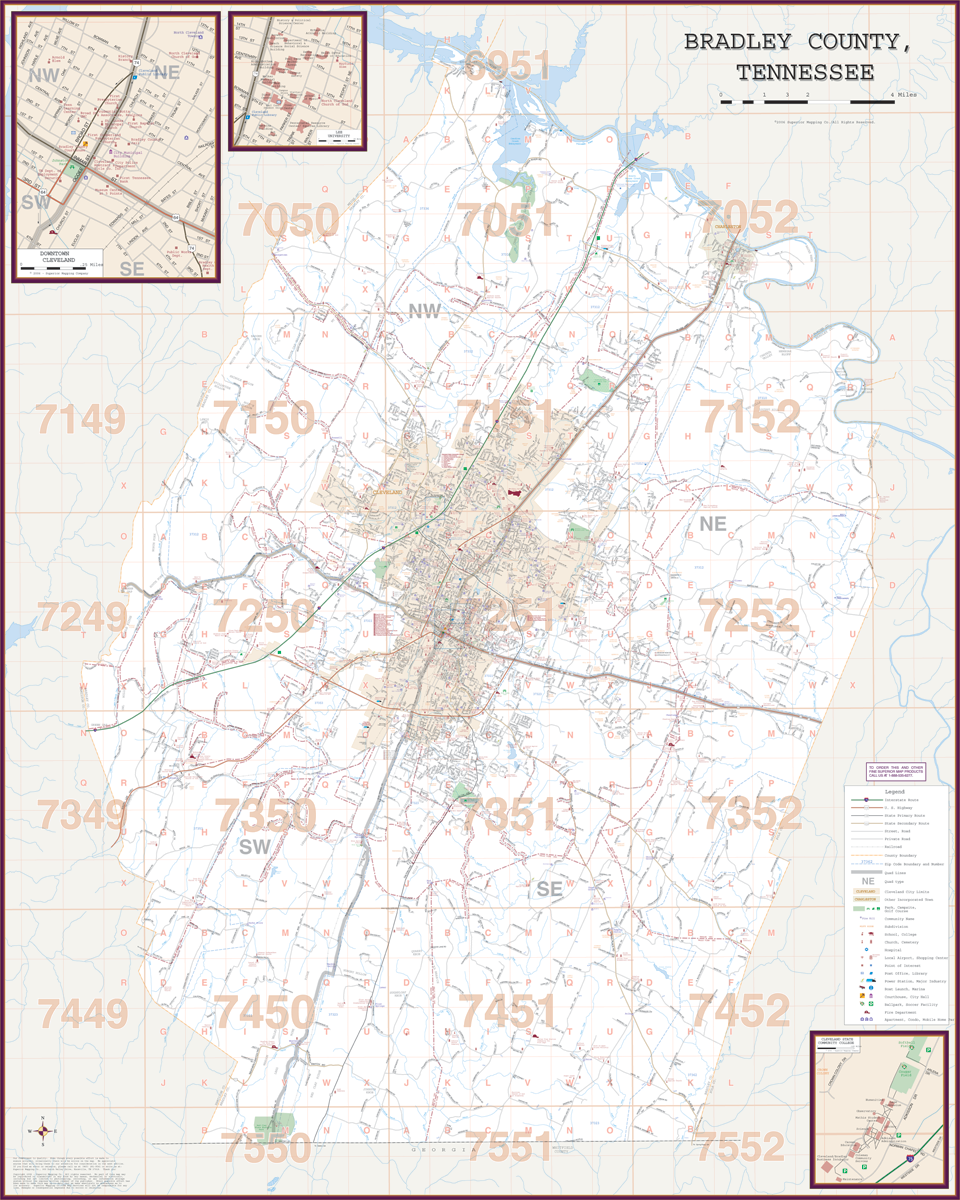
The area of coverage includes all of Bradley County, with the following boundaries:
- North to McMinn and the Meigs County line
- South to the Georgia State line
- East to the Polk County line
- West to the Hamilton County line
The Cleveland and Bradley Co, TN Wall Map also includes inset maps of Downtown Cleveland, Lee University, and Cleveland State University.
Details and features include:
- AIRPORTS
- CEMETERIES
- CITY LIMITS
- EDUCATIONAL INSTITUTIONS
- FIRE POLICE STATIONS
- GOLF COUNTRY CLUBS
- GOVERNMENT BUILDINGS
- HOSPITALS
- POST OFFICES
- RAILROADS
- RECREATIONAL PARKS
- SHOPPING CENTERS
- STREETS HIGHWAYS
- SUBDIVISIONS
- WATER FEATURES
- ZIP CODE BOUNDARIES
Framing rails are included, top and bottom, for easy wall mounting. Spring roller mounting is also available, for an additional $30.
Year: 2005
Edition:
These maps are printed and finished to order. Please allow 4-6 weeks for delivery.