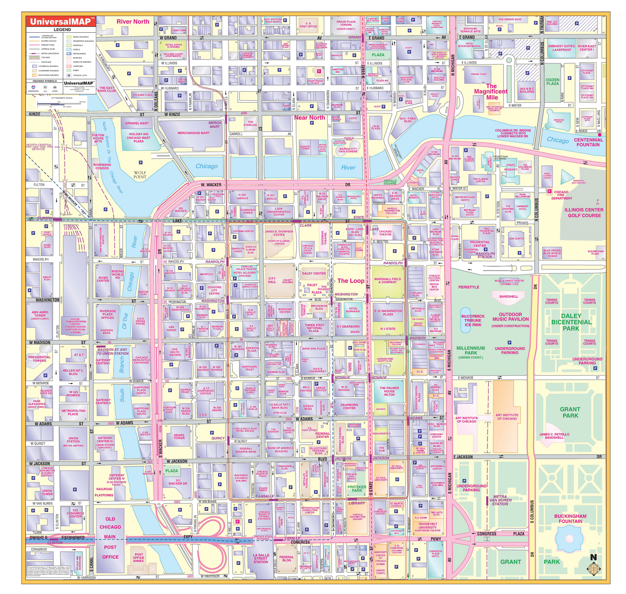
The Chicago, Illinois Loop Wall Map by Kappa Map Group measures 54? x 54? (4'6"W x 4'6"H) providing up-to-date cartography at a scale of 1? = 100 feet. Printed in color with a markable/washable-laminated surface. Provided with hanging rails mounted top and bottom.
The area of coverage ranges: North: to the Chicago River; South: to include Congress Parkway; East: to Columbus Drive; West: to Canal Street.
Details include streets and highways, churches, retail buildings, metro lines and stations, museums and parks, government buildings, one-way streets, shopping centers, educational buildings, CTA lines, hospitals, commercial buildings, railroads, water features, and points of interest.
Railed wall maps can be turned into pull down maps on spring rollers for an additional $30.
Year: 2007
Edition: 3rd
These maps are printed and finished to order. Please allow 4-6 weeks for delivery.