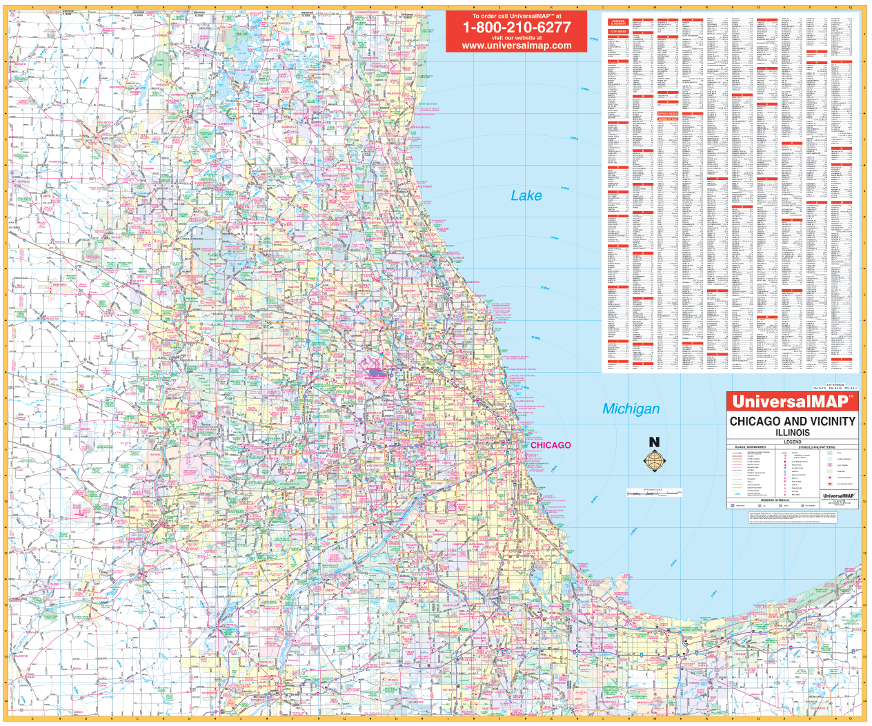
The Chicago, Illinois and 50 mile vicinity Wall Map by Kappa Map Group measures 58? W x 48? H (4'8"W x 4'H), uses up-to-date cartography, color, and lamination making the map markable and washable. Streets are indexed on the face of the map and framing rails are used on top and bottom for ease in hanging.
Area of coverage: All of Cook, Dupage, Kane, and Lake Counties and portions of McHenry, Will, and Kendall Counties with the following boundaries: North: to the Wisconsin State line; South: includes Joliet, Frankfort, and Sauk Village; East: includes Beverly Shores and Valparaiso, IN; West: to Kane/DeKalb Co, includes city of Harvard.
Details covered: airports, cemeteries, hospitals, railroads, post offices, mileage circles from Chicago City Hall, major roads and highways, shopping centers, water features, golf courses and country clubs, exit numbers, government buildings, major fire and police stations, colleges and universities, trails and recreational parks, city limits, and annexations.
Railed wall maps can be turned into pull down maps on spring rollers for an additional $30.
Year: 2017
Edition: 4th
These maps are printed and finished to order. Please allow 4-6 weeks for delivery.