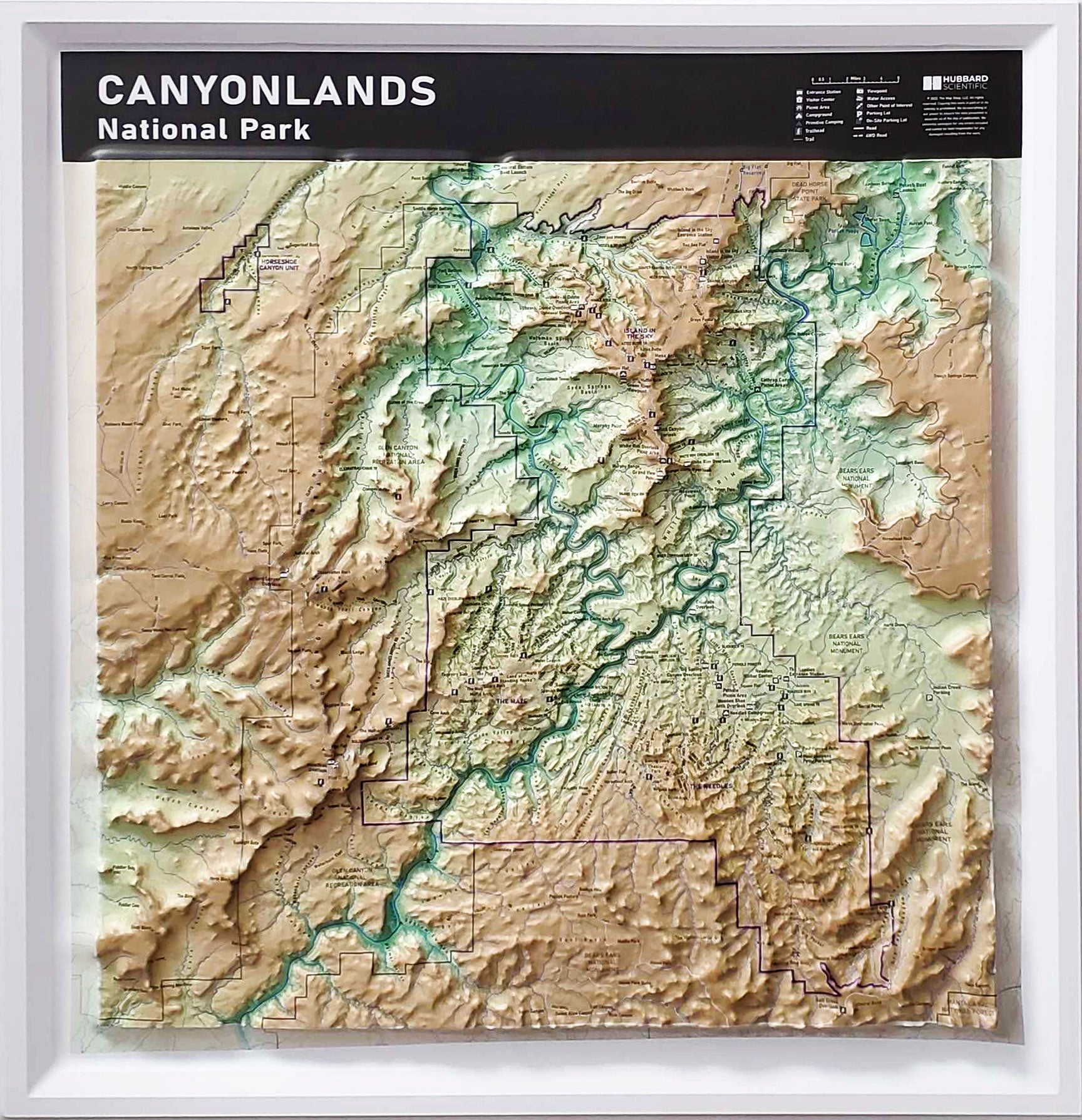
Canyonlands National Park: Explore the Majesty in 3D with a Raised Relief Map
Bring the breathtaking beauty of Canyonlands National Park into your home with this stunning raised relief map! This meticulously crafted map goes beyond a flat illustration, offering a tactile experience that brings the park's diverse landscapes to life.
Here's what makes this Canyonlands National Park raised relief map exceptional:
-
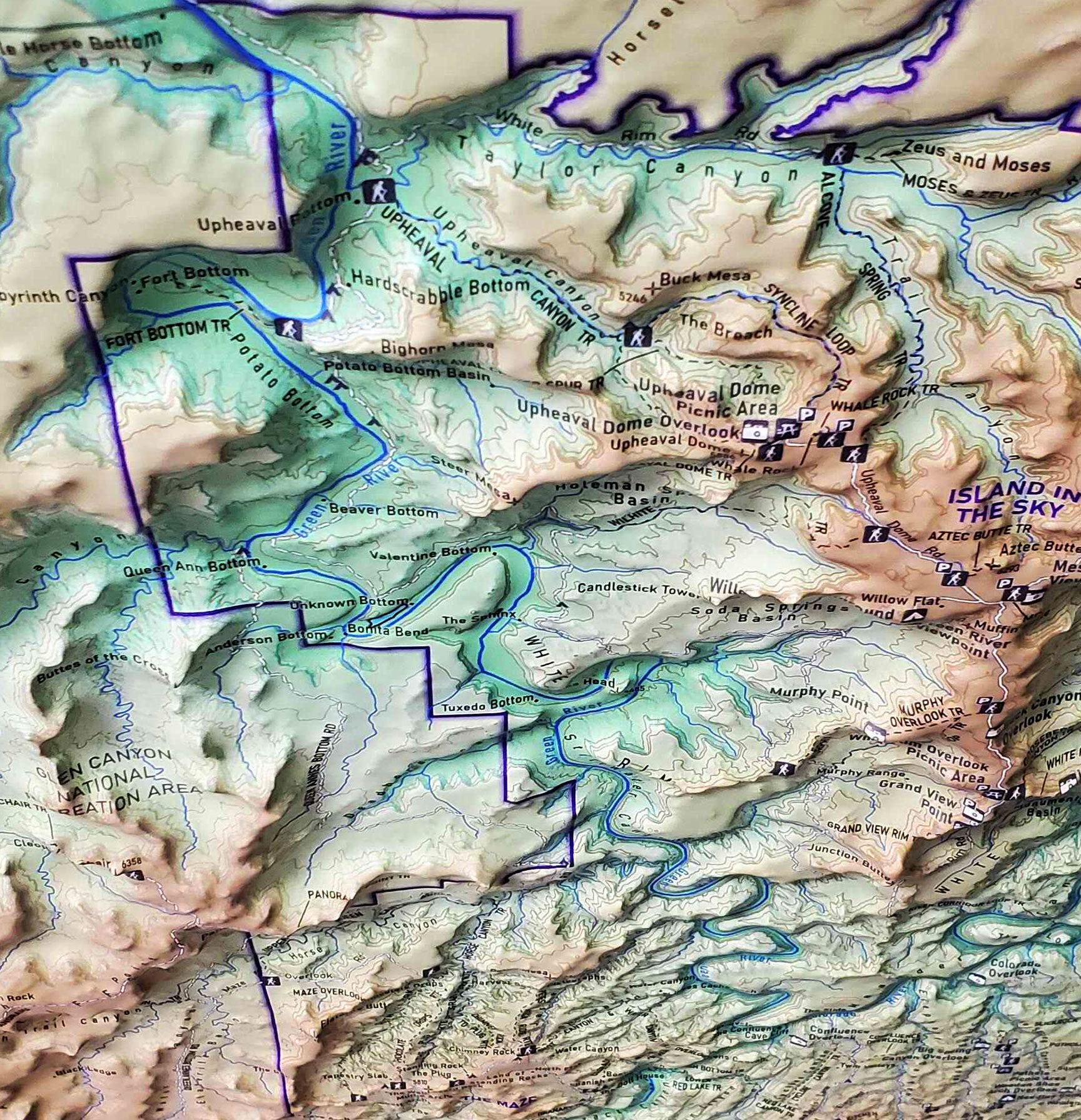
Vivid 3D Detail: Experience the towering mesas, plunging canyons, and labyrinthine canyons of Canyonlands in three dimensions. Feel the dramatic elevation changes and visualize the park's awe-inspiring scale.
-
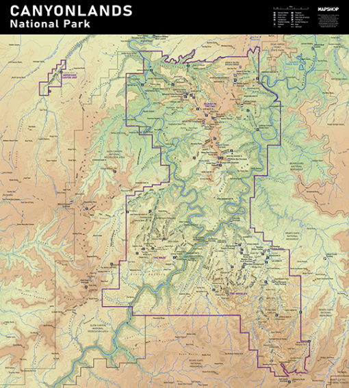
Landmark Identification: Easily locate iconic features like The Needles, The Maze, Mesa Arch, and viewpoints with clear labels. Perfect for planning your next adventure or reminiscing about past visits.
-
Educational Tool: Spark curiosity and ignite a passion for geography with this engaging map. Students and adults alike can learn about Canyonlands' unique geological formations.
-
High-Quality Materials: Made with durable and attractive materials, this map is built to last. It will be a conversation starter and a cherished piece of home decor for years to come.
Whether you're a seasoned Canyonlands enthusiast, armchair traveler, or educator, this raised relief map is the perfect way to:
-
Plan your dream trip: Visualize hikes, viewpoints, and scenic drives to create the perfect itinerary.
-
Relive your adventures: Rekindle the memories of your Canyonlands exploration with this stunning 3D representation.
-
Learn about the park's geology: Gain a deeper understanding of the forces that shaped this extraordinary landscape.
-
Add a touch of adventure to your home: Showcase your love for the outdoors and spark wanderlust in your guests.
Order your Canyonlands National Park raised relief map today and embark on a geographical adventure, all from the comfort of your home!
Raised relief 3D maps provide an unique tactile experience to map reading. Feeling the terrain allows you to truly understand the terrain. For over 30 years as an authorized dealer of these maps, we have placed these maps in schools, offices, real estate offices, rental houses, restaurants, welcome centers and homes. If you are using this for education or for decoration, raised relief maps make a perfect gift.
Each raised relief map starts as a map printed on a flat study sheet of vinyl. It is carefully registered over a 3D model that is made from USGS digital elevation model data. The vinyl is heated to make it pliable and a vacuum is created to form the map over the model. Take a look at the process below.