Baltimore, MD 50 Mile Radius Vicinity Wall Map Available from UniversalMAP
UniversalMAP is proud to announce publication of our wall map of Baltimore, MD and Vicinity by ADC: Alexandria Drafting Company.
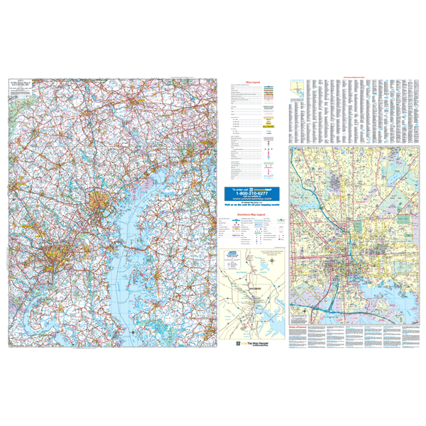
Specifications of this high quality map include: Measures 6' W x 4' 2" H (72? x 50?)
Up-to-date cartography at a scale of 1" = 2.66 miles. Printed in color with a markable and washable laminated surface. Hanging options of spring roller; or rails, mounted top and bottom. Streets are indexed on the face of the map, plus index book form.
Areas of Coverage: District of Columbia - The counties of Anne Arundel, Baltimore, Cecil, Carroll, Charles, Calvert, Caroline, Harford, Howard, Kent, Montgomery, Prince Georges, Queen Ann, Talbot portions of Frederick, St. Mary, Dorchester Wicomico. PA portions of York, Adams, Lancaster Chester. VA- Arlington portions of Fairfax, Prince Williams King George. DE - Portions of Kent, Sussex New Castle. Coverage includes North: to Lancaster York, PA; South: to Leonardtown in St Mary's Co Salisbury in Wicomico Co. MD; East: Wilmington, Dover, DE ; West: Frederick Gaithersburg, MD.
Downtown Baltimore Inset: 1" = 1,000 feet. Complete street detailed, Block #, Building List of major points of interest. North: Morgan State University; East: Orangeville Industrial Area; South: I-95 Port Covington; West: US 1 - Monroe Street.
Year: 2011
Edition: 1st
These maps are printed and finished to order. Please allow 4-6 weeks for delivery.