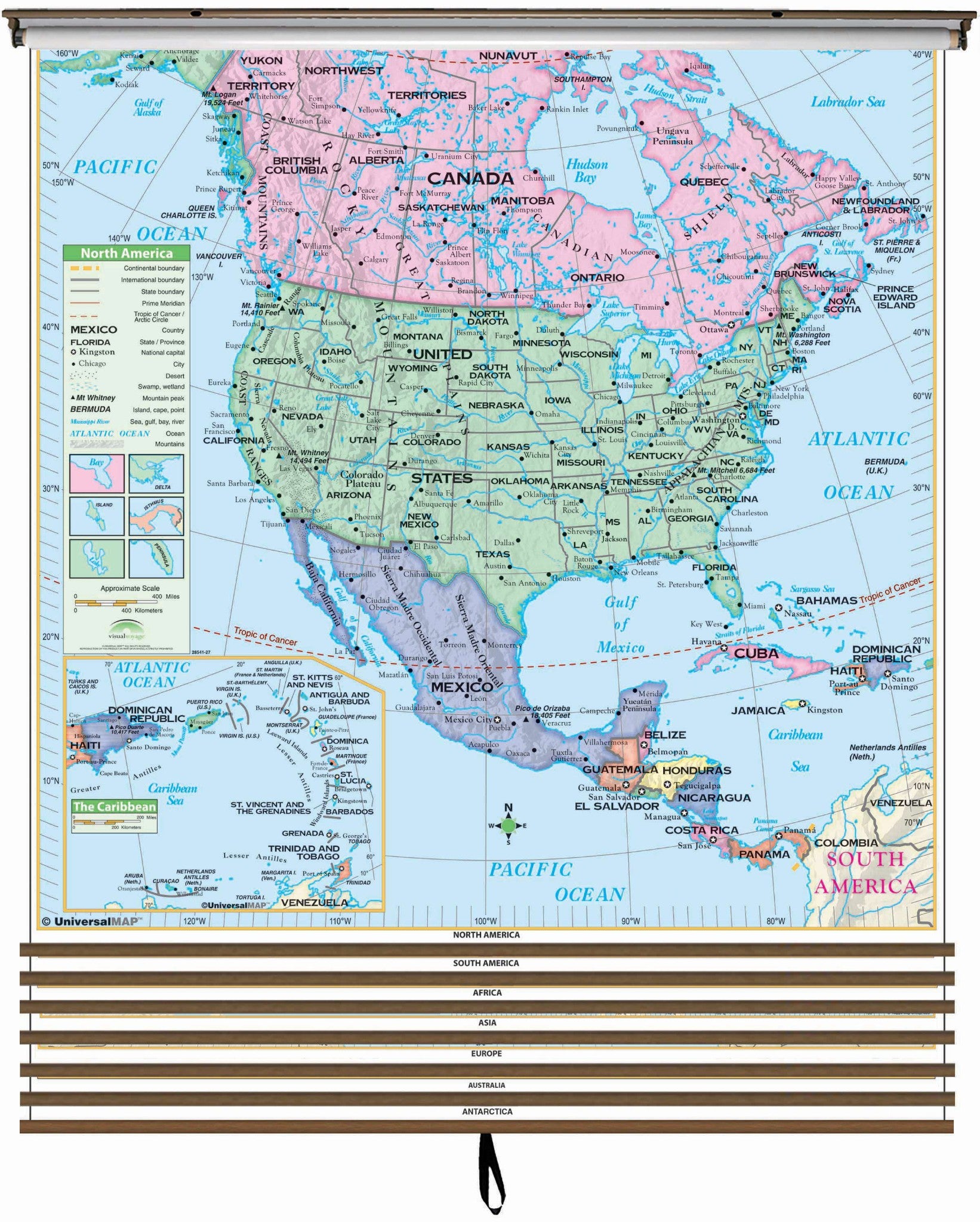
The 5-Map Continent Wall Map Set includes individual continent wall maps of North America, South America, Africa, Asia, and Europe.
Continent edition wall maps clearly identify political county borders, with shaded relief highlighting the physical features of the land. Capitals, major cities, Waterways, and latitude and longitude lines are also included. A World inset map shows the location of each continent. Meets U.S. History curriculum requirements. This product is ideal for public, private, parochial, and home schools.
All maps in this series are markable with a wet erase or water-soluble marker. Durably laminated maps measure 54"¿½ x 43"¿½ or 54"¿½ x 69"¿½, and are mounted on roller with backboard and we provide backboard and all components to mount map on wall.
Suggested for grades 4-8.
These maps are printed and finished to order. Please allow 4-6 weeks for delivery.