Menu


Made to order. Usually ships in 2-3 weeks.
Size: 46"x37"
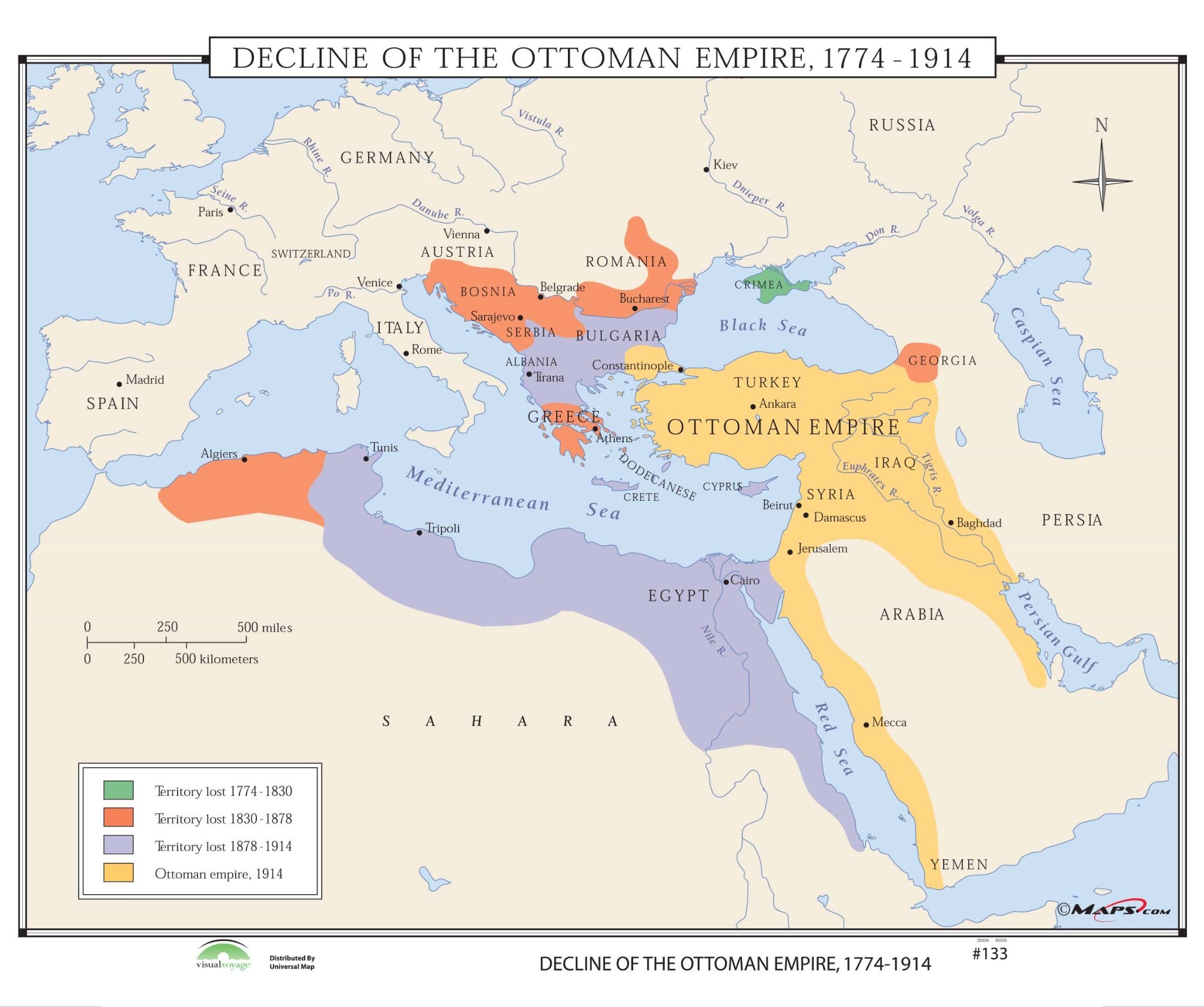
Decline of the Ottoman Empire, 1774-1914 shows four eras of decline of the Empire: territory lost from 1774-1830; territory lost from 1830-1878; territory lost from 1878-1914; and the Ottoman Empire, in 1914.
All maps in this series meet US history curriculum requirements and are markable with a wet erase or dry erase marker. This durably laminated maps measures 46"x37". This map is ideal for public, private, parochial, and home schools.
Educational maps are available with the following options:
We understand that finding the right materials to teach kids can be a hassle and expensive. GeoMart makes it easy and affordable to get the perfect map combination for your classroom. With our range of World, US, US states and history maps and combination packages, you’ll be sure to find the perfect set-up for your classroom.
We can set up multiple classroom maps on one roller system for you. Please contact us with a list of the maps you would like to include and we will be happy to provide you with a custom quote. You can find our pricing list here for an idea of what different combinations may cost. We also accept school purchase orders. Terms: Net 30
Thank you for considering GeoMart for your classroom pull down map needs! We look forward to helping you get the perfect combination of maps to help your students learn and explore the World.
