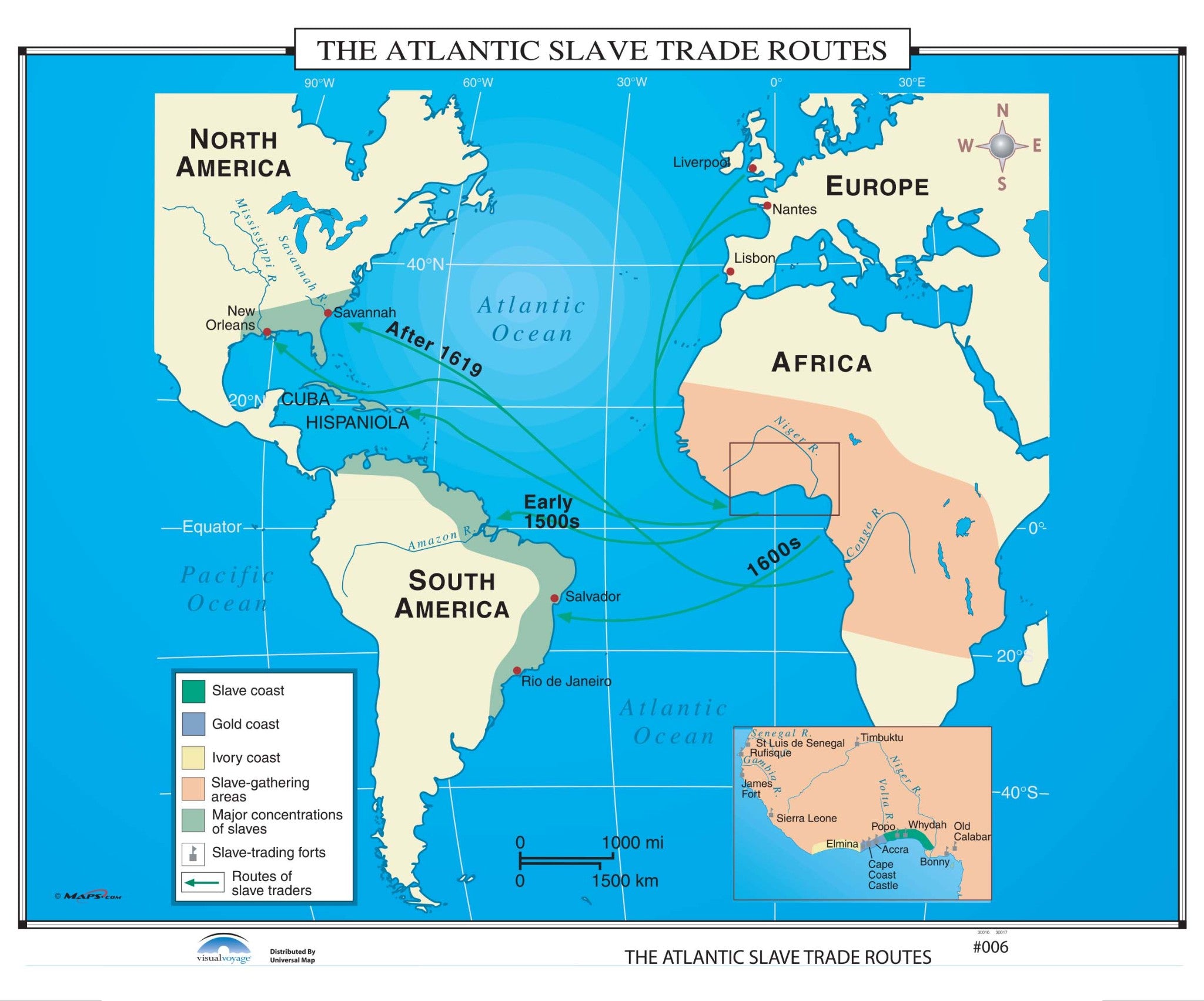
The shaded areas on The Atlantic Slave Trade Routes wall map identify the Slave, Gold, and Ivory Coasts; along with slave gathering areas, major concentrations of slaves, slave trading forts, and the routes of the slave traders.
All maps in this series meet US history curriculum requirements and are markable with a wet erase or dry erase marker. This durably laminated maps measures 46"x37". This map is ideal for public, private, parochial, and home schools.
Educational maps are available with the following options:
Paper: Printed on heavy 24 lb bonded paper.
Laminated: Laminated for protection on both sides. Use wet or dry erase markers to write on and wipe off.
Railed: Black plastic hanging rails are added on the top and bottom of your laminated map for easy wall mounting.
Railed: Wooden walnut hanging rails are added on the top and bottom of your laminated map for easy wall mounting.
Spring Roller: A spring roller is applied to a laminated map to turn it into a pull down map.
Spring Roller/Backboard: Laminated map is attached to spring roller and we provide backboard and all components to mount map on wall.
Classroom Educational Pull Down Maps
We understand that finding the right materials to teach kids can be a hassle and expensive. GeoMart makes it easy and affordable to get the perfect map combination for your classroom. With our range of World, US, US states and history maps and combination packages, you’ll be sure to find the perfect set-up for your classroom.
We can set up multiple classroom maps on one roller system for you. Please contact us with a list of the maps you would like to include and we will be happy to provide you with a custom quote. You can find our pricing list here for an idea of what different combinations may cost. We also accept school purchase orders. Terms: Net 30
2-Map History Custom Pull Down Classroom Set with Backboard $530
3-Map History Custom Pull Down Classroom Set with Backboard $750
4-Map History Custom Pull Down Classroom Set with Backboard $815
5-Map History Custom Pull Down Classroom Set with Backboard $840
6-Map History Custom Pull Down Classroom Set with Backboard $890
7-Map History Custom Pull Down Classroom Set with Backboard $930
8-Map History Custom Pull Down Classroom Set with Backboard $960
Thank you for considering GeoMart for your classroom pull down map needs! We look forward to helping you get the perfect combination of maps to help your students learn and explore the World.
Recommended for You
Choosing a selection results in a full page refresh.