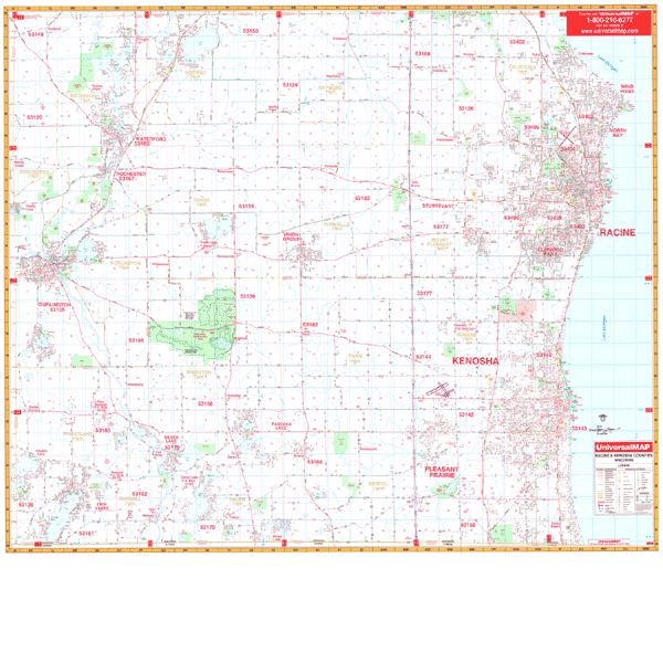
The Racine and Kenosha Counties, Wisconsin Wall Map by Kappa Map Group measures 62? x 54? and has up-to-date cartography. Provides complete street detail at a scale of 1? = approximately 2,640 feet. Printed on a laminated surface that is both markable and washable. Street indexing appears in a separate book. Contains hanging rails mounted top and bottom.
Area of coverage ranges: North: Racine County line; South: Wisconsin-Illinois state lines; East: Lake Michigan; West: Kenosha-Racine-Walworth County lines. The special features and data are as follows: all streets and highways, government buildings, airports, golf courses and country clubs, railroads, longitude and latitude lines, block numbers, shopping centers, recreational parks, mileage circles, cemeteries, educational facilities, hospitals, post offices, city limits and annexations, water features, fire and police stations, and assorted points of interest.
Railed wall maps can be turned into pull down maps on spring rollers for an additional $30.
Year: 2012
Edition: 2nd
These maps are printed and finished to order. Please allow 4-6 weeks for delivery.