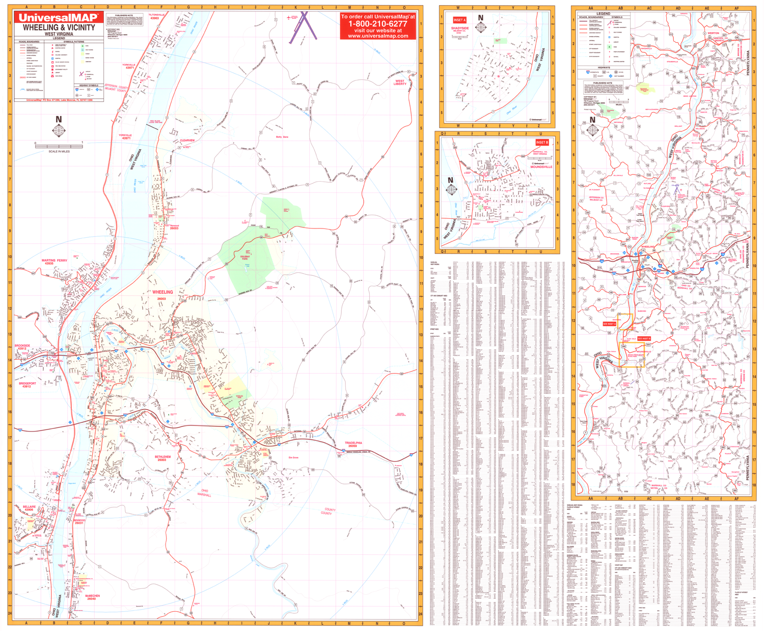
The Wheeling, West Virginia Wall Map by Kappa Map Group includes adjacent areas, measures 66 by 54 inches, includes complete street detail, up-to-date cartography with new streets and changes, is printed in color, laminated, and indexed for streets on the face of the map.
Coverage ranges north to include Tiltonsville, OH and the Wheeling/Ohio County Airport; south to include McMechen, WV; east to include Triadelphia, WV; and west to include Brookside, Bellaire, and Martins Ferry. Also includes insets of Shadyside, Ohio and Moundsville, West Virginia. Shows an area map covering from Steubenville, Weirton and south to the Wetzell, WV county line.
Details all streets/highways, government buildings, airports, golf courses/country clubs, railroads, ZIP codes/boundaries, shopping centers, water features, recreational parks, cemeteries, educational facilities, hospitals, post offices, city limits/annexations, mileage circles, fire/police stations, and more.
Framing rails are included on top and bottom for easy wall mounting. Railed wall maps can be turned into pull down maps on spring rollers for an additional $30.
Year: 2000
Edition: 1st
These maps are printed and finished to order. Please allow 4-6 weeks for delivery.