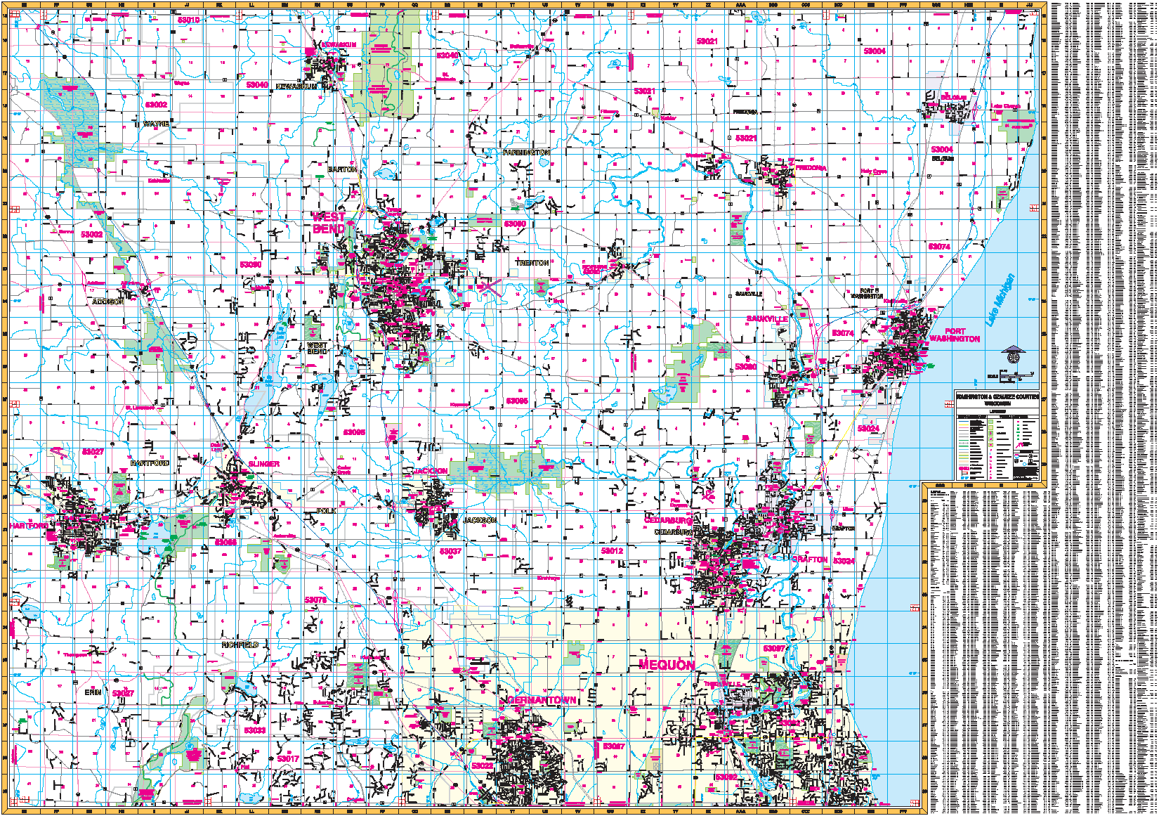
The Washington and Ozaukee Counties of Wisconsin provide up-to-date cartography with new streets and changes in complete street detail at a scale of 1? = 2,560 feet. Measures 76? x 54? and printed in color with a markable/washable, laminated surface. Streets indexed on the face of the map. Includes wood grain framing rails mounted top and bottom.
Area of coverage: North: Fond Du Lac and Sheboygan County lines; South: Waukesha and Milwaukee County lines; East: Lake Michigan; West: Dodge County line.
Details included: all streets and highways, government buildings, airports, mileage circles, fire/police stations, post offices, shopping centers, educational facilities, hospitals, water features, golf/country clubs, railroads, recreational parks, ZIP codes/boundaries, cemeteries, block numbers, city limits/annexations, section/township/range lines, and longitude/latitude lines.
Railed wall maps can be turned into pull down maps on spring rollers for an additional $30.
Year: 2001
Edition: 1st
These maps are printed and finished to order. Please allow 4-6 weeks for delivery.