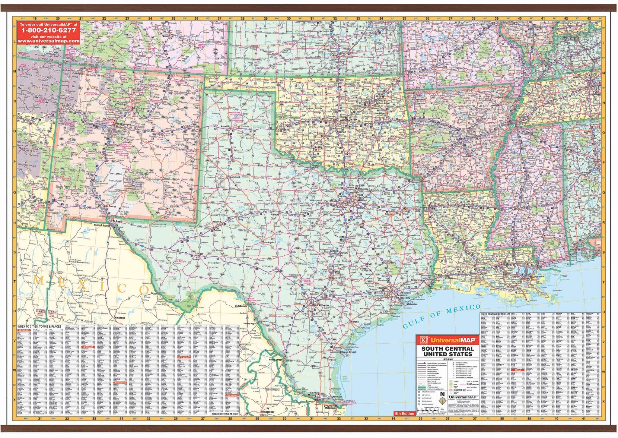
The South Central United States Wall Map by Kappa Map Group measures 65" W x 46" H and shows all of the following states: Arkansas, Louisiana, Mississippi, New Mexico, Oklahoma and Texas. Partial coverage of the following states in included: Illinois, Indiana, Tennessee, Alabama, Arizona, Colorado, Kansas, and Missouri.
The boundaries are as follows: North: Southern Colorado, including Pueblo to Evansville, IN; South: Northern Mexico to Tonichi in Sonoma State, Mexico and the Gulf of Mexico; East: Nashville, TN and Birmingham, AL; West: Eastern portion of Arizona down to the eastern Mexican State of Sonora.
The special features and data are as follows: state highways, time zones, interstate highways, rivers and lakes, freeways, national forests, state lines, mountain ranges, longitude and latitude lines, cities and towns. Protected with a laminate finish, which is both markable and washable. In addition, for your convenience, indexing is on the face of the face of the map.
Map is available with the following options:
-
Laminated:Laminated for protection on both sides. Use wet erase markers to write on wipe off.
-
Railed:Black plastic framing rails are added on the top and bottom of your Laminated map for easy wall mounting.
-
Spring roller:A Spring roller is applied to a Laminated map to turn it into a pull down map.
-
Spring roller/Backboard:Laminated map is attached to spring roller and we provide backboard and all components to mount map on wall.
Year: 2009
5th Edition