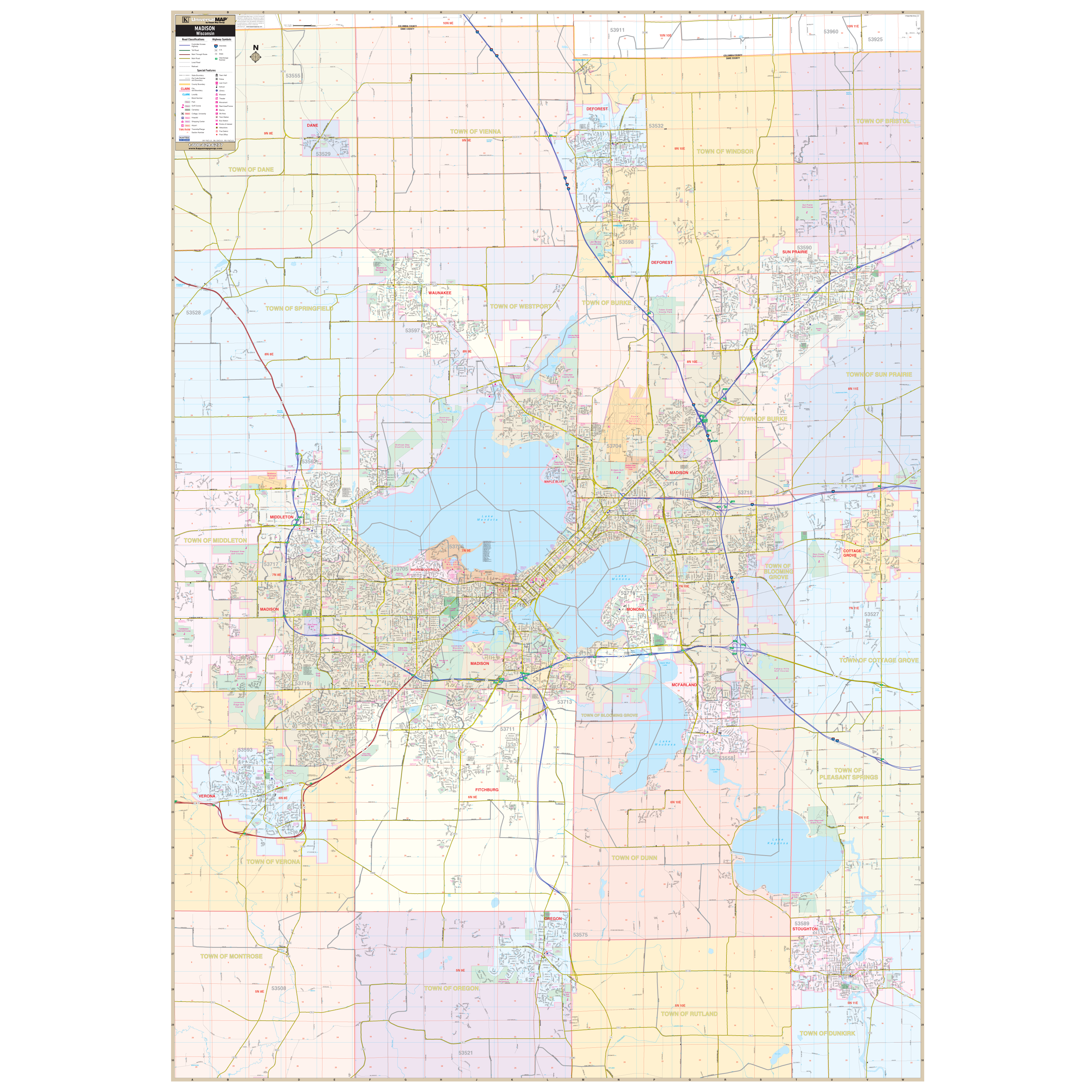
The Madison, Wisconsin Wall Map by Kappa Map Group includes adjacent areas and offers up-to-date cartography with new streets and changes. Measuring 54 x 77 inches at a scale of 1" = 2,000 feet, this colorful map provides complete street detail. The map's area of coverage ranges North: To the Dane / Columbia Co line to include all of the Villages of Dane and DeForest; South to include the Village of Oregon and the City of Stoughton; East to include the City of Sun Prairie and the Village of Cottage Grove; and West: to include the cities of Middleton and Verona.
The special features and data contained on this map are as follows: all streets, all highways, educational facilities, government buildings, shopping centers, hospitals, airports, recreational parks, post offices, golf and country clubs, points of interest, city/town/village limits (color coded), railroads, mileage circles, water features, cemeteries, fire and police stations, ZIP code and boundaries.
In addition, for your convenience, streets are indexed in a separate book. Framing rails are included on top and bottom for easy wall mounting. Railed wall maps can be turned into pull down maps on spring rollers for an additional $30.
Year: 2013
Edition: 1st
These maps are printed and finished to order. Please allow 4-6 weeks for delivery.