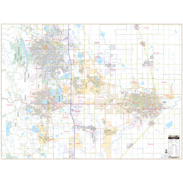
The Fort Collins Greeley, CO and adjacent areas Wall Map by Kappa Map Group includes up-to-date cartography and complete street detail. Coverage includes all of Fort Collins Greeley and surrounding areas with the following boundaries: North All of Ft. Collins to include all of the Town of Pierce in Weld County; South to the Fossil Creek Reservoir; Just east of the Greeley ? Weld County Airport; and West To the Carter Lake Reservoir to include all of Charles A. Lory State Park and Horsetooth Mountain Park
Details included with the wall map are airports, cemeteries, hospitals, railroads, post offices, block numbers, city limits (color coded), all streets and highways, shopping centers, water features, recreational parks, government buildings, fire and police stations, educational facilities, golf courses and country clubs, libraries and other points of interest.
This map offers up-to-date cartography plotted in complete street detail. It is printed in color and is laminated making the surface both markable and washable. Map measures 72" x 58" (6' W x 4'10" H); streets are indexed in a separate book.
Framing rails are included on top and bottom for easy wall mounting. Railed wall maps can be turned into pull down maps on spring rollers for an additional $30.
Year: 2013
Edition: 1st
These maps are printed and finished to order. Please allow 4-6 weeks for delivery.