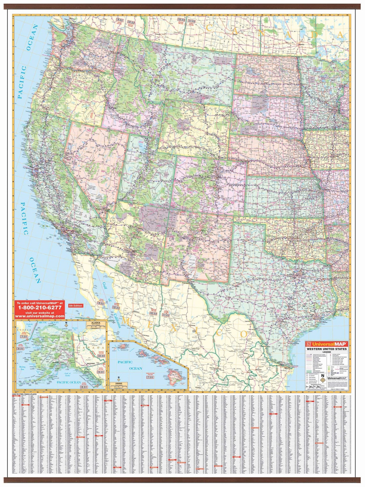
The Western United States Wall Map by Kappa Map Group
Features all of the following states: Alaska, Arizona, California, Colorado, Hawaii, Idaho, Kansas, Montana, Nebraska, Nevada, New Mexico, North Dakota, Oklahoma, Oregon, South Dakota, Texas, Utah, Washington and Wyoming.
The boundaries are as follows: North: Vancouver Island to Winnipeg; South: To Northern Mexico; East: Duluth, Minnesota to Little Rock, Arkansas and Waterloo, Iowa; West: to the Pacific Ocean. Also includes insets of Alaska and Hawaii.
The special features and data are as follows: State Highways, Time Zones, Interstate Highways, Rivers and Lakes, Freeways, National Forests, State Lines, Mountain Ranges, Longitude and Latitude Lines, Cities and Towns.
This wall map measures 50"H x 68"W in size and is protected with a laminate finish, which is both markable and washable. In addition, for your convenience, the map is indexed on the face of the face of the map.
Map is available with the following options:
-
Laminated:Laminated for protection on both sides. Use wet erase markers to write on wipe off.
-
Railed:Black plastic framing rails are added on the top and bottom of your Laminated map for easy wall mounting.
-
Spring roller:A Spring roller is applied to a Laminated map to turn it into a pull down map.
-
Spring roller/Backboard:Laminated map is attached to spring roller and we provide backboard and all components to mount map on wall.
Year: 2009
5th Edition