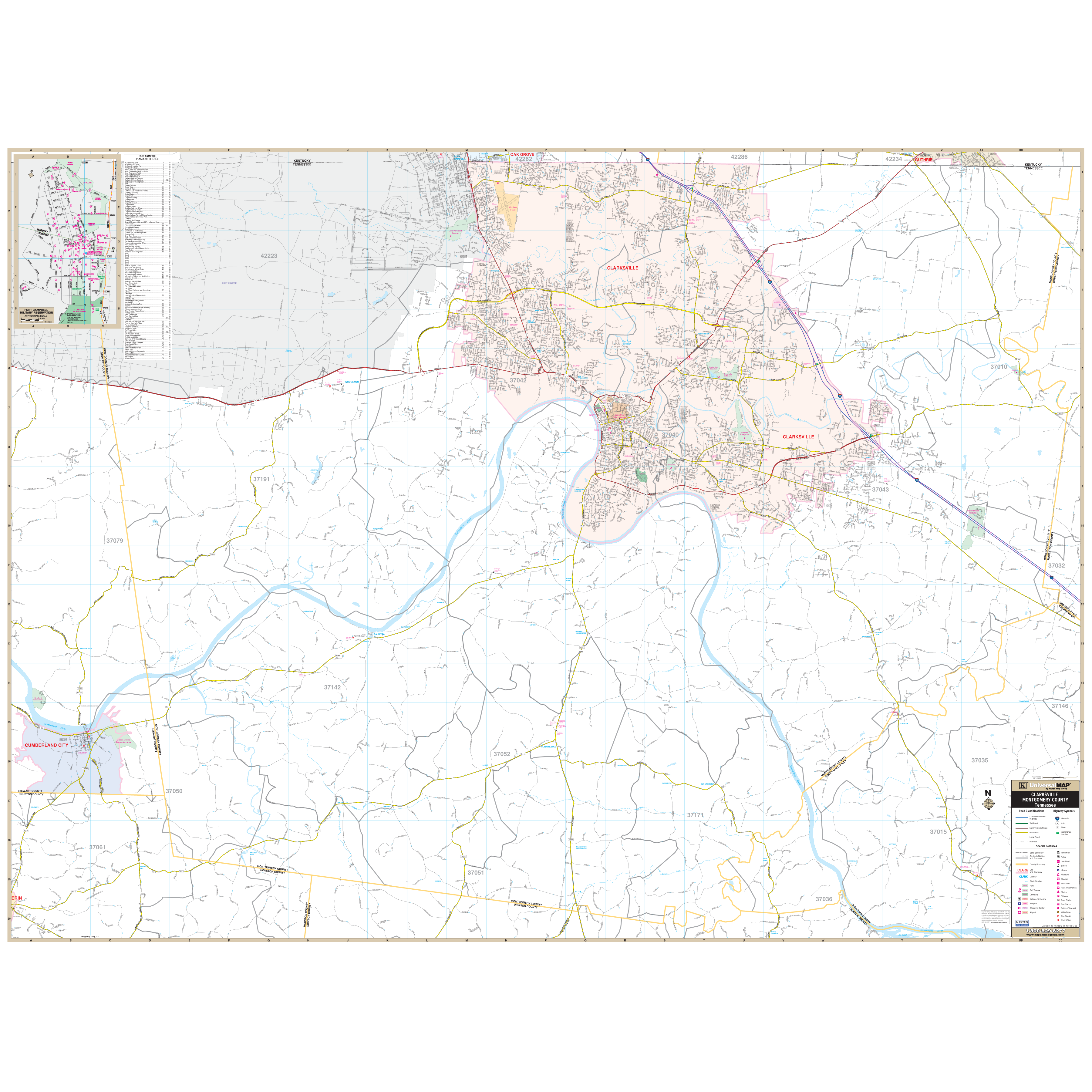
The Clarksville and Montgomery County, Tennessee Wall Map by Kappa Map Group measures 68? x 50? and was produced with a durable lamination, allowing the map to be easily marked on and wiped off. Street indexing is in a separate book. Includes complete street detail at a scale of 1? = 2,640 feet.
The area of coverage ranges: North: to the Kentucky State line; South: to the Dickson County line; East: to the Robertson County line; West: to all of Cumberland City in Stewart County.
The special features and data are as follows: all streets and highways, government buildings, airports, golf courses and country clubs, railroads, ZIP code numbers/ boundaries, shopping centers, recreational parks, cemeteries, educational institutions, hospitals, post offices, city limits and annexations, fire and police stations, and miscellaneous points of interest.
Framing rails are included on top and bottom for easy wall mounting. Railed wall maps can be turned into pull down maps on spring rollers for an additional $30.
Year: 2013
Edition: 1st
These maps are printed and finished to order. Please allow 4-6 weeks for delivery.