Menu


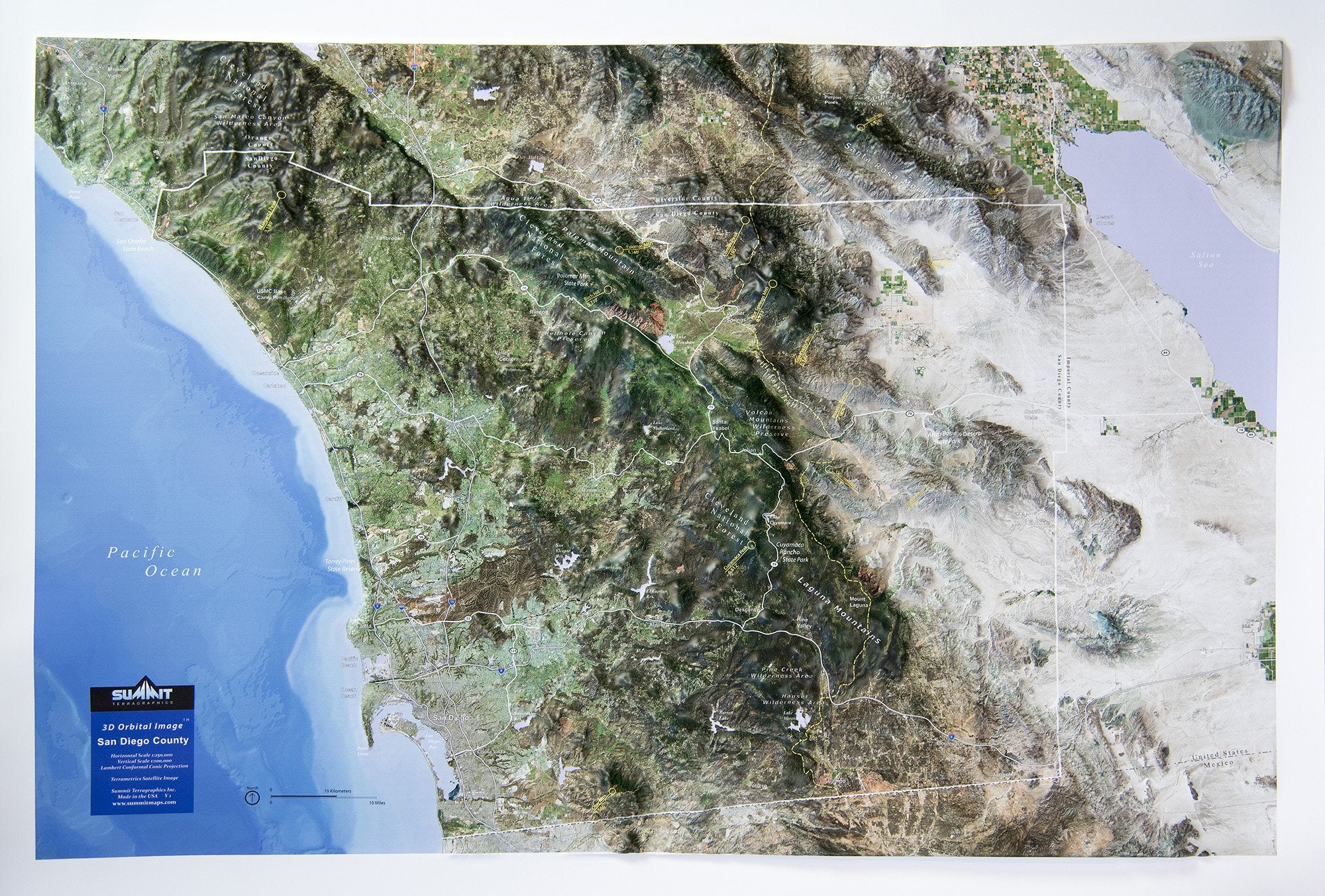
This raised relief wall map shows San Diego County in stunning 3D detail, as though you were looking down from space on a clear day. The high-resolution satellite image is precisely molded to the 3D terrain shape, showing the beauty of the coastal mountains and deserts. The map covers all of San Diego County and parts of Orange, Riverside and Imperial Counties. Key towns, roads, mountain ranges, forests, valleys, lakes and deserts are labeled for easy reference. The high mountain peaks, state parks and Pacific Crest Trail are marked/labeled. Hikers, backpackers, mountain bikers and all outdoor enthusiasts will value this 3D wall map. These 3D Earth Image maps are available unframed or framed (black aluminum, light or dark stained solid oak wood, or black painted wood).

This large map is available fully framed and ready to hang or unframed, perfect for pinning to a bulletin board.
Usually ships in 5-7 business days. Please allow additional 5 business days for framed options.
This raised relief wall map shows San Diego County in stunning 3D detail, as though you were looking down from space on a clear day. The high-resolution satellite image is precisely molded to the 3D terrain shape, showing the beauty of the coastal mountains and deserts. The map covers all of San Diego County and parts of Orange, Riverside and Imperial Counties. Key towns, roads, mountain ranges, forests, valleys, lakes and deserts are labeled for easy reference. The high mountain peaks, state parks and Pacific Crest Trail are marked/labeled. Hikers, backpackers, mountain bikers and all outdoor enthusiasts will value this 3D wall map. These 3D Earth Image maps are available unframed or framed (black aluminum, light or dark stained solid oak wood, or black painted wood).
This large map is available fully framed and ready to hang or unframed, perfect for pinning to a bulletin board.
Usually ships in 5-7 business days. Please allow additional 5 business days for framed options.