Menu


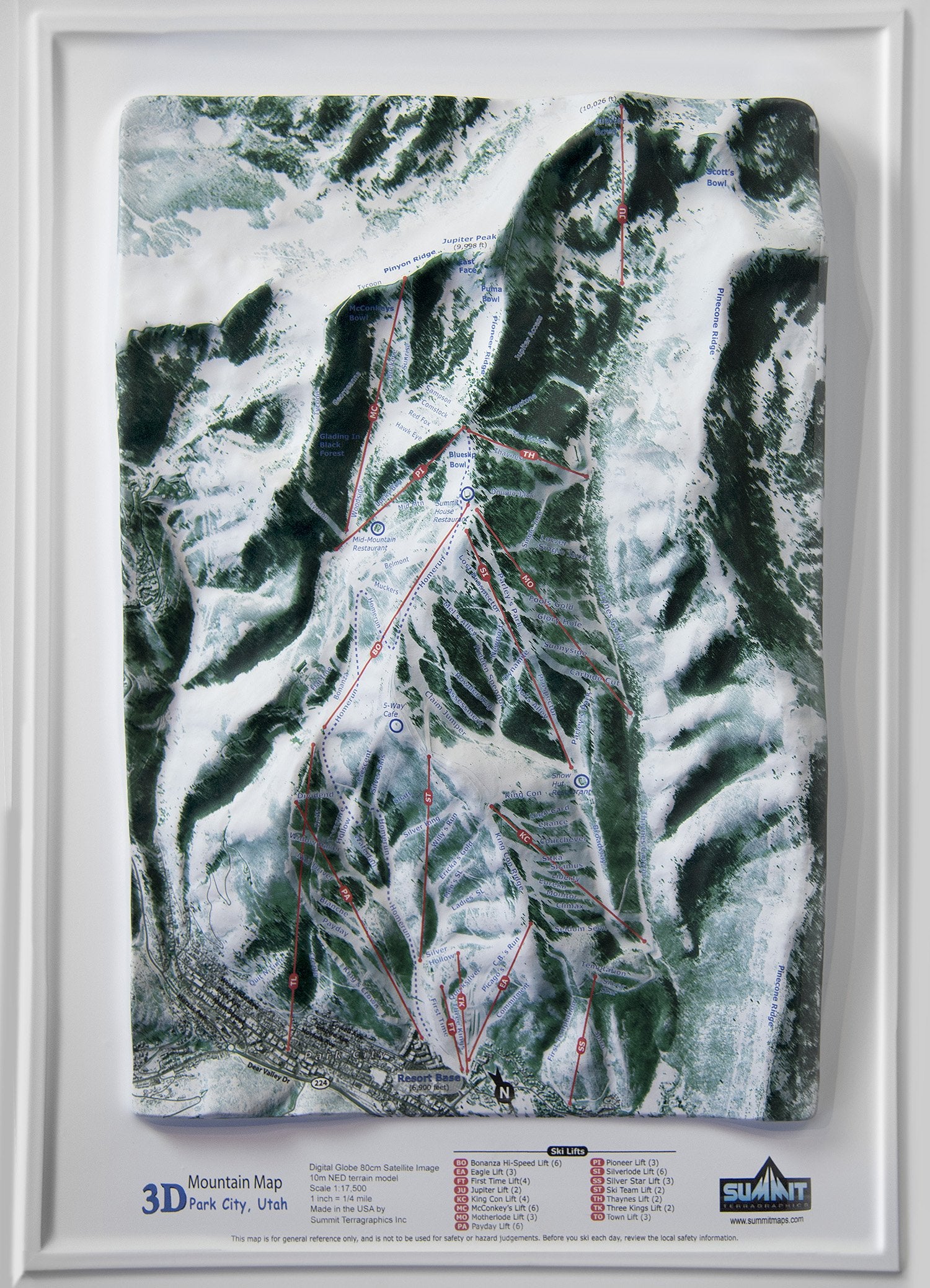
This stunning 3D model/map of the Park City Mountain Resort Ski Area uses a high-resolution satellite image that is precisely molded to the shape of the terrain. The ski trails and lifts and other mountain features are clearly marked and labeled. Displayed on the wall of a home, office, or lodge, these 3D maps will be valued for recalling past days on the slopes or planning new ones. These 3D Mountain Maps are available as unframed or framed (black aluminum, natural-oak finish wood, dark-stained oak wood, or black painted wood).

This large map is available fully framed and ready to hang or unframed, perfect for pinning to a bulletin board.
Usually ships in 5-7 business days. Please allow additional 5 business days for framed options.
This stunning 3D model/map of the Park City Mountain Resort Ski Area uses a high-resolution satellite image that is precisely molded to the shape of the terrain. The ski trails and lifts and other mountain features are clearly marked and labeled. Displayed on the wall of a home, office, or lodge, these 3D maps will be valued for recalling past days on the slopes or planning new ones. These 3D Mountain Maps are available as unframed or framed (black aluminum, natural-oak finish wood, dark-stained oak wood, or black painted wood).
This large map is available fully framed and ready to hang or unframed, perfect for pinning to a bulletin board.
Usually ships in 5-7 business days. Please allow additional 5 business days for framed options.