Menu


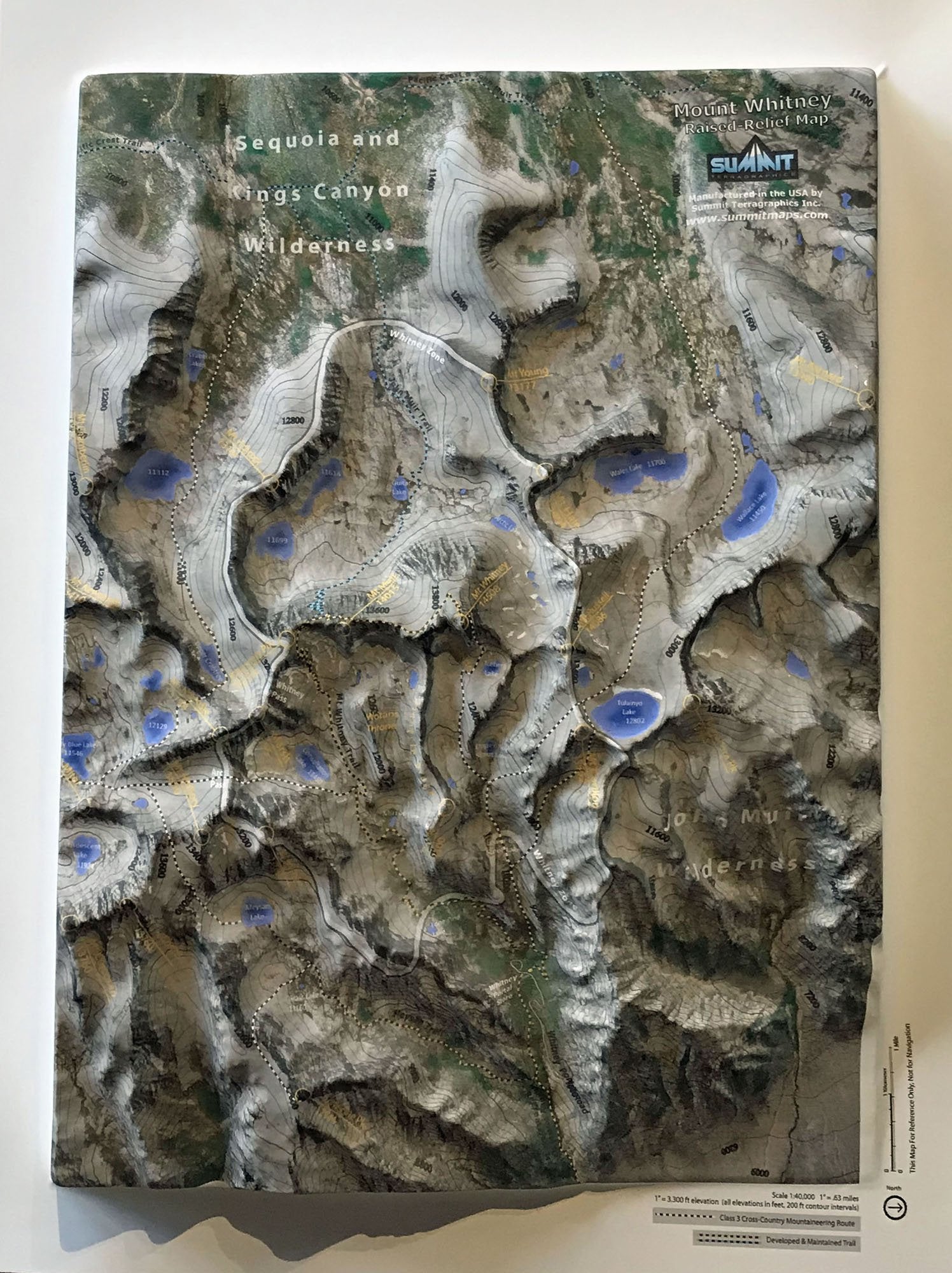
This stunning 3D model/map of Mount Whitney and the surrounding area uses a high-resolution satellite image that is precisely molded to the shape of the terrain. The trails and mountaineering routes, key peak and lake names and elevations, and other mountain features are clearly marked and labeled. The Whitney summit has over 2.5" of vertical relief (1" = 3300' of elevation). Displayed on the wall of a home, office or classroom, this 3D map will be valued those who have climbed Mt Whitney or are planning to. These 3D Mountain Maps are available unframed or framed (black aluminum, dark oak wood, light oak wood, or black painted wood).

This large map is available fully framed and ready to hang or unframed, perfect for pinning to a bulletin board.
Usually ships in 5-7 business days. Please allow additional 5 business days for framed options.
This stunning 3D model/map of Mount Whitney and the surrounding area uses a high-resolution satellite image that is precisely molded to the shape of the terrain. The trails and mountaineering routes, key peak and lake names and elevations, and other mountain features are clearly marked and labeled. The Whitney summit has over 2.5" of vertical relief (1" = 3300' of elevation). Displayed on the wall of a home, office or classroom, this 3D map will be valued those who have climbed Mt Whitney or are planning to. These 3D Mountain Maps are available unframed or framed (black aluminum, dark oak wood, light oak wood, or black painted wood).
This large map is available fully framed and ready to hang or unframed, perfect for pinning to a bulletin board.
Usually ships in 5-7 business days. Please allow additional 5 business days for framed options.