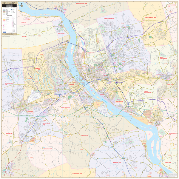
The Harrisburg, Pennsylvania Wall Map by Kappa Map Group measures 55" x 55" (4? 7? W x 4' 7? H) at a scale of 1? = 2,000 feet and features up-to-date cartography, with new streets and community changes in complete street detail; is printed in color, with a markable and washable laminated surface; and offers a street index in a separate book-format.
Area of coverage includes all of Harrisburg, with the following boundaries:
North: to include all of the city of Dauphin and all the city of Marysville;
South: to include York Haven and Dillsburg;
East: to include all of the city of Hummelstown;
West: to include all Mechanicsburg and Dillsburg
Details Features Include: All Streets Highways, Government Buildings, Airports, Water Features, Fire Police Stations, Hospitals, Shopping Centers, Educational Institutions, Railroads, Recreational Parks, Golf and Country Clubs, Post Offices, Points of Interest, City Limits (color coded), Cemeteries, Libraries, Block Numbers, Zip Codes Boundaries, and Township Names Boundaries,
Framing rails included on top and bottom for easy wall mounting. Railed wall maps can be turned into pull down maps on spring rollers for an additional $30.
Year: 2014
Edition: 1st
These maps are printed and finished to order. Please allow 4-6 weeks for delivery.