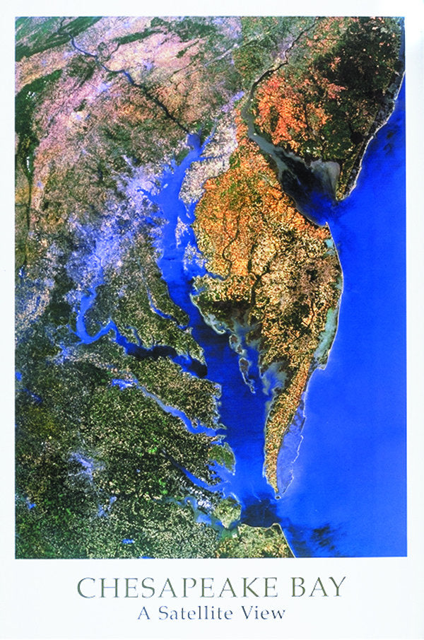
24x36 inches, (61x91cm) Landsat Data, Scale is 1"= 8 miles, image size on the map is 21.75"x 30"
Located as an inlet of the Atlantic Ocean, 200 mi (320 km) long, from 3 to 30 mi (4.8 to 48 km) wide, and 3,237 sq mi (8, 384 sq km), separating the Delmarva Peninsula from the mainland, E MD. and E VA. The bay is the drowned estuary of the Susquehanna River and is fed by many rivers including the Potomac, Rappahannock, and James. The Chesapeake Bay Bridge - Tunnel runs across the mouth of the bay. An important part of the Intra coastal Waterway, the bay is linked with the Delaware River by the Chesapeake and Delaware Canal. Baltimore, MD., is the largest city and main port on the bay; Norfolk, VA., is an important port and naval base. This image includes Richmond, VA, Philadelphia, PA, Fayetteville, PA and surrounding areas