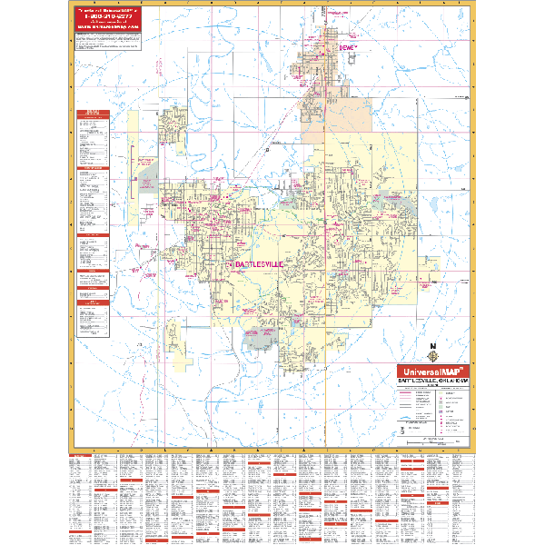
The Bartlesville, Oklahoma Wall Map by Kappa Map Group provides up-to-date cartography showing the new streets and changes. Provides street indexing with ZIP codes, lamination, and measures 4 feet 2 inches by 5 feet 6 inches.
Covers north to Dewey and the Washington County softball field; south 2 miles south of Rice Creek Road; east to Bartlesville; and west to Bartlesville Municipal Airport. Shows all streets, post offices, hospitals, railroads, mileage circles, airports, cemeteries, shopping centers, water features, recreational parks, government buildings, fire/police stations, educational facilities, and golf courses/country clubs.
Framing rails are included on top and bottom for easy wall mounting. Railed wall maps can be turned into pull down maps on spring rollers for an additional $30.
Year: 2003
Edition: 2nd
These maps are printed and finished to order. Please allow 4-6 weeks for delivery.