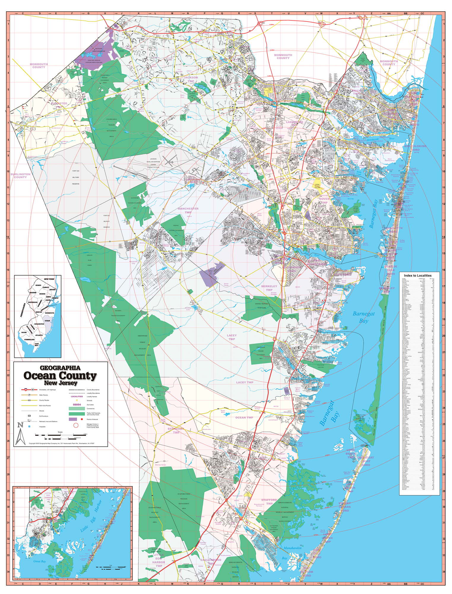
The Ocean County, New Jersey Wall Map published by Geographia Maps measures 65? x 53? in complete street detail at a scale of 1? = 3,588 feet. Printed in color with a markable washable, laminated surface. Provides separate book indexing. Includes hanging rails mounted top and bottom.
The area of coverage includes all of Ocean County, with the following boundaries: North: to Monmouth/Ocean County line; South: Great Bay; East: to the Atlantic Ocean; West: to the Burlington/Ocean County line.
Details include airports, streets highways, government buildings, cemeteries, shopping centers, fire police stations, hospitals, educational facilities, railroads, recreational parks, golf country clubs, post offices, mileage circles, city limits annexations, ZIP codes, longitude latitude lines, and points of interest.
Railed wall maps can be turned into pull down maps on spring rollers for an additional $30.
Year: 2005
Edition: 1st
These maps are printed and finished to order. Please allow 4-6 weeks for delivery.