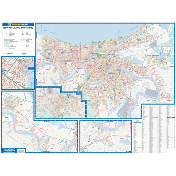
The New Orleans, Louisiana Wall Map by Kappa Map Group has added numerous new streets and changes and measures 79? W x 52? H. (6'7" W x 4' 4" H) at a scale of 1" = 2666'. This commercial wall map shows all of New Orleans, LA in complete street detail.
Boundaries are as follows: North: Lake Pontchartrain. South: Jean Lafitte National Historical Park and all of the New Orleans US Naval Air Station. East: Just past the intersection of US Highways 90 11. West: to the intersection of Interstate 10 and Belle Terre Blvd. Map insets include: Slidell Downtown New Orleans.
The special features and data are as follows: all streets, all highways, educational facilities, government buildings, hospitals, ZIP codes and boundaries, shopping centers, airports, cemeteries, recreational parks, mobile home parks, golf and country clubs, police fire stations, water features, subdivisions, and railroads.
The map is printed in color and protected with a durable laminate finish, which is both markable and washable. In addition, for your convenience, the map is indexed in a separate book. Railed wall maps can be turned into pull down maps on spring rollers for an additional $30.
Year: 2015
Edition: 2nd
These maps are printed and finished to order. Please allow 4-6 weeks for delivery.